
5-day weather forecast Fairfax Oct 23, 2026
 25°
25°Weather forecast Fairfax Friday Oct 23, 2026: sunny, temperature from 15 °C to 25 °C.
Precipitation probability 12%. Wind up to 8.19 m/s (gusts 16.19 m/s). Air humidity 36–67%, atmospheric pressure 763–765 mm Hg, UV index up to 7.
5 days at a glance — tap a day to open it
Sunrise 07:41
Sunset 18:30
Sunset 18:30
Full Moon97% illuminated
Moonrise 17:06 · Moonset 05:02
Moonrise 17:06 · Moonset 05:02
Chart
Table
Fri, Oct 23, 2026
| Time | Weather | Temperature | Rain chance | Cloud cover | Humidity | Pressure | Wind | UV Index |
|---|---|---|---|---|---|---|---|---|
| 00:00 |  Clear | 16 °C | 5% | 5% | 67% | 765 mm Hg | SSE 149° 3.5 (9.31) m/s | 0 |
| 01:00 | Clear | 16 °C | 5% | 5% | 66% | 765 mm Hg | SSE 152° 3.61 (9.42) m/s | 0 |
| 02:00 | Clear | 16 °C | 5% | 5% | 66% | 765 mm Hg | SSE 155° 3.61 (10.19) m/s | 0 |
| 03:00 | Clear | 15 °C | 5% | 5% | 66% | 765 mm Hg | SSE 154° 3.69 (10.31) m/s | 0 |
| 04:00 |  Partly cloudy | 15 °C | 8% | 40% | 66% | 765 mm Hg | SSE 149° 3.69 (10.22) m/s | 0 |
| 05:00 | Clear | 15 °C | 5% | 12% | 66% | 765 mm Hg | SSE 151° 4.11 (10.72) m/s | 0 |
| 06:00 | Clear | 15 °C | 5% | 8% | 65% | 765 mm Hg | SSE 155° 4.11 (11.31) m/s | 0 |
| 07:00 | Clear | 15 °C | 5% | 5% | 66% | 765 mm Hg | SSE 151° 3.81 (10.64) m/s | 0 |
| 08:00 | Sunny | 15 °C | 5% | 1% | 66% | 765 mm Hg | SSE 152° 4.39 (11.42) m/s | 4 |
| 09:00 | Sunny | 16 °C | 4% | 0% | 61% | 765 mm Hg | SSE 156° 4.89 (12.31) m/s | 5 |
| 10:00 | Sunny | 19 °C | 2% | 0% | 52% | 765 mm Hg | SSE 166° 6.11 (11.81) m/s | 5 |
| 11:00 | Sunny | 21 °C | 1% | 0% | 46% | 765 mm Hg | SSE 168° 6.89 (11.5) m/s | 6 |
| 12:00 | Sunny | 23 °C | 1% | 0% | 41% | 764 mm Hg | SSE 168° 7.5 (11.31) m/s | 6 |
| 13:00 | Sunny | 24 °C | 1% | 5% | 38% | 764 mm Hg | S 174° 7.81 (10.5) m/s | 6 |
| 14:00 | Sunny | 25 °C | 1% | 5% | 36% | 764 mm Hg | S 173° 8.11 (10.39) m/s | 6 |
| 15:00 | Sunny | 25 °C | 1% | 5% | 36% | 763 mm Hg | S 172° 8.19 (10.61) m/s | 7 |
| 16:00 | Sunny | 25 °C | 1% | 5% | 38% | 763 mm Hg | S 171° 7.5 (10.81) m/s | 7 |
| 17:00 | Sunny | 24 °C | 1% | 5% | 40% | 763 mm Hg | SSE 167° 7.11 (11.31) m/s | 6 |
| 18:00 | Sunny | 23 °C | 1% | 5% | 44% | 763 mm Hg | SSE 165° 6.69 (12.81) m/s | 6 |
| 19:00 |  Cloudy | 21 °C | 7% | 70% | 46% | 764 mm Hg | SSE 161° 5.89 (14) m/s | 0 |
| 20:00 | Cloudy | 20 °C | 9% | 85% | 49% | 764 mm Hg | SSE 158° 5.81 (15) m/s | 0 |
| 21:00 |  Overcast | 20 °C | 11% | 98% | 50% | 764 mm Hg | SSE 162° 6.19 (15.5) m/s | 0 |
| 22:00 | Overcast | 19 °C | 12% | 100% | 50% | 764 mm Hg | SSE 164° 6.19 (16.11) m/s | 0 |
| 23:00 | Overcast | 19 °C | 12% | 100% | 50% | 764 mm Hg | SSE 163° 6.11 (16.19) m/s | 0 |
Fri, Oct 23, 2026
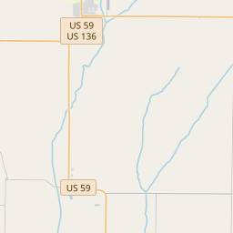
Fairfax on the map
Data Sources & Methodology
Our weather forecasts are powered by a professional weather data provider that aggregates data from national weather services, satellite observations, radar networks, and over 80,000 weather stations worldwide. Forecast data is updated multiple times daily. We convert raw data into clear summaries — wind speed in m/s, pressure in mmHg — so you can plan your day with confidence.