5-day weather forecast Bangkok 29-07-2026

Weather forecast Bangkok today 29.07.2026: overcast, temperature from 25 °C to 31 °C.

Precipitation probability 81%. Wind up to 3.89 m/s (gusts 6.25 m/s). Air humidity 59–90%, atmospheric pressure 753–756 mm Hg, UV index up to 5.1.

Weather Alerts

Hide alerts
SevereJul 29, 06:00 AMJul 30, 06:00 PMTranslate with Google
Heavy Rain Risk Area

Heavy Rain

The monsoon trough lies across the upper North and upper Northeast while the rather strong southwest monsoon prevails over the Andaman Sea, Thailand and the Gulf. Isolated very heavy rains are forecast in the Northeast and the East while isolated heavy rains are possible in the North, the Central including Bangkok and its vicinity and the South regions. The rather strong winds force the waves in the upper Andaman Sea up to 2–3 meters high and above 3 meters high in thundershowers. In the lower Andaman Sea and the upper Gulf, the waves are expected to be about 2 meters high and above 2 meters high in thundershowers.
People should beware of heavy to very heavy rains and accumulation that may cause flash floods, overflows and landslides especially along the waterways near foothills and lowlands. All ships should proceed with caution and keep off thundershowers, small boats in the upper Andaman Sea should keep ashore.
SevereJul 29, 05:57 AMJul 30, 06:00 PMTranslate with Google
Heavy Rain Risk Area

Heavy Rain

The monsoon trough lies across the upper North and upper Northeast while the rather strong southwest monsoon prevails over the Andaman Sea, Thailand and the Gulf. Isolated very heavy rains are forecast in the Northeast and the East while isolated heavy rains are possible in the North, the Central including Bangkok and its vicinity and the South regions. The rather strong winds force the waves in the upper Andaman Sea up to 2–3 meters high and above 3 meters high in thundershowers. In the lower Andaman Sea and the upper Gulf, the waves are expected to be about 2 meters high and above 2 meters high in thundershowers.
People should beware of heavy to very heavy rains and accumulation that may cause flash floods, overflows and landslides especially along the waterways near foothills and lowlands. All ships should proceed with caution and keep off thundershowers, small boats in the upper Andaman Sea should keep ashore.
SevereJul 29, 06:00 AMJul 30, 06:00 PMTranslate with Google
พื้นที่เสี่ยงภัยฝนตกหนักบริเวณประเทศไทย

Heavy Rain

พยากรณ์อากาศ 24 ชั่วโมงข้างหน้า ภาคตะวันออกเฉียงเหนือ และภาคตะวันออก มีฝนตกหนักมากบางแห่ง ส่วนภาคเหนือ ภาคกลาง รวมทั้งกรุงเทพมหานครและปริมณฑล และภาคใต้ มีฝนตกหนักบางพื้นที่ เนื่องจากร่องมรสุมพาดผ่านภาคเหนือตอนบน และภาคตะวันออกเฉียงเหนือตอนบน ประกอบกับมรสุมตะวันตกเฉียงใต้กำลังค่อนข้างแรงพัดปกคลุมทะเลอันดามัน ประเทศไทย และอ่าวไทย สำหรับคลื่นลมบริเวณทะเลอันดามันตอนบนมีกำลังค่อนข้างแรง โดยมีคลื่นสูง 2-3 เมตร บริเวณที่มีฝนฟ้าคะนองจะมีคลื่นสูงมากกว่า 3 เมตร ส่วนทะเลอันดามันตอนล่างและอ่าวไทยตอนบนมีคลื่นสูงประมาณ 2 เมตร บริเวณที่มีฝนฟ้าคะนองจะมีคลื่นสูงมากกว่า 2 เมตร
ขอให้ประชาชนระวังอันตรายจากฝนตกหนักถึงหนักมากและฝนที่ตกสะสม ซึ่งอาจทำให้เกิดน้ำท่วมฉับพลันและน้ำป่าไหลหลาก โดยเฉพาะพื้นที่ลาดเชิงเขาใกล้ทางน้ำไหลผ่านและพื้นที่ลุ่ม ขอให้ชาวเรือเดินเรือด้วยความระมัดระวัง และหลีกเลี่ยงการเดินเรือในบริเวณที่มีฝนฟ้าคะนอง ส่วนเรือเล็กบริเวณทะเลอันดามันตอนบนควรงดออกจากฝั่งในระยะนี้ไว้ด้วย
SevereJul 29, 05:57 AMJul 30, 06:00 PMTranslate with Google
พื้นที่เสี่ยงภัยฝนตกหนักบริเวณประเทศไทย

Heavy Rain

พยากรณ์อากาศ 24 ชั่วโมงข้างหน้า ภาคตะวันออกเฉียงเหนือ และภาคตะวันออก มีฝนตกหนักมากบางแห่ง ส่วนภาคเหนือ ภาคกลาง รวมทั้งกรุงเทพมหานครและปริมณฑล และภาคใต้ มีฝนตกหนักบางพื้นที่ เนื่องจากร่องมรสุมพาดผ่านภาคเหนือตอนบน และภาคตะวันออกเฉียงเหนือตอนบน ประกอบกับมรสุมตะวันตกเฉียงใต้กำลังค่อนข้างแรงพัดปกคลุมทะเลอันดามัน ประเทศไทย และอ่าวไทย สำหรับคลื่นลมบริเวณทะเลอันดามันตอนบนมีกำลังค่อนข้างแรง โดยมีคลื่นสูง 2-3 เมตร บริเวณที่มีฝนฟ้าคะนองจะมีคลื่นสูงมากกว่า 3 เมตร ส่วนทะเลอันดามันตอนล่างและอ่าวไทยตอนบนมีคลื่นสูงประมาณ 2 เมตร บริเวณที่มีฝนฟ้าคะนองจะมีคลื่นสูงมากกว่า 2 เมตร
ขอให้ประชาชนระวังอันตรายจากฝนตกหนักถึงหนักมากและฝนที่ตกสะสม ซึ่งอาจทำให้เกิดน้ำท่วมฉับพลันและน้ำป่าไหลหลาก โดยเฉพาะพื้นที่ลาดเชิงเขาใกล้ทางน้ำไหลผ่านและพื้นที่ลุ่ม ขอให้ชาวเรือเดินเรือด้วยความระมัดระวัง และหลีกเลี่ยงการเดินเรือในบริเวณที่มีฝนฟ้าคะนอง ส่วนเรือเล็กบริเวณทะเลอันดามันตอนบนควรงดออกจากฝั่งในระยะนี้ไว้ด้วย
Sunrise 06:01
Sunset 18:47
Full Moon99% illuminated
Moonrise 18:55 · Moonset 05:46
Chart
Table
Wed, Jul 29, 2026

Forecast from 25 °C to 31 °C and precipitation

Temperature & Precipitation
Time00:0001:0002:0003:0004:0005:0006:0007:0008:0009:0010:0011:0012:0013:0014:0015:0016:0017:0018:0019:0020:0021:0022:0023:00
Temperature (°C)252526262626262626272829292929303127262626262626
Precipitation (mm/hr)0.080.030.020.01000000000000.11.13.51.161.741.341.311.560.48

Cloud cover and precipitation probability

Cloud cover & Rain chance
Time00:0001:0002:0003:0004:0005:0006:0007:0008:0009:0010:0011:0012:0013:0014:0015:0016:0017:0018:0019:0020:0021:0022:0023:00
Cloud cover (%)625410010010010010010010010010010010081100611001006874991008184
Rain chance (%)231825242323222221191616151115175781647073747156

Wind speed and direction

Wind & Wind gust
Time00:0001:0002:0003:0004:0005:0006:0007:0008:0009:0010:0011:0012:0013:0014:0015:0016:0017:0018:0019:0020:0021:0022:0023:00
Wind (m/s)2.612.192.532.812.612.111.811.812.312.693.193.53.893.693.311.812.53.113.112.893.313.53.39
Wind gust (m/s)43.443.864.614.253.973.282.782.753.223.393.944.334.724.53.812.53.975.55.814.725.396.255.92
Wind direction (°)WSW 252°SW 233°SW 220°SW 225°SW 216°SSW 211°SSW 212°SW 217°SW 228°WSW 247°WSW 257°W 259°W 260°W 264°W 259°WSW 246°ENE 64°E 94°SE 137°SE 142°SSE 158°S 174°S 176°S 184°

Air humidity

Humidity
Time00:0001:0002:0003:0004:0005:0006:0007:0008:0009:0010:0011:0012:0013:0014:0015:0016:0017:0018:0019:0020:0021:0022:0023:00
Humidity (%)828381807979787776726765626162596282878887898990

Atmospheric pressure

Pressure
Time00:0001:0002:0003:0004:0005:0006:0007:0008:0009:0010:0011:0012:0013:0014:0015:0016:0017:0018:0019:0020:0021:0022:0023:00
Pressure (mm Hg)756755755755755755755755756756756756756755755755753754754755755756756756

Ultraviolet index

UV Index
Time00:0001:0002:0003:0004:0005:0006:0007:0008:0009:0010:0011:0012:0013:0014:0015:0016:0017:0018:0019:0020:0021:0022:0023:00
UV Index000000000.30.61.25.12.41.81.50.90.50.2000000

Air quality & pollen

Air quality
Time00:0001:0002:0003:0004:0005:0006:0007:0008:0009:0010:0011:0012:0013:0014:0015:0016:0017:0018:0019:0020:0021:0022:0023:00
PM2.5 (µg/m³)8.68.8910.11213.514.615.91412.611.511.812.112.513.713.611.910.69.88.88.187.16.7
PM10 (µg/m³)11.41213.215.419.82324.32724.320.817.918.418.11819.419.317.315.514.312.811.812.910.69.7
Ozone (O₃) (µg/m³)222021232423222328344251606770706759494036343332
NO₂ (µg/m³)19.717.41512.711.71315.617.417.416.615.915.715.615.716.116.617.318.319.419.618.215.813.712.1
SO₂ (µg/m³)4.84.64.54.54.85.66.67.588.28.48.68.78.78.68.58.17.36.25.454.94.74.3
CO (µg/m³)1056392162157272564976122911769647545723922972713316051323225628462797240620071705
Wed, Jul 29, 2026

Frequently asked questions about the 5-day weather in Bangkok

Over the next 5 days in Bangkok the temperature is expected to range from about 25 to 34 °C. See the detailed hourly forecast for each of the 5 days in the charts above.

The chance of rain in Bangkok over the next 5 days reaches 81%. Check the 5-day precipitation chart above to see exactly which days and hours bring rain.

A 5-day forecast is fairly reliable: the first 2–3 days are usually very accurate, while days 4–5 may be refined. The data is updated several times a day, so check back before important plans.

Over the next 5 days the temperature in Bangkok ranges from about 25 to 34 °C. Compare the warmest and coolest day on the temperature chart above.

Over the next 5 days the wind in Bangkok picks up to 5 m/s. The windiest days are easy to spot on the wind chart above.

For a walk or a trip, pick the days with the lowest chance of rain (up to 81%) and light wind — easy to compare on the 5-day charts above.

The first 2–3 days are reliable enough for firm decisions, while days 4–5 are a guide that sharpens as they approach. The forecast is updated several times a day, so check again before important plans.

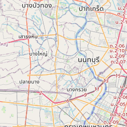
Bangkok on the map

Data Sources & Methodology

Our weather forecasts are powered by a professional weather data provider that aggregates data from national weather services, satellite observations, radar networks, and over 80,000 weather stations worldwide. Forecast data is updated multiple times daily. We convert raw data into clear summaries — wind speed in m/s, pressure in mmHg — so you can plan your day with confidence.