5-day weather forecast Limbach-Oberfrohna 17-08-2026
Weather forecast Limbach-Oberfrohna today 17.08.2026: blowing snow, temperature from -2 °C to 1 °C.
Precipitation probability 94%. Wind up to 16.69 m/s (gusts 22.53 m/s). Air humidity 68–99%, atmospheric pressure 740–743 mm Hg, UV index up to 2.7.
Weather Alerts
Hide alertsModerate Fire Impact
Risk of fires due to prolonged drought. Possible occurrence of severe fire with subsequent damage. Possible damage to ecosystems, property, forestry, agriculture, etc. Risk of human injury. Deterioration of air quality causing respiratory problems and other health issues.
Do not light fires outdoors, do not burn grass, do not smoke or discard cigarette butts on the ground. Do not use portable stoves or other open flame sources. Follow local bans issued due to drought and fire risk. Stay alert when using agricultural machinery and near railway tracks where sparks from wheels and brakes can ignite vegetation.
Moderate Fire Impact
Risk of fires due to prolonged drought. Possible occurrence of severe fire with subsequent damage. Possible damage to ecosystems, property, forestry, agriculture, etc. Risk of human injury. Deterioration of air quality causing respiratory problems and other health issues.
Do not light fires outdoors, do not burn grass, do not smoke or discard cigarette butts on the ground. Do not use portable stoves or other open flame sources. Follow local bans issued due to drought and fire risk. Stay alert when using agricultural machinery and near railway tracks where sparks from wheels and brakes can ignite vegetation.
Moderate Fire Impact
Risk of fires due to prolonged drought. Possible occurrence of severe fire with subsequent damage. Possible damage to ecosystems, property, forestry, agriculture, etc. Risk of human injury. Deterioration of air quality causing respiratory problems and other health issues.
Do not light fires outdoors, do not burn grass, do not smoke or discard cigarette butts on the ground. Do not use portable stoves or other open flame sources. Follow local bans issued due to drought and fire risk. Stay alert when using agricultural machinery and near railway tracks where sparks from wheels and brakes can ignite vegetation.
Moderate Thunderstorm Impact
Risk of severe thunderstorms. Possible local property damage and complications, especially in the energy industry and transport. Potential for local flooding, especially of low-lying areas. Local wind damage to roofs, fences, soft shelters and trees. Local power outages. Some travel delays. Driving conditions difficult. Possible crop damage from small hail. Risk of fire caused by lightning strike. Risk of injury from flying or falling objects, and lightning strikes.
Beware of lightning strikes and flying or falling objects (especially branches). Seek shelter in a building equipped with lightning protection. Outdoors, take cover in dense forest or low vegetation; avoid water bodies, hilltops, metal structures, isolated trees, and rock overhangs. When driving reduce speed. Observe weather warnings, weather radar (www.chmi.cz or mobile apps) and local flood risk https://produkty.chmi.cz/ffi.
Moderate Thunderstorm Impact
Risk of severe thunderstorms. Possible local property damage and complications, especially in the energy industry and transport. Potential for local flooding, especially of low-lying areas. Local wind damage to roofs, fences, soft shelters and trees. Local power outages. Some travel delays. Driving conditions difficult. Possible crop damage from small hail. Risk of fire caused by lightning strike. Risk of injury from flying or falling objects, and lightning strikes.
Beware of lightning strikes and flying or falling objects (especially branches). Seek shelter in a building equipped with lightning protection. Outdoors, take cover in dense forest or low vegetation; avoid water bodies, hilltops, metal structures, isolated trees, and rock overhangs. When driving reduce speed. Observe weather warnings, weather radar (www.chmi.cz or mobile apps) and local flood risk https://produkty.chmi.cz/ffi.
5 days at a glance — tap a day to open it
Sunrise 05:59
Sunset 20:26
Sunset 20:26
Waxing Crescent27% illuminated
Moonrise 12:02 · Moonset 21:47
Chart
TableMon, Aug 17, 2026
Forecast from -2 °C to 1 °C and precipitation
Cloud cover and precipitation probability
Wind speed and direction
Air humidity
Atmospheric pressure
Ultraviolet index
Air quality & pollen
Mon, Aug 17, 2026
Frequently asked questions about the 5-day weather in Limbach-Oberfrohna
What will the weather be like in Limbach-Oberfrohna over the next 5 days?
Over the next 5 days in Limbach-Oberfrohna the temperature is expected to range from about -2 to 5 °C. See the detailed hourly forecast for each of the 5 days in the charts above.
On which of the next 5 days will it rain in Limbach-Oberfrohna?
The chance of rain in Limbach-Oberfrohna over the next 5 days reaches 94%. Check the 5-day precipitation chart above to see exactly which days and hours bring rain.
How accurate is the 5-day weather forecast for Limbach-Oberfrohna?
A 5-day forecast is fairly reliable: the first 2–3 days are usually very accurate, while days 4–5 may be refined. The data is updated several times a day, so check back before important plans.
Which of the next 5 days in Limbach-Oberfrohna will be the warmest and which the coolest?
Over the next 5 days the temperature in Limbach-Oberfrohna ranges from about -2 to 5 °C. Compare the warmest and coolest day on the temperature chart above.
Will it be windy in Limbach-Oberfrohna over the next 5 days?
Over the next 5 days the wind in Limbach-Oberfrohna picks up to 19 m/s. The windiest days are easy to spot on the wind chart above.
Which day of the week in Limbach-Oberfrohna is best for a walk or a trip?
For a walk or a trip, pick the days with the lowest chance of rain (up to 94%) and light wind — easy to compare on the 5-day charts above.
How can I best use the 5-day forecast for Limbach-Oberfrohna?
The first 2–3 days are reliable enough for firm decisions, while days 4–5 are a guide that sharpens as they approach. The forecast is updated several times a day, so check again before important plans.
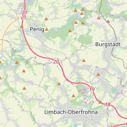
Limbach-Oberfrohna on the map
Data Sources & Methodology
Our weather forecasts are powered by a professional weather data provider that aggregates data from national weather services, satellite observations, radar networks, and over 80,000 weather stations worldwide. Forecast data is updated multiple times daily. We convert raw data into clear summaries — wind speed in m/s, pressure in mmHg — so you can plan your day with confidence.