
5-day weather forecast San Diego Sep 26, 2026

25°22–25° · Sunny

Weather forecast San Diego today Sep 26, 2026: overcast, temperature from 22 °C to 25 °C.

Precipitation probability 25%. Wind up to 4.69 m/s (gusts 9.61 m/s). Air humidity 60–83%, atmospheric pressure 758–759 mm Hg, UV index up to 8.2.

Weather Alerts

ModerateSep 25, 08:48 PM — Sep 26, 06:00 AMTranslate with Google
Beach Hazards Statement issued September 25 at 8:48PM PDT until September 30 at 4:00PM PDT by NWS San Diego CA

Beach Hazards Statement

* WHAT...Elevated surf of 3-5 feet with sets up to 6 feet through next Tuesday. Astronomical tides of 6.0-6.5 feet through Sunday, rising to 6.5-7.0 feet Monday through Wednesday leading to minor tidal overflow. * WHERE...Beaches of Orange and San Diego Counties. * WHEN...Through Wednesday afternoon. * IMPACTS...Minor tidal overflow and minor coastal erosion expected during high tides. Additionally, elevated surf will lead to strong rip currents. * ADDITIONAL DETAILS...High tides will approach 7.0 feet each morning Monday through Wednesday. These water levels in combination with elevated surf provides a window for moderate coastal flooding on Monday and Tuesday, especially along south and southwest-facing beaches.
Remain out of the water to avoid hazardous swimming conditions.
ModerateSep 26, 05:36 AM — Sep 26, 02:15 PMTranslate with Google
Beach Hazards Statement issued September 26 at 5:36AM PDT until September 30 at 4:00PM PDT by NWS San Diego CA

Beach Hazards Statement

* WHAT...Elevated surf of 3-5 feet with sets up to 6 feet through next Tuesday. Astronomical tides of 6.0-6.5 feet through Sunday, rising to 6.5-7.0 feet Monday through Wednesday leading to minor tidal overflow. * WHERE...Beaches of Orange and San Diego Counties. * WHEN...Through Wednesday afternoon. * IMPACTS...Minor tidal overflow and minor coastal erosion expected during high tides. Additionally, elevated surf will lead to strong rip currents. * ADDITIONAL DETAILS...High tides will approach 7.0 feet each morning Monday through Wednesday. These water levels in combination with elevated surf provides a window for moderate coastal flooding on Monday and Tuesday, especially along south and southwest-facing beaches.
Remain out of the water to avoid hazardous swimming conditions.
Sunrise 06:39
Sunset 18:40
Full Moon99% illuminated
Moonrise 18:36 · Moonset 06:42
Chart
Table
Sat, Sep 26, 2026

Forecast from 22 °C to 25 °C and precipitation

Temperature & Precipitation
Time00:0001:0002:0003:0004:0005:0006:0007:0008:0009:0010:0011:0012:0013:0014:0015:0016:0017:0018:0019:0020:0021:0022:0023:00
Temperature (°C)232322222222222222232425252525252525242424242424
Precipitation (mm/hr)000000000000000000000000

Cloud cover and precipitation probability

Cloud cover & Rain chance
Time00:0001:0002:0003:0004:0005:0006:0007:0008:0009:0010:0011:0012:0013:0014:0015:0016:0017:0018:0019:0020:0021:0022:0023:00
Cloud cover (%)81001001001007933998445124000687910098100100100100
Rain chance (%)8212525242012231965543341012161617171617

Wind speed and direction

Wind & Wind gust
Time00:0001:0002:0003:0004:0005:0006:0007:0008:0009:0010:0011:0012:0013:0014:0015:0016:0017:0018:0019:0020:0021:0022:0023:00
Wind (m/s)2.391.611.310.691.191.51.611.391.891.811.52.813.113.394.614.394.693.612.692.692.191.391.112.61
Wind gust (m/s)2.611.831.315.691.195.56.611.391.895.814.56.818.117.399.618.394.723.722.922.812.421.424.115.61
Wind direction (°)NW 306°NW 315°NNW 333°NW 311°NNW 332°WNW 302°NW 311°NW 325°NNW 333°NW 320°WNW 297°WNW 283°W 277°WNW 286°WNW 286°WNW 289°WNW 289°WNW 297°NW 321°WNW 302°NNW 328°WNW 300°W 270°W 279°

Air humidity

Humidity
Time00:0001:0002:0003:0004:0005:0006:0007:0008:0009:0010:0011:0012:0013:0014:0015:0016:0017:0018:0019:0020:0021:0022:0023:00
Humidity (%)777683828181818077726664626160616464656868676667

Atmospheric pressure

Pressure
Time00:0001:0002:0003:0004:0005:0006:0007:0008:0009:0010:0011:0012:0013:0014:0015:0016:0017:0018:0019:0020:0021:0022:0023:00
Pressure (mm Hg)758758759758758758758758758759759759758758758758758758758758758758759758

Ultraviolet index

UV Index
Time00:0001:0002:0003:0004:0005:0006:0007:0008:0009:0010:0011:0012:0013:0014:0015:0016:0017:0018:0019:0020:0021:0022:0023:00
UV Index000000000.51.73.75.97.78.27.25.22.910.200000

Air quality & pollen

Air quality
Time00:0001:0002:0003:0004:0005:0006:0007:0008:0009:0010:0011:0012:0013:0014:0015:0016:0017:0018:0019:0020:0021:0022:0023:00
PM2.5 (µg/m³)18.720.722.824.324.924.222.822.221.520.117.616.417.217.717.517.116.616.416.517.118.420.923.726.2
PM10 (µg/m³)21.92426.127.427.52624.123.322.522.821.420.321.823.122.722.221.420.820.921.222.625.228.130.5
Ozone (O₃) (µg/m³)1298655441132608510311812612611910995796142228
NO₂ (µg/m³)51.655.757.556.252.448.344.640.435.629.422.616.511.57.34.53.43.75.37.5111832.249.862.2
SO₂ (µg/m³)1.9221.91.81.71.71.71.82.22.62.92.82.42.1221.91.81.61.61.92.42.7
CO (µg/m³)144141140143149153156158159161162160154144137133130130135144149148143143
Sat, Sep 26, 2026

Frequently asked questions about the 5-day weather in San Diego

What will the weather be like in San Diego over the next 5 days?

Over the next 5 days in San Diego the temperature is expected to range from about 21 to 25 °C. See the detailed hourly forecast for each of the 5 days in the charts above.

On which of the next 5 days will it rain in San Diego?

The chance of rain in San Diego over the next 5 days reaches 25%. Check the 5-day precipitation chart above to see exactly which days and hours bring rain.

How accurate is the 5-day weather forecast for San Diego?

A 5-day forecast is fairly reliable: the first 2–3 days are usually very accurate, while days 4–5 may be refined. The data is updated several times a day, so check back before important plans.

Which of the next 5 days in San Diego will be the warmest and which the coolest?

Over the next 5 days the temperature in San Diego ranges from about 21 to 25 °C. Compare the warmest and coolest day on the temperature chart above.

Will it be windy in San Diego over the next 5 days?

Over the next 5 days the wind in San Diego picks up to 6 m/s. The windiest days are easy to spot on the wind chart above.

Which day of the week in San Diego is best for a walk or a trip?

For a walk or a trip, pick the days with the lowest chance of rain (up to 25%) and light wind — easy to compare on the 5-day charts above.

How can I best use the 5-day forecast for San Diego?

The first 2–3 days are reliable enough for firm decisions, while days 4–5 are a guide that sharpens as they approach. The forecast is updated several times a day, so check again before important plans.

Will I need an umbrella or sunscreen in San Diego this week?

Rain reaches a 25% chance across the next 5 days, so pack something waterproof for the wettest of them — the daily strip above shows which. Today’s UV index peaks at 8.2; sunscreen is worth it from about 3 upwards.

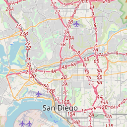
San Diego on the map
Data Sources & Methodology

Our weather forecasts are powered by a professional weather data provider that aggregates data from national weather services, satellite observations, radar networks, and over 80,000 weather stations worldwide. Forecast data is updated multiple times daily. We convert raw data into clear summaries — wind speed in m/s, pressure in mmHg — so you can plan your day with confidence.