5-day weather forecast San Diego 01-08-2026
Weather forecast San Diego Saturday, August 1 01.08.2026: sunny, temperature from 24 °C to 28 °C.
Precipitation probability 5%. Wind up to 3.81 m/s (gusts 4.36 m/s). Air humidity 53–67%, atmospheric pressure 757–759 mm Hg, UV index up to 7.
Weather Alerts
Hide alertsCoastal Flood Advisory issued July 27 at 1:36PM PDT until August 1 at 3:00AM PDT by NWS San Diego CA
Coastal Flood Advisory
* WHAT...For the Beach Hazards Statement, 3-6 feet with sets to 7
feet expected. For the Coastal Flood Advisory, minor coastal
flooding expected. For the High Surf Advisory, large breaking
waves of 5-8 feet with sets up to 9 feet on south-southwest facing
beaches and 3-6 feet on west-facing beaches.
* WHERE...San Diego County Coastal Areas and Orange County
Coastal Areas.
* WHEN...For the Beach Hazards Statement, through Wednesday
afternoon. For the Coastal Flood Advisory, from 5 PM Wednesday
to 3 AM PDT Saturday. For the High Surf Advisory, from 5 PM
Wednesday to 5 PM PDT Saturday.
* IMPACTS...Flooding of lots, parks, and roads with only
isolated road closures expected. Dangerous swimming and
surfing conditions and localized beach erosion. Breaking
waves can sweep people off jetties and docks, and into
dangerous seas.
* ADDITIONAL DETAILS...A long period southerly swell of 3 feet
at 17 seconds continues through Wednesday. A higher amplitude
swell associated with Hurricane Genevieve of around 5 feet at
14 seconds builds late Wednesday into Thursday. Swell and
associated surf look to subside late Saturday into Sunday.
Also, the following are the evening high tides for La Jolla:
Wednesday: 6.11 ft at 9:36 PM PDT
Thursday: 5.96 ft at 10:08 PM PDT
Friday: 5.65 ft at 10:41 PM PDT
Note, tides have been chronically underpredicted this summer,
with observed tides at La Jolla generally 0.3-0.4 ft higher
than these predictions.
Inexperienced swimmers should remain out of the water due to
dangerous surf conditions.
High Surf Advisory issued July 27 at 1:36PM PDT until August 1 at 5:00PM PDT by NWS San Diego CA
High Surf Advisory
* WHAT...For the Beach Hazards Statement, 3-6 feet with sets to 7
feet expected. For the Coastal Flood Advisory, minor coastal
flooding expected. For the High Surf Advisory, large breaking
waves of 5-8 feet with sets up to 9 feet on south-southwest facing
beaches and 3-6 feet on west-facing beaches.
* WHERE...San Diego County Coastal Areas and Orange County
Coastal Areas.
* WHEN...For the Beach Hazards Statement, through Wednesday
afternoon. For the Coastal Flood Advisory, from 5 PM Wednesday
to 3 AM PDT Saturday. For the High Surf Advisory, from 5 PM
Wednesday to 5 PM PDT Saturday.
* IMPACTS...Flooding of lots, parks, and roads with only
isolated road closures expected. Dangerous swimming and
surfing conditions and localized beach erosion. Breaking
waves can sweep people off jetties and docks, and into
dangerous seas.
* ADDITIONAL DETAILS...A long period southerly swell of 3 feet
at 17 seconds continues through Wednesday. A higher amplitude
swell associated with Hurricane Genevieve of around 5 feet at
14 seconds builds late Wednesday into Thursday. Swell and
associated surf look to subside late Saturday into Sunday.
Also, the following are the evening high tides for La Jolla:
Wednesday: 6.11 ft at 9:36 PM PDT
Thursday: 5.96 ft at 10:08 PM PDT
Friday: 5.65 ft at 10:41 PM PDT
Note, tides have been chronically underpredicted this summer,
with observed tides at La Jolla generally 0.3-0.4 ft higher
than these predictions.
Inexperienced swimmers should remain out of the water due to
dangerous surf conditions.
Beach Hazards Statement issued July 27 at 1:36PM PDT until July 29 at 5:00PM PDT by NWS San Diego CA
Beach Hazards Statement
* WHAT...For the Beach Hazards Statement, 3-6 feet with sets to 7
feet expected. For the Coastal Flood Advisory, minor coastal
flooding expected. For the High Surf Advisory, large breaking
waves of 5-8 feet with sets up to 9 feet on south-southwest facing
beaches and 3-6 feet on west-facing beaches.
* WHERE...San Diego County Coastal Areas and Orange County
Coastal Areas.
* WHEN...For the Beach Hazards Statement, through Wednesday
afternoon. For the Coastal Flood Advisory, from 5 PM Wednesday
to 3 AM PDT Saturday. For the High Surf Advisory, from 5 PM
Wednesday to 5 PM PDT Saturday.
* IMPACTS...Flooding of lots, parks, and roads with only
isolated road closures expected. Dangerous swimming and
surfing conditions and localized beach erosion. Breaking
waves can sweep people off jetties and docks, and into
dangerous seas.
* ADDITIONAL DETAILS...A long period southerly swell of 3 feet
at 17 seconds continues through Wednesday. A higher amplitude
swell associated with Hurricane Genevieve of around 5 feet at
14 seconds builds late Wednesday into Thursday. Swell and
associated surf look to subside late Saturday into Sunday.
Also, the following are the evening high tides for La Jolla:
Wednesday: 6.11 ft at 9:36 PM PDT
Thursday: 5.96 ft at 10:08 PM PDT
Friday: 5.65 ft at 10:41 PM PDT
Note, tides have been chronically underpredicted this summer,
with observed tides at La Jolla generally 0.3-0.4 ft higher
than these predictions.
Inexperienced swimmers should remain out of the water due to
dangerous surf conditions.
High Surf Advisory issued July 27 at 9:11PM PDT until August 1 at 5:00PM PDT by NWS San Diego CA
High Surf Advisory
* WHAT...For the Beach Hazards Statement, 3-6 feet with sets to
7 feet expected. For the Coastal Flood Advisory, minor coastal
flooding expected. For the High Surf Advisory, large breaking
waves of 5-8 feet with sets up to 9 feet on south-southwest
facing beaches and 3-6 feet on west-facing beaches.
* WHERE...San Diego County Coastal Areas and Orange County
Coastal Areas.
* WHEN...For the Beach Hazards Statement, through Wednesday
afternoon. For the Coastal Flood Advisory, from 5 PM Wednesday
to 3 AM PDT Saturday. For the High Surf Advisory, from 5 PM
Wednesday to 5 PM PDT Saturday.
* IMPACTS...Flooding of lots, parks, and roads with only
isolated road closures expected. Dangerous swimming and
surfing conditions and localized beach erosion. Breaking waves
can sweep people off jetties and docks, and into dangerous
seas.
* ADDITIONAL DETAILS...A long period southerly swell of 3 feet
at 17 seconds continues through Wednesday. A higher amplitude
swell associated with Hurricane Genevieve of around 5 feet at
14 seconds builds late Wednesday into Thursday. Swell and
associated surf look to subside late Saturday into Sunday.
If travel is required, allow extra time as some roads may be
closed. Do not drive around barricades or through water of
unknown depth. Take the necessary actions to protect flood-prone
property.
Inexperienced swimmers should remain out of the water due to
dangerous surf conditions.
Remain out of the water to avoid hazardous swimming conditions.
Beach Hazards Statement issued July 27 at 9:11PM PDT until July 29 at 5:00PM PDT by NWS San Diego CA
Beach Hazards Statement
* WHAT...For the Beach Hazards Statement, 3-6 feet with sets to
7 feet expected. For the Coastal Flood Advisory, minor coastal
flooding expected. For the High Surf Advisory, large breaking
waves of 5-8 feet with sets up to 9 feet on south-southwest
facing beaches and 3-6 feet on west-facing beaches.
* WHERE...San Diego County Coastal Areas and Orange County
Coastal Areas.
* WHEN...For the Beach Hazards Statement, through Wednesday
afternoon. For the Coastal Flood Advisory, from 5 PM Wednesday
to 3 AM PDT Saturday. For the High Surf Advisory, from 5 PM
Wednesday to 5 PM PDT Saturday.
* IMPACTS...Flooding of lots, parks, and roads with only
isolated road closures expected. Dangerous swimming and
surfing conditions and localized beach erosion. Breaking waves
can sweep people off jetties and docks, and into dangerous
seas.
* ADDITIONAL DETAILS...A long period southerly swell of 3 feet
at 17 seconds continues through Wednesday. A higher amplitude
swell associated with Hurricane Genevieve of around 5 feet at
14 seconds builds late Wednesday into Thursday. Swell and
associated surf look to subside late Saturday into Sunday.
If travel is required, allow extra time as some roads may be
closed. Do not drive around barricades or through water of
unknown depth. Take the necessary actions to protect flood-prone
property.
Inexperienced swimmers should remain out of the water due to
dangerous surf conditions.
Remain out of the water to avoid hazardous swimming conditions.
5 days at a glance — tap a day to open it
Sunrise 06:02
Sunset 19:47
Sunset 19:47
Waning Gibbous83% illuminated
Moonrise 21:37 · Moonset 09:01
Chart
TableSat, Aug 1, 2026
Forecast from 24 °C to 28 °C and precipitation
Cloud cover and precipitation probability
Wind speed and direction
Air humidity
Atmospheric pressure
Ultraviolet index
Sat, Aug 1, 2026
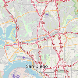
San Diego on the map
Data Sources & Methodology
Our weather forecasts are powered by a professional weather data provider that aggregates data from national weather services, satellite observations, radar networks, and over 80,000 weather stations worldwide. Forecast data is updated multiple times daily. We convert raw data into clear summaries — wind speed in m/s, pressure in mmHg — so you can plan your day with confidence.