
Prognoza pogody na 5 dni Kali 24 lis 2026

11°4° · Częściowe zachmurzenie

Prognoza pogody — Kali, wtorek, 24 lis 2026: częściowe zachmurzenie, temperatura od 4 °C do 11 °C.

Prawdopodobieństwo opadów 17%. Wiatr do 2.19 m/s (porywy 3.86 m/s). Wilgotność powietrza 37–72%, ciśnienie atmosferyczne 767–770 mm Hg, indeks UV do 1.

Ostrzeżenia pogodowe

Moderate21 lis, 06:43 — 22 lis, 23:59Przetłumacz przez Google
Yellow wind warning
SE wind increasing to strong or near gale force, veering to southwesterly by the end of the day. Maximum wind gusts 35-40 knots (65-75 km/h)
IMPACT: Although rather usual in this region, locally or potentially dangerous wind speeds are expected to produce dangerous wave conditions to small crafts. Inexperienced mariners, especially those operating smaller vessels, should avoid navigating in these conditions. Mariners should pay close attention to the marine forecast and consider wind and sea conditions in planning. It is possible that some ferry lines will not operate so follow traffic information if travelling.
Moderate21 lis, 06:43 — 22 lis, 23:59Przetłumacz przez Google
Yellow wind warning
SE wind increasing to strong or near gale force, veering to southwesterly by the end of the day. Maximum wind gusts 35-40 knots (65-75 km/h)
IMPACT: Although rather usual in this region, locally or potentially dangerous wind speeds are expected to produce dangerous wave conditions to small crafts. Inexperienced mariners, especially those operating smaller vessels, should avoid navigating in these conditions. Mariners should pay close attention to the marine forecast and consider wind and sea conditions in planning. It is possible that some ferry lines will not operate so follow traffic information if travelling.
Moderate21 lis, 06:43 — 22 lis, 23:59Przetłumacz przez Google
Yellow wind warning
SE wind increasing to strong or near gale force, veering to southwesterly and northwesterly by the end of the day. Maximum wind gusts 35-40 knots (65-75 km/h)
IMPACT: Although rather usual in this region, locally or potentially dangerous wind speeds are expected to produce dangerous wave conditions to small crafts. Inexperienced mariners, especially those operating smaller vessels, should avoid navigating in these conditions. Mariners should pay close attention to the marine forecast and consider wind and sea conditions in planning. It is possible that some ferry lines will not operate so follow traffic information if travelling.
Moderate21 lis, 06:43 — 22 lis, 23:59Przetłumacz przez Google
Yellow wind warning
SE wind increasing to strong or near gale force, veering to southwesterly and northwesterly by the end of the day. Maximum wind gusts 35-40 knots (65-75 km/h)
IMPACT: Although rather usual in this region, locally or potentially dangerous wind speeds are expected to produce dangerous wave conditions to small crafts. Inexperienced mariners, especially those operating smaller vessels, should avoid navigating in these conditions. Mariners should pay close attention to the marine forecast and consider wind and sea conditions in planning. It is possible that some ferry lines will not operate so follow traffic information if travelling.
Moderate21 lis, 06:43 — 22 lis, 23:59Przetłumacz przez Google
Yellow wind warning
SE wind increasing to strong or near gale force, veering to southwesterly and northwesterly by the end of the day. Maximum wind gusts 35-40 knots (65-75 km/h)
IMPACT: Although rather usual in this region, locally or potentially dangerous wind speeds are expected to produce dangerous wave conditions to small crafts. Inexperienced mariners, especially those operating smaller vessels, should avoid navigating in these conditions. Mariners should pay close attention to the marine forecast and consider wind and sea conditions in planning. It is possible that some ferry lines will not operate so follow traffic information if travelling.
Wschód słońca 07:05
Zachód słońca 16:25
Pełnia99% oświetlenia
Wschód księżyca 15:45 · Zachód księżyca 06:52
Wykres
Tabela

Prognoza od 4 °C do 11 °C i opady

Temperatura & Opady
Czas00:0001:0002:0003:0004:0005:0006:0007:0008:0009:0010:0011:0012:0013:0014:0015:0016:0017:0018:0019:0020:0021:0022:0023:00
Temperatura (°C)665555546791010111110109876666
Opady (mm/godz.)000000000000000000000000

Zachmurzenie i prawdopodobieństwo opadów

Zachmurzenie & Szansa na deszcz
Czas00:0001:0002:0003:0004:0005:0006:0007:0008:0009:0010:0011:0012:0013:0014:0015:0016:0017:0018:0019:0020:0021:0022:0023:00
Zachmurzenie (%)24614233233343425514144474948404227266170859697
Szansa na deszcz (%)86789988564444445461213161717

Prędkość i kierunek wiatru

Wiatr & Porywy wiatru
Czas00:0001:0002:0003:0004:0005:0006:0007:0008:0009:0010:0011:0012:0013:0014:0015:0016:0017:0018:0019:0020:0021:0022:0023:00
Wiatr (m/s)21.8922.112222.111.611.3910.310.190.890.610.390.310.811.52.192.1121.892.11
Porywy wiatru (m/s)3.032.972.812.642.252.422.692.972.832.862.832.612.612.562.1721.642.362.973.752.312.693.253.86
Kierunek wiatru (°)NE 46°NE 47°NE 51°NE 50°ENE 57°ENE 61°ENE 68°ENE 68°ENE 72°E 82°E 94°E 91°W 276°W 274°W 271°WSW 237°ESE 107°ENE 74°ENE 57°NE 55°ENE 63°ENE 73°E 86°E 88°

Wilgotność powietrza

Wilgotność
Czas00:0001:0002:0003:0004:0005:0006:0007:0008:0009:0010:0011:0012:0013:0014:0015:0016:0017:0018:0019:0020:0021:0022:0023:00
Wilgotność (%)717071717270696860534441393741464956637170706967

Ciśnienie atmosferyczne

Ciśnienie
Czas00:0001:0002:0003:0004:0005:0006:0007:0008:0009:0010:0011:0012:0013:0014:0015:0016:0017:0018:0019:0020:0021:0022:0023:00
Ciśnienie (mm Hg)767767767767767767767768768768769769769769768768768769769769770770770770

Indeks ultrafioletowy

Indeks UV
Czas00:0001:0002:0003:0004:0005:0006:0007:0008:0009:0010:0011:0012:0013:0014:0015:0016:0017:0018:0019:0020:0021:0022:0023:00
Indeks UV0000000000.20.60.8110.80.400000000

Jakość powietrza i pyłki

Dane o jakości powietrza są dostępne tylko przez pierwsze trzy dni.

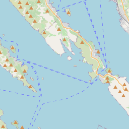
Kali na mapie
Źródła danych i metodologia

Nasze prognozy pogody są zasilane przez profesjonalnego dostawcę danych pogodowych, który agreguje dane z krajowych służb meteorologicznych, obserwacji satelitarnych, sieci radarowych i ponad 80 000 stacji meteorologicznych na całym świecie. Dane prognostyczne są aktualizowane wielokrotnie w ciągu dnia. Przetwarzamy surowe dane na czytelne podsumowania — prędkość wiatru w m/s, ciśnienie w mm Hg — abyście Państwo mogli planować dzień z pewnością.