
Prognoza pogody na 5 dni Kali 13 paź 2026
 20°
20°Prognoza pogody Kali jutro 13 paź 2026: słonecznie, temperatura od 14 °C do 20 °C.
Prawdopodobieństwo opadów 6%. Wiatr do 7 m/s (porywy 8.92 m/s). Wilgotność powietrza 37–67%, ciśnienie atmosferyczne 765–769 mm Hg, indeks UV do 3.3.
Ostrzeżenia pogodowe
Yellow wind warning
Locally fresh, in the evening also strong NE wind. Maximum wind gusts 35-45 knots (65-85 km/h)
IMPACT: Although rather usual in this region, locally or potentially dangerous wind speeds are expected to produce dangerous wave conditions to small crafts. Inexperienced mariners, especially those operating smaller vessels, should avoid navigating in these conditions.
Mariners should pay close attention to the marine forecast and consider wind and sea conditions in planning. It is possible that some ferry lines will not operate so follow traffic information if travelling.
Yellow wind warning
Locally fresh, in the evening also strong NE wind. Maximum wind gusts 35-45 knots (65-85 km/h)
IMPACT: Although rather usual in this region, locally or potentially dangerous wind speeds are expected to produce dangerous wave conditions to small crafts. Inexperienced mariners, especially those operating smaller vessels, should avoid navigating in these conditions.
Mariners should pay close attention to the marine forecast and consider wind and sea conditions in planning. It is possible that some ferry lines will not operate so follow traffic information if travelling.
Yellow wind warning
Locally fresh to strong NE wind. Maximum wind gusts 35-45 knots (65-85 km/h)
IMPACT: Although rather usual in this region, locally or potentially dangerous wind speeds are expected to produce dangerous wave conditions to small crafts. Inexperienced mariners, especially those operating smaller vessels, should avoid navigating in these conditions.
Mariners should pay close attention to the marine forecast and consider wind and sea conditions in planning. It is possible that some ferry lines will not operate so follow traffic information if travelling.
Yellow wind warning
Locally fresh NE wind. Maximum wind gusts 35-40 knots (65-75 km/h)
IMPACT: Although rather usual in this region, locally or potentially dangerous wind speeds are expected to produce dangerous wave conditions to small crafts. Inexperienced mariners, especially those operating smaller vessels, should avoid navigating in these conditions.
Mariners should pay close attention to the marine forecast and consider wind and sea conditions in planning. It is possible that some ferry lines will not operate so follow traffic information if travelling.
Yellow wind warning
Strong, locally near gale NE wind. Maximum wind gusts 35-55 knots (65-100 km/h)
IMPACT: Although rather usual in this region, locally or potentially dangerous wind speeds are expected to produce dangerous wave conditions to small crafts. Inexperienced mariners, especially those operating smaller vessels, should avoid navigating in these conditions.
Mariners should pay close attention to the marine forecast and consider wind and sea conditions in planning. It is possible that some ferry lines will not operate so follow traffic information if travelling.
5 dni w skrócie — dotknij dnia, aby go otworzyć
Wschód słońca 07:11
Zachód słońca 18:19
Zachód słońca 18:19
Przybywający sierp11% oświetlenia
Wschód księżyca 10:34 · Zachód księżyca 19:24
Wschód księżyca 10:34 · Zachód księżyca 19:24
Wykres
TabelaPrognoza od 14 °C do 20 °C i opady
Zachmurzenie i prawdopodobieństwo opadów
Prędkość i kierunek wiatru
Wilgotność powietrza
Ciśnienie atmosferyczne
Indeks ultrafioletowy
Jakość powietrza i pyłki
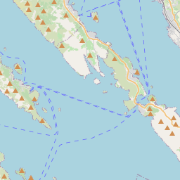
Kali na mapie
Źródła danych i metodologia
Nasze prognozy pogody są zasilane przez profesjonalnego dostawcę danych pogodowych, który agreguje dane z krajowych służb meteorologicznych, obserwacji satelitarnych, sieci radarowych i ponad 80 000 stacji meteorologicznych na całym świecie. Dane prognostyczne są aktualizowane wielokrotnie w ciągu dnia. Przetwarzamy surowe dane na czytelne podsumowania — prędkość wiatru w m/s, ciśnienie w mm Hg — abyście Państwo mogli planować dzień z pewnością.