Prognoza pogody na 5 dni Kali 25 lis 2026

11°6° · Lekka mżawka

Prognoza pogody — Kali, środa, 25 lis 2026: lekka mżawka, temperatura od 6 °C do 11 °C.

Prawdopodobieństwo opadów 65%. Wiatr do 8 m/s (porywy 16.17 m/s). Wilgotność powietrza 41–79%, ciśnienie atmosferyczne 759–770 mm Hg, indeks UV do 2.

Ostrzeżenia pogodowe

Moderate21 lis, 06:43 — 22 lis, 23:59Przetłumacz przez Google
Yellow wind warning
SE wind increasing to strong or near gale force, veering to southwesterly by the end of the day. Maximum wind gusts 35-40 knots (65-75 km/h)
IMPACT: Although rather usual in this region, locally or potentially dangerous wind speeds are expected to produce dangerous wave conditions to small crafts. Inexperienced mariners, especially those operating smaller vessels, should avoid navigating in these conditions. Mariners should pay close attention to the marine forecast and consider wind and sea conditions in planning. It is possible that some ferry lines will not operate so follow traffic information if travelling.
Moderate21 lis, 06:43 — 22 lis, 23:59Przetłumacz przez Google
Yellow wind warning
SE wind increasing to strong or near gale force, veering to southwesterly by the end of the day. Maximum wind gusts 35-40 knots (65-75 km/h)
IMPACT: Although rather usual in this region, locally or potentially dangerous wind speeds are expected to produce dangerous wave conditions to small crafts. Inexperienced mariners, especially those operating smaller vessels, should avoid navigating in these conditions. Mariners should pay close attention to the marine forecast and consider wind and sea conditions in planning. It is possible that some ferry lines will not operate so follow traffic information if travelling.
Moderate21 lis, 06:43 — 22 lis, 23:59Przetłumacz przez Google
Yellow wind warning
SE wind increasing to strong or near gale force, veering to southwesterly and northwesterly by the end of the day. Maximum wind gusts 35-40 knots (65-75 km/h)
IMPACT: Although rather usual in this region, locally or potentially dangerous wind speeds are expected to produce dangerous wave conditions to small crafts. Inexperienced mariners, especially those operating smaller vessels, should avoid navigating in these conditions. Mariners should pay close attention to the marine forecast and consider wind and sea conditions in planning. It is possible that some ferry lines will not operate so follow traffic information if travelling.
Moderate21 lis, 06:43 — 22 lis, 23:59Przetłumacz przez Google
Yellow wind warning
SE wind increasing to strong or near gale force, veering to southwesterly and northwesterly by the end of the day. Maximum wind gusts 35-40 knots (65-75 km/h)
IMPACT: Although rather usual in this region, locally or potentially dangerous wind speeds are expected to produce dangerous wave conditions to small crafts. Inexperienced mariners, especially those operating smaller vessels, should avoid navigating in these conditions. Mariners should pay close attention to the marine forecast and consider wind and sea conditions in planning. It is possible that some ferry lines will not operate so follow traffic information if travelling.
Moderate21 lis, 06:43 — 22 lis, 23:59Przetłumacz przez Google
Yellow wind warning
SE wind increasing to strong or near gale force, veering to southwesterly and northwesterly by the end of the day. Maximum wind gusts 35-40 knots (65-75 km/h)
IMPACT: Although rather usual in this region, locally or potentially dangerous wind speeds are expected to produce dangerous wave conditions to small crafts. Inexperienced mariners, especially those operating smaller vessels, should avoid navigating in these conditions. Mariners should pay close attention to the marine forecast and consider wind and sea conditions in planning. It is possible that some ferry lines will not operate so follow traffic information if travelling.
Wschód słońca 07:07
Zachód słońca 16:25
Pełnia96% oświetlenia
Wschód księżyca 16:32 · Zachód księżyca 08:06
Wykres
Tabela
śr., 25 lis 2026

Prognoza od 6 °C do 11 °C i opady

Temperatura & Opady
Czas00:0001:0002:0003:0004:0005:0006:0007:0008:0009:0010:0011:0012:0013:0014:0015:0016:0017:0018:0019:0020:0021:0022:0023:00
Temperatura (°C)666666778991010101099991010101011
Opady (mm/godz.)00000000000.030.090.220.130.20.460.440.620.730.90.680.470.270.18

Zachmurzenie i prawdopodobieństwo opadów

Zachmurzenie & Szansa na deszcz
Czas00:0001:0002:0003:0004:0005:0006:0007:0008:0009:0010:0011:0012:0013:0014:0015:0016:0017:0018:0019:0020:0021:0022:0023:00
Zachmurzenie (%)99100100999999100100100100100100100100100100100100100100100100100100
Szansa na deszcz (%)161615141413121211101217292029454655626564584638

Prędkość i kierunek wiatru

Wiatr & Porywy wiatru
Czas00:0001:0002:0003:0004:0005:0006:0007:0008:0009:0010:0011:0012:0013:0014:0015:0016:0017:0018:0019:0020:0021:0022:0023:00
Wiatr (m/s)2.192.192.312.312.52.692.813.193.614.114.615.315.896.696.817.197.5887.816.395.815.395.89
Porywy wiatru (m/s)3.834.064.334.755.225.645.837.067.788.979.4710.6412.3614.514.3914.8115.9216.1715.514.3612.1711.1111.8312.69
Kierunek wiatru (°)E 88°E 91°E 94°E 98°E 98°E 99°ESE 102°E 101°ESE 105°ESE 106°ESE 107°ESE 107°ESE 108°ESE 109°ESE 110°ESE 109°ESE 106°ESE 108°ESE 110°ESE 106°E 98°E 97°E 92°E 98°

Wilgotność powietrza

Wilgotność
Czas00:0001:0002:0003:0004:0005:0006:0007:0008:0009:0010:0011:0012:0013:0014:0015:0016:0017:0018:0019:0020:0021:0022:0023:00
Wilgotność (%)656361595754504744424144484953586268747978787773

Ciśnienie atmosferyczne

Ciśnienie
Czas00:0001:0002:0003:0004:0005:0006:0007:0008:0009:0010:0011:0012:0013:0014:0015:0016:0017:0018:0019:0020:0021:0022:0023:00
Ciśnienie (mm Hg)770769769768768768767767767767767767766765764764763762762761761760760759

Indeks ultrafioletowy

Indeks UV
Czas00:0001:0002:0003:0004:0005:0006:0007:0008:0009:0010:0011:0012:0013:0014:0015:0016:0017:0018:0019:0020:0021:0022:0023:00
Indeks UV0000000000.30.7110.82220000000

Jakość powietrza i pyłki

Dane o jakości powietrza są dostępne tylko przez pierwsze trzy dni.

śr., 25 lis 2026

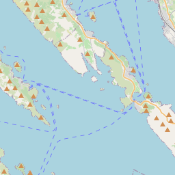
Kali na mapie

Źródła danych i metodologia

Nasze prognozy pogody są zasilane przez profesjonalnego dostawcę danych pogodowych, który agreguje dane z krajowych służb meteorologicznych, obserwacji satelitarnych, sieci radarowych i ponad 80 000 stacji meteorologicznych na całym świecie. Dane prognostyczne są aktualizowane wielokrotnie w ciągu dnia. Przetwarzamy surowe dane na czytelne podsumowania — prędkość wiatru w m/s, ciśnienie w mm Hg — abyście Państwo mogli planować dzień z pewnością.