5-day weather forecast Bled 04-08-2026

Weather forecast Bled today 04.08.2026: sunny, temperature from 17 °C to 30 °C.

Precipitation probability 5%. Wind up to 2.31 m/s (gusts 3.17 m/s). Air humidity 29–68%, atmospheric pressure 761–764 mm Hg, UV index up to 8.3.

Weather Alerts

Hide alerts
ModerateAug 3, 06:06 AMAug 5, 09:59 PMTranslate with Google
Moderate Thunderstorms Warning (Degree 2/4) - Slovenia / North-West

Moderate Thunderstorms Warning

Thunderstorms are possible, accompanied by local intense precipitation and gusty winds. Intense local showers with wind blasts and lightning strikes are possible. Torrential watercourses may rise quickly. Rainwater floods are possible.
Beware of approaching storm clouds. Do not linger in exposed locations, e.g. under trees or power lines. Wait in a safe place, as storms usually do not last long.
SevereAug 4, 08:53 AMAug 5, 08:59 PMTranslate with Google
Severe High temperature Warning (Degree 3/4) - Slovenia / North-West

Severe High temperature Warning

High temperatures will affect the health of sensitive members of the population.
Stay in the shade at midday and in the afternoon, while intense physical effort is not recommended. Eat light food and drink enough liquids. Wear airy and light clothes. Drinking coffee, alcohol or very sweet drinks is not recommended. If you take medication for regulating blood pressure, consult your doctor. Air conditioning should be set to a temperature that is no more than 8 °C lower than the outside temperature. Domestic animals should have enough fresh water and shade. Living premises should be aired out at night and in the morning and sufficient air circulation should be ensured. We recommend shading premises externally. Vehicles parked in the sun should be aired out thoroughly before driving.
SevereAug 4, 08:53 AMAug 9, 12:59 AMTranslate with Google
Severe Forestfire danger Warning (Degree 3/4) - Slovenia / North-West

Severe Forestfire danger Warning

There is a large risk of forest and bush fire.
Stay vigilant and be prepared there is a large risk of forest and bush fire. Immediately react to any developing fire. The public are asked to exercise extreme caution in the countryside, and immediately notify emergency services on any fire.
Sunrise 05:48
Sunset 20:30
Last Quarter55% illuminated
Moonrise 22:37 · Moonset 12:05
Chart
Table
Tue, Aug 4, 2026

Forecast from 17 °C to 30 °C and precipitation

Temperature & Precipitation
Time00:0001:0002:0003:0004:0005:0006:0007:0008:0009:0010:0011:0012:0013:0014:0015:0016:0017:0018:0019:0020:0021:0022:0023:00
Temperature (°C)181818181717171821242528292930302929282522202019
Precipitation (mm/hr)000000000000000000000000

Cloud cover and precipitation probability

Cloud cover & Rain chance
Time00:0001:0002:0003:0004:0005:0006:0007:0008:0009:0010:0011:0012:0013:0014:0015:0016:0017:0018:0019:0020:0021:0022:0023:00
Cloud cover (%)422024566670355554443334
Rain chance (%)444333343211111111135555

Wind speed and direction

Wind & Wind gust
Time00:0001:0002:0003:0004:0005:0006:0007:0008:0009:0010:0011:0012:0013:0014:0015:0016:0017:0018:0019:0020:0021:0022:0023:00
Wind (m/s)1.311.311.311.111.191.111.1110.891.111.311.311.611.892.112.192.312.191.891.691.391.111.311.39
Wind gust (m/s)2.722.722.722.312.532.312.312.111.531.331.51.51.832.192.422.532.642.642.583.172.942.312.722.94
Wind direction (°)W 270°W 269°W 273°W 275°W 281°W 281°WNW 287°WNW 284°W 278°WSW 247°SW 230°SW 225°SW 218°SW 215°SW 214°SW 217°SW 220°SW 222°SW 221°SW 230°WSW 247°WSW 249°WSW 252°W 265°

Air humidity

Humidity
Time00:0001:0002:0003:0004:0005:0006:0007:0008:0009:0010:0011:0012:0013:0014:0015:0016:0017:0018:0019:0020:0021:0022:0023:00
Humidity (%)616162605956556056464034312929303134435968666666

Atmospheric pressure

Pressure
Time00:0001:0002:0003:0004:0005:0006:0007:0008:0009:0010:0011:0012:0013:0014:0015:0016:0017:0018:0019:0020:0021:0022:0023:00
Pressure (mm Hg)764764764764763763763764763763763763763762762762762761761761762763764764

Ultraviolet index

UV Index
Time00:0001:0002:0003:0004:0005:0006:0007:0008:0009:0010:0011:0012:0013:0014:0015:0016:0017:0018:0019:0020:0021:0022:0023:00
UV Index00000000.31.12.44.26.27.68.37.86.44.52.61.20.40000

Air quality & pollen

Air quality
Time00:0001:0002:0003:0004:0005:0006:0007:0008:0009:0010:0011:0012:0013:0014:0015:0016:0017:0018:0019:0020:0021:0022:0023:00
PM2.5 (µg/m³)9.89.89.79.69.69.69.28.710.410.711.610.910.29.69.610.21111.913.314.514.814.815.115.4
PM10 (µg/m³)15.415.415.21514.914.914.914.815.115.316.415.514.513.714.316.117.117.618.919.920.420.521.321.6
Ozone (O₃) (µg/m³)929394958891909598107109107105105105106107108108107103968486
NO₂ (µg/m³)1.21.21.21.21.21.21.11.10.90.60.40.40.30.30.30.30.40.40.50.60.70.811.1
SO₂ (µg/m³)1.91.91.91.91.921.91.81.71.81.51.31.21.21.21.11.11.11.11.31.31.20.91
CO (µg/m³)144149147137130130131140140145144143142142143144142143144144142144144144
Tue, Aug 4, 2026

Frequently asked questions about the 5-day weather in Bled

Over the next 5 days in Bled the temperature is expected to range from about 15 to 31 °C. See the detailed hourly forecast for each of the 5 days in the charts above.

The chance of rain in Bled over the next 5 days reaches 78%. Check the 5-day precipitation chart above to see exactly which days and hours bring rain.

A 5-day forecast is fairly reliable: the first 2–3 days are usually very accurate, while days 4–5 may be refined. The data is updated several times a day, so check back before important plans.

Over the next 5 days the temperature in Bled ranges from about 15 to 31 °C. Compare the warmest and coolest day on the temperature chart above.

Over the next 5 days the wind in Bled picks up to 2 m/s. The windiest days are easy to spot on the wind chart above.

For a walk or a trip, pick the days with the lowest chance of rain (up to 78%) and light wind — easy to compare on the 5-day charts above.

The first 2–3 days are reliable enough for firm decisions, while days 4–5 are a guide that sharpens as they approach. The forecast is updated several times a day, so check again before important plans.

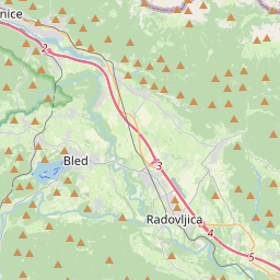
Bled on the map

Data Sources & Methodology

Our weather forecasts are powered by a professional weather data provider that aggregates data from national weather services, satellite observations, radar networks, and over 80,000 weather stations worldwide. Forecast data is updated multiple times daily. We convert raw data into clear summaries — wind speed in m/s, pressure in mmHg — so you can plan your day with confidence.