
5-day weather forecast Zakopane Oct 17, 2026
 7°
7°Weather forecast Zakopane Saturday Oct 17, 2026: overcast, temperature from 1 °C to 7 °C.
Precipitation probability 58%. Wind up to 1.19 m/s (gusts 4.69 m/s). Air humidity 59–99%, atmospheric pressure 764–767 mm Hg, UV index up to 1.2.
Weather Alerts
Yellow Strong wind in the coastal zone warning for Poland - Eastern coastal zone
Yellow Wind warning
Wind south veering west to northwest force 5 to 7.
BE AWARE. Difficult navigation conditions. It is recommended to avoid traveling through coastal zone area.
Yellow Strong wind warning for Poland - Zachodniopomorskie Province Slawienski County
Yellow Wind warning
It is forecasted strong wind with mean speed to 40 km/h and gusts up to 75 km/h, from northwest.
BE AWARE of debris being blown around. Localised outdoor activity disruption is possible due to debris.
Yellow Strong wind warning for Poland - Zachodniopomorskie Province Koszalinski County
Yellow Wind warning
It is forecasted strong wind with mean speed to 40 km/h and gusts up to 75 km/h, from northwest.
BE AWARE of debris being blown around. Localised outdoor activity disruption is possible due to debris.
Yellow Strong wind warning for Poland - Zachodniopomorskie Province Kolobrzeski County
Yellow Wind warning
It is forecasted strong wind with mean speed to 40 km/h and gusts up to 75 km/h, from northwest.
BE AWARE of debris being blown around. Localised outdoor activity disruption is possible due to debris.
Yellow Strong wind warning for Poland - Pomorskie Province Wejherowski County
Yellow Wind warning
It is forecasted strong wind with mean speed to 40 km/h and gusts up to 75 km/h, from northwest.
BE AWARE of debris being blown around. Localised outdoor activity disruption is possible due to debris.
5 days at a glance — tap a day to open it
Sunrise 07:04
Sunset 17:46
Sunset 17:46
First Quarter47% illuminated
Moonrise 14:27 · Moonset 22:12
Moonrise 14:27 · Moonset 22:12
Chart
Table
| Time | Weather | Temperature | Rain chance | Cloud cover | Humidity | Pressure | Wind | UV Index |
|---|---|---|---|---|---|---|---|---|
| 00:00 |  Overcast | 2 °C | 16% | 96% | 64% | 767 mm Hg | SE 126° 0.39 (0.53) m/s | 0 |
| 01:00 | Overcast | 3 °C | 15% | 100% | 61% | 767 mm Hg | ESE 102° 0.89 (3.89) m/s | 0 |
| 02:00 |  Cloudy | 3 °C | 10% | 71% | 59% | 766 mm Hg | SE 143° 0.89 (0.92) m/s | 0 |
| 03:00 |  Partly cloudy | 2 °C | 6% | 39% | 60% | 766 mm Hg | SSW 207° 0.81 (0.81) m/s | 0 |
| 04:00 | Overcast | 1 °C | 15% | 93% | 62% | 766 mm Hg | SW 232° 0.19 (0.31) m/s | 0 |
| 05:00 | Overcast | 2 °C | 15% | 99% | 61% | 765 mm Hg | WSW 251° 0.5 (0.61) m/s | 0 |
| 06:00 | Overcast | 3 °C | 16% | 100% | 62% | 765 mm Hg | NNW 337° 0.69 (4.69) m/s | 0 |
| 07:00 | Overcast | 3 °C | 17% | 100% | 64% | 765 mm Hg | NNW 338° 0.39 (0.42) m/s | 0 |
| 08:00 | Overcast | 4 °C | 18% | 100% | 67% | 765 mm Hg | N 4° 0.31 (0.31) m/s | 0 |
| 09:00 |  Patchy rain possible | 6 °C | 20% (0.01 mm/hr) | 100% | 71% | 764 mm Hg | N 350° 0.61 (0.81) m/s | 0.4 |
| 10:00 | Patchy rain possible | 7 °C | 22% (0.01 mm/hr) | 100% | 75% | 764 mm Hg | N 4° 0.69 (1) m/s | 1 |
| 11:00 | Patchy rain possible | 6 °C | 31% (0.06 mm/hr) | 100% | 81% | 764 mm Hg | N 349° 0.5 (0.61) m/s | 1.2 |
| 12:00 | Patchy rain possible | 6 °C | 40% (0.14 mm/hr) | 100% | 86% | 764 mm Hg | NNW 340° 0.39 (0.61) m/s | 0.6 |
| 13:00 | Patchy rain possible | 6 °C | 42% (0.14 mm/hr) | 100% | 89% | 764 mm Hg | NW 317° 0.69 (0.83) m/s | 0.3 |
| 14:00 | Patchy rain possible | 7 °C | 37% (0.05 mm/hr) | 100% | 92% | 764 mm Hg | NW 325° 0.69 (0.97) m/s | 0.4 |
| 15:00 |  Mist | 6 °C | 43% (0.04 mm/hr) | 100% | 95% | 764 mm Hg | NNW 337° 1 (1.36) m/s | 0.4 |
| 16:00 |  Fog | 6 °C | 44% (0.02 mm/hr) | 100% | 97% | 764 mm Hg | NNW 339° 1.11 (1.5) m/s | 0.4 |
| 17:00 | Fog | 6 °C | 55% (0.13 mm/hr) | 100% | 98% | 764 mm Hg | NNW 339° 1.11 (1.61) m/s | 0.1 |
| 18:00 |  Fog | 6 °C | 54% (0.1 mm/hr) | 100% | 99% | 764 mm Hg | N 350° 1.19 (1.86) m/s | 0 |
| 19:00 | Fog | 5 °C | 54% (0.1 mm/hr) | 100% | 99% | 764 mm Hg | N 355° 1.19 (1.89) m/s | 0 |
| 20:00 |  Light drizzle | 6 °C | 58% (0.23 mm/hr) | 100% | 99% | 765 mm Hg | N 4° 1.19 (1.83) m/s | 0 |
| 21:00 | Light drizzle | 6 °C | 56% (0.19 mm/hr) | 100% | 99% | 765 mm Hg | N 5° 1.11 (1.72) m/s | 0 |
| 22:00 | Fog | 6 °C | 54% (0.1 mm/hr) | 100% | 99% | 765 mm Hg | N 5° 1.19 (1.89) m/s | 0 |
| 23:00 | Fog | 6 °C | 44% (0.01 mm/hr) | 100% | 99% | 765 mm Hg | N 357° 1.11 (1.61) m/s | 0 |
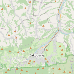
Zakopane on the map
Data Sources & Methodology
Our weather forecasts are powered by a professional weather data provider that aggregates data from national weather services, satellite observations, radar networks, and over 80,000 weather stations worldwide. Forecast data is updated multiple times daily. We convert raw data into clear summaries — wind speed in m/s, pressure in mmHg — so you can plan your day with confidence.