
5-day weather forecast Zakopane Oct 24, 2026
 7°
7°Weather forecast Zakopane today Oct 24, 2026: patchy rain possible, temperature from -1 °C to 8 °C.
Precipitation probability 42%. Wind up to 3.11 m/s (gusts 6.31 m/s). Air humidity 65–97%, atmospheric pressure 764–766 mm Hg, UV index up to 1.8.
Weather Alerts
Moderate wind on mountains warning
Moderate wind on mountains warning
Moderate wind on mountains warning
Moderate wind on mountains warning
Moderate wind on mountains warning
Sunset 17:33
Moonrise 16:29 · Moonset 05:09
| Time | Weather | Temperature | Rain chance | Cloud cover | Humidity | Pressure | Wind | UV Index |
|---|---|---|---|---|---|---|---|---|
| 00:00 |  Partly cloudy | 0 °C | 16% | 52% | 82% | 765 mm Hg | S 184° 3.11 (4.14) m/s | 0 |
| 01:00 | Partly cloudy | -1 °C | 14% | 52% | 78% | 765 mm Hg | S 183° 3 (3.61) m/s | 0 |
| 02:00 | Partly cloudy | -1 °C | 12% | 51% | 74% | 764 mm Hg | S 181° 2.39 (5.39) m/s | 0 |
| 03:00 | Partly cloudy | -1 °C | 10% | 36% | 72% | 764 mm Hg | S 190° 2.81 (3.33) m/s | 0 |
| 04:00 |  Clear | -1 °C | 7% | 8% | 72% | 764 mm Hg | S 188° 2.5 (2.53) m/s | 0 |
| 05:00 |  Light freezing rain | -1 °C | 13% (0.01 mm/hr) | 53% | 71% | 764 mm Hg | S 191° 1.89 (4.56) m/s | 0 |
| 06:00 | Clear | -1 °C | 8% | 5% | 74% | 764 mm Hg | SSW 195° 2.39 (5.39) m/s | 0 |
| 07:00 |  Overcast | -1 °C | 21% | 99% | 74% | 764 mm Hg | S 190° 2.31 (6.31) m/s | 0 |
| 08:00 | Overcast | 0 °C | 18% | 94% | 70% | 764 mm Hg | SSW 193° 1.11 (3.11) m/s | 0 |
| 09:00 | Overcast | 6 °C | 17% | 100% | 65% | 764 mm Hg | SSW 209° 1.31 (2.06) m/s | 0.3 |
| 10:00 | Overcast | 7 °C | 17% | 100% | 65% | 764 mm Hg | WSW 242° 0.89 (1.33) m/s | 0.8 |
| 11:00 | Patchy rain possible | 7 °C | 23% (0.04 mm/hr) | 100% | 72% | 764 mm Hg | SSW 200° 0.5 (2.94) m/s | 1.2 |
| 12:00 | Patchy rain possible | 8 °C | 18% (0.01 mm/hr) | 95% | 69% | 764 mm Hg | SSE 160° 0.31 (1.33) m/s | 1.7 |
| 13:00 | Patchy rain possible | 7 °C | 20% (0.01 mm/hr) | 91% | 75% | 764 mm Hg | ESE 105° 0.61 (0.89) m/s | 1.8 |
| 14:00 | Patchy rain possible | 7 °C | 26% (0.01 mm/hr) | 100% | 81% | 764 mm Hg | W 270° 0.39 (2.97) m/s | 0.8 |
| 15:00 | Patchy rain possible | 6 °C | 28% (0.01 mm/hr) | 100% | 84% | 764 mm Hg | NNW 345° 0.89 (1.31) m/s | 0.4 |
| 16:00 | Patchy rain possible | 5 °C | 32% (0.02 mm/hr) | 100% | 90% | 765 mm Hg | N 9° 0.69 (1.11) m/s | 0.2 |
| 17:00 | Patchy rain possible | 5 °C | 33% (0.02 mm/hr) | 100% | 91% | 764 mm Hg | ENE 67° 0.31 (2.47) m/s | 0 |
| 18:00 |  Patchy rain possible | 5 °C | 32% (0.01 mm/hr) | 100% | 92% | 765 mm Hg | ENE 59° 0.61 (0.89) m/s | 0 |
| 19:00 |  Mist | 5 °C | 39% (0.01 mm/hr) | 100% | 94% | 766 mm Hg | ENE 72° 0.61 (1) m/s | 0 |
| 20:00 |  Fog | 4 °C | 42% | 100% | 97% | 765 mm Hg | ESE 120° 0.61 (2.14) m/s | 0 |
| 21:00 | Mist | 5 °C | 39% (0.01 mm/hr) | 100% | 95% | 766 mm Hg | ENE 71° 0.5 (0.83) m/s | 0 |
| 22:00 | Mist | 5 °C | 38% | 100% | 95% | 766 mm Hg | E 94° 0.5 (0.92) m/s | 0 |
| 23:00 | Mist | 3 °C | 38% | 100% | 95% | 765 mm Hg | SE 142° 0.5 (2) m/s | 0 |
Frequently asked questions about the 5-day weather in Zakopane
What will the weather be like in Zakopane over the next 5 days?
On which of the next 5 days will it rain in Zakopane?
How accurate is the 5-day weather forecast for Zakopane?
Which of the next 5 days in Zakopane will be the warmest and which the coolest?
Will it be windy in Zakopane over the next 5 days?
Which day of the week in Zakopane is best for a walk or a trip?
How can I best use the 5-day forecast for Zakopane?
Will I need an umbrella or sunscreen in Zakopane this week?
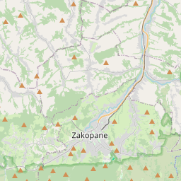
Zakopane on the map
Data Sources & Methodology
Our weather forecasts are powered by a professional weather data provider that aggregates data from national weather services, satellite observations, radar networks, and over 80,000 weather stations worldwide. Forecast data is updated multiple times daily. We convert raw data into clear summaries — wind speed in m/s, pressure in mmHg — so you can plan your day with confidence.