5-day weather forecast Zakopane 12-08-2026

Weather forecast Zakopane today 12.08.2026: sunny, temperature from 5 °C to 20 °C.

Precipitation probability 15%. Wind up to 2.81 m/s (gusts 3.36 m/s). Air humidity 40–91%, atmospheric pressure 769–772 mm Hg, UV index up to 7.

Sunrise 05:27
Sunset 20:02
New Moon0% illuminated
Moonrise 04:15 · Moonset 19:56
Chart
Table
Wed, Aug 12, 2026

Forecast from 5 °C to 20 °C and precipitation

Temperature & Precipitation
Time00:0001:0002:0003:0004:0005:0006:0007:0008:0009:0010:0011:0012:0013:0014:0015:0016:0017:0018:0019:0020:0021:0022:0023:00
Temperature (°C)7685555101214151718191920201917159888
Precipitation (mm/hr)000000000000000000000000

Cloud cover and precipitation probability

Cloud cover & Rain chance
Time00:0001:0002:0003:0004:0005:0006:0007:0008:0009:0010:0011:0012:0013:0014:0015:0016:0017:0018:0019:0020:0021:0022:0023:00
Cloud cover (%)1004381134433777788875333
Rain chance (%)10991112141596432111112247766

Wind speed and direction

Wind & Wind gust
Time00:0001:0002:0003:0004:0005:0006:0007:0008:0009:0010:0011:0012:0013:0014:0015:0016:0017:0018:0019:0020:0021:0022:0023:00
Wind (m/s)11.191.111.191.311.311.191.52.112.312.392.52.612.692.612.612.692.812.812.311.611.311.191.19
Wind gust (m/s)2.112.532.312.532.722.722.531.722.422.642.752.8933.11333.113.223.223.173.362.722.532.53
Wind direction (°)N 7°N 10°NNE 22°NE 40°NE 49°ENE 58°ENE 64°NE 51°NE 44°NE 40°NE 38°NE 35°NNE 33°NNE 31°NNE 33°NNE 32°NE 35°NE 39°NE 41°NE 41°ENE 66°E 99°ESE 107°ESE 105°

Air humidity

Humidity
Time00:0001:0002:0003:0004:0005:0006:0007:0008:0009:0010:0011:0012:0013:0014:0015:0016:0017:0018:0019:0020:0021:0022:0023:00
Humidity (%)807887838690917968615448444140404144506273727069

Atmospheric pressure

Pressure
Time00:0001:0002:0003:0004:0005:0006:0007:0008:0009:0010:0011:0012:0013:0014:0015:0016:0017:0018:0019:0020:0021:0022:0023:00
Pressure (mm Hg)770770769770770770771770770770770770770770770769770770770770771772771772

Ultraviolet index

UV Index
Time00:0001:0002:0003:0004:0005:0006:0007:0008:0009:0010:0011:0012:0013:0014:0015:0016:0017:0018:0019:0020:0021:0022:0023:00
UV Index00000000.51.32.64.35.86.876.24.83.21.70.70.20000

Air quality & pollen

Air quality
Time00:0001:0002:0003:0004:0005:0006:0007:0008:0009:0010:0011:0012:0013:0014:0015:0016:0017:0018:0019:0020:0021:0022:0023:00
PM2.5 (µg/m³)6.476.66.76.76.46.85.74.74.13.83.63.843.73.73.83.94.14.55.25.25.65.6
PM10 (µg/m³)9.910.11010.29.19.7109.38.37.47.67.47.27.17.37.47.47.57.47.78.28.68.57.7
Ozone (O₃) (µg/m³)555349494950505262667071727375767676747272666060
NO₂ (µg/m³)4.74.74.64.13.63.53.42.72.11.20.90.70.60.50.50.50.60.70.91.41.72.12.32.1
SO₂ (µg/m³)1.41.31.31.41.41.211.110.90.70.70.70.70.60.50.50.50.50.50.50.70.80.7
CO (µg/m³)140142139138135133123122116116115115114114115115116117119125129130128128
Wed, Aug 12, 2026

Frequently asked questions about the 5-day weather in Zakopane

Over the next 5 days in Zakopane the temperature is expected to range from about 5 to 29 °C. See the detailed hourly forecast for each of the 5 days in the charts above.

The chance of rain in Zakopane over the next 5 days reaches 15%. Check the 5-day precipitation chart above to see exactly which days and hours bring rain.

A 5-day forecast is fairly reliable: the first 2–3 days are usually very accurate, while days 4–5 may be refined. The data is updated several times a day, so check back before important plans.

Over the next 5 days the temperature in Zakopane ranges from about 5 to 29 °C. Compare the warmest and coolest day on the temperature chart above.

Over the next 5 days the wind in Zakopane picks up to 3 m/s. The windiest days are easy to spot on the wind chart above.

For a walk or a trip, pick the days with the lowest chance of rain (up to 15%) and light wind — easy to compare on the 5-day charts above.

The first 2–3 days are reliable enough for firm decisions, while days 4–5 are a guide that sharpens as they approach. The forecast is updated several times a day, so check again before important plans.

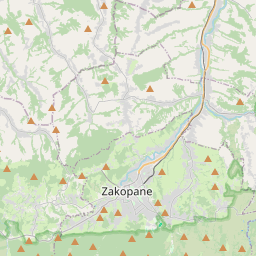
Zakopane on the map

Data Sources & Methodology

Our weather forecasts are powered by a professional weather data provider that aggregates data from national weather services, satellite observations, radar networks, and over 80,000 weather stations worldwide. Forecast data is updated multiple times daily. We convert raw data into clear summaries — wind speed in m/s, pressure in mmHg — so you can plan your day with confidence.