
Prognoza pogody na 5 dni Auerbach 23 paź 2026
 12°
12°Prognoza pogody Auerbach piątek 23 paź 2026: całkowite zachmurzenie, temperatura od 4 °C do 12 °C.
Prawdopodobieństwo opadów 29%. Wiatr do 7 m/s (porywy 17.22 m/s). Wilgotność powietrza 47–89%, ciśnienie atmosferyczne 760–766 mm Hg, indeks UV do 1.5.
Ostrzeżenia pogodowe
Moderate Wind Related Impact
SE wind with gusts between 15 and 20 m/s (55 to 70 km/h).
Possible complications in the energy industry, forestry, and transport. Possible damage to trees and forests. Minor damage to energy infrastructure, property (especially older buildings). Risk of injury from flying or falling objects, especially broken branches. Minor travel delays due to debris and outages.
Secure windows, doors, remove or anchor loosely stored objects, tents, greenhouses, etc. Watch out for falling objects such as branches or roof tiles. When driving, watch out for strong crosswinds at exposed points such as bridges, drive slowly. In the mountains, limit hikes and avoid ridge areas in particular.
Moderate Wind Related Impact
SE wind with gusts between 15 and 20 m/s (55 to 70 km/h).
Possible complications in the energy industry, forestry, and transport. Possible damage to trees and forests. Minor damage to energy infrastructure, property (especially older buildings). Risk of injury from flying or falling objects, especially broken branches. Minor travel delays due to debris and outages.
Secure windows, doors, remove or anchor loosely stored objects, tents, greenhouses, etc. Watch out for falling objects such as branches or roof tiles. When driving, watch out for strong crosswinds at exposed points such as bridges, drive slowly. In the mountains, limit hikes and avoid ridge areas in particular.
Moderate Wind Related Impact
SE wind with gusts between 15 and 20 m/s (55 to 70 km/h).
Possible complications in the energy industry, forestry, and transport. Possible damage to trees and forests. Minor damage to energy infrastructure, property (especially older buildings). Risk of injury from flying or falling objects, especially broken branches. Minor travel delays due to debris and outages.
Secure windows, doors, remove or anchor loosely stored objects, tents, greenhouses, etc. Watch out for falling objects such as branches or roof tiles. When driving, watch out for strong crosswinds at exposed points such as bridges, drive slowly. In the mountains, limit hikes and avoid ridge areas in particular.
Moderate Wind Related Impact
SE wind with gusts between 15 and 20 m/s (55 to 70 km/h).
Possible complications in the energy industry, forestry, and transport. Possible damage to trees and forests. Minor damage to energy infrastructure, property (especially older buildings). Risk of injury from flying or falling objects, especially broken branches. Minor travel delays due to debris and outages.
Secure windows, doors, remove or anchor loosely stored objects, tents, greenhouses, etc. Watch out for falling objects such as branches or roof tiles. When driving, watch out for strong crosswinds at exposed points such as bridges, drive slowly. In the mountains, limit hikes and avoid ridge areas in particular.
5 dni w skrócie — dotknij dnia, aby go otworzyć
Wschód słońca 07:46
Zachód słońca 18:02
Zachód słońca 18:02
Pełnia97% oświetlenia
Wschód księżyca 16:45 · Zachód księżyca 04:31
Wschód księżyca 16:45 · Zachód księżyca 04:31
Wykres
Tabela
| Czas | Pogoda | Temperatura | Szansa na deszcz | Zachmurzenie | Wilgotność | Ciśnienie | Wiatr | Indeks UV |
|---|---|---|---|---|---|---|---|---|
| 00:00 |  Możliwy przelotny deszcz | 8 °C | 19% (0.01 mm/godz.) | 82% | 76% | 766 mm Hg | SSW 195° 3 (9.03) m/s | 0 |
| 01:00 |  Bezchmurnie | 5 °C | 12% | 7% | 85% | 766 mm Hg | S 170° 2.69 (6.11) m/s | 0 |
| 02:00 | Bezchmurnie | 4 °C | 13% | 5% | 88% | 766 mm Hg | S 169° 2.61 (4.72) m/s | 0 |
| 03:00 |  Częściowe zachmurzenie | 4 °C | 18% | 45% | 89% | 766 mm Hg | SSE 166° 2.69 (4.72) m/s | 0 |
| 04:00 |  Całkowite zachmurzenie | 4 °C | 29% | 100% | 88% | 765 mm Hg | SSE 162° 2.69 (4.11) m/s | 0 |
| 05:00 | Całkowite zachmurzenie | 4 °C | 28% | 100% | 87% | 765 mm Hg | SSE 158° 2.69 (4.22) m/s | 0 |
| 06:00 | Całkowite zachmurzenie | 5 °C | 27% | 100% | 84% | 764 mm Hg | SSE 157° 2.61 (5.03) m/s | 0 |
| 07:00 | Całkowite zachmurzenie | 5 °C | 26% | 100% | 84% | 764 mm Hg | SSE 159° 2.81 (5.72) m/s | 0 |
| 08:00 | Całkowite zachmurzenie | 5 °C | 25% | 100% | 82% | 764 mm Hg | SSE 152° 3 (7.69) m/s | 0 |
| 09:00 | Całkowite zachmurzenie | 6 °C | 20% | 100% | 72% | 763 mm Hg | SSE 153° 3.61 (12) m/s | 0.1 |
| 10:00 | Całkowite zachmurzenie | 8 °C | 14% | 100% | 59% | 761 mm Hg | SSE 158° 4.61 (12.89) m/s | 0.4 |
| 11:00 | Całkowite zachmurzenie | 9 °C | 13% | 100% | 54% | 761 mm Hg | SSE 158° 4.39 (12.69) m/s | 0.6 |
| 12:00 | Całkowite zachmurzenie | 10 °C | 13% | 100% | 52% | 762 mm Hg | S 181° 4.19 (12.81) m/s | 0.8 |
| 13:00 |  Możliwy przelotny deszcz | 10 °C | 14% (0.01 mm/godz.) | 100% | 54% | 761 mm Hg | SSE 152° 4.89 (13.11) m/s | 0.9 |
| 14:00 | Całkowite zachmurzenie | 12 °C | 11% | 100% | 47% | 760 mm Hg | S 176° 6.19 (14.72) m/s | 1.5 |
| 15:00 | Całkowite zachmurzenie | 12 °C | 12% | 100% | 49% | 760 mm Hg | SSW 192° 5.39 (17.22) m/s | 1 |
| 16:00 | Całkowite zachmurzenie | 12 °C | 12% | 100% | 50% | 760 mm Hg | SSW 204° 6.19 (13.19) m/s | 0.6 |
| 17:00 | Możliwy przelotny deszcz | 11 °C | 15% (0.01 mm/godz.) | 100% | 60% | 761 mm Hg | SSW 212° 6.39 (16.75) m/s | 0.2 |
| 18:00 | Całkowite zachmurzenie | 10 °C | 18% | 98% | 70% | 761 mm Hg | SSW 212° 7 (15.72) m/s | 0 |
| 19:00 |  Pochmurno | 9 °C | 11% | 63% | 68% | 761 mm Hg | SSW 213° 6 (13.83) m/s | 0 |
| 20:00 | Pochmurno | 8 °C | 14% | 68% | 72% | 761 mm Hg | SW 215° 5.69 (12.81) m/s | 0 |
| 21:00 | Częściowe zachmurzenie | 8 °C | 11% | 43% | 74% | 761 mm Hg | SW 218° 5.61 (12.92) m/s | 0 |
| 22:00 | Możliwy przelotny deszcz | 7 °C | 19% (0.01 mm/godz.) | 71% | 80% | 762 mm Hg | SW 220° 4.81 (12) m/s | 0 |
| 23:00 | Możliwy przelotny deszcz | 7 °C | 24% (0.02 mm/godz.) | 83% | 84% | 762 mm Hg | SSW 211° 5.11 (12.53) m/s | 0 |
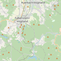
Auerbach na mapie
Źródła danych i metodologia
Nasze prognozy pogody są zasilane przez profesjonalnego dostawcę danych pogodowych, który agreguje dane z krajowych służb meteorologicznych, obserwacji satelitarnych, sieci radarowych i ponad 80 000 stacji meteorologicznych na całym świecie. Dane prognostyczne są aktualizowane wielokrotnie w ciągu dnia. Przetwarzamy surowe dane na czytelne podsumowania — prędkość wiatru w m/s, ciśnienie w mm Hg — abyście Państwo mogli planować dzień z pewnością.