
Prognoza pogody na 5 dni Auerbach 21 paź 2026
 6°
6°Prognoza pogody Auerbach dziś 21 paź 2026: całkowite zachmurzenie, temperatura od 5 °C do 12 °C.
Prawdopodobieństwo opadów 78%. Wiatr do 5.69 m/s (porywy 11 m/s). Wilgotność powietrza 70–95%, ciśnienie atmosferyczne 756–761 mm Hg, indeks UV do 2.
Ostrzeżenia pogodowe
Moderate Wind Related Impact
SE wind with gusts between 15 and 20 m/s (55 to 70 km/h).
Possible complications in the energy industry, forestry, and transport. Possible damage to trees and forests. Minor damage to energy infrastructure, property (especially older buildings). Risk of injury from flying or falling objects, especially broken branches. Minor travel delays due to debris and outages.
Secure windows, doors, remove or anchor loosely stored objects, tents, greenhouses, etc. Watch out for falling objects such as branches or roof tiles. When driving, watch out for strong crosswinds at exposed points such as bridges, drive slowly. In the mountains, limit hikes and avoid ridge areas in particular.
Moderate Wind Related Impact
SE wind with gusts between 15 and 20 m/s (55 to 70 km/h).
Possible complications in the energy industry, forestry, and transport. Possible damage to trees and forests. Minor damage to energy infrastructure, property (especially older buildings). Risk of injury from flying or falling objects, especially broken branches. Minor travel delays due to debris and outages.
Secure windows, doors, remove or anchor loosely stored objects, tents, greenhouses, etc. Watch out for falling objects such as branches or roof tiles. When driving, watch out for strong crosswinds at exposed points such as bridges, drive slowly. In the mountains, limit hikes and avoid ridge areas in particular.
Moderate Wind Related Impact
SE wind with gusts between 15 and 20 m/s (55 to 70 km/h).
Possible complications in the energy industry, forestry, and transport. Possible damage to trees and forests. Minor damage to energy infrastructure, property (especially older buildings). Risk of injury from flying or falling objects, especially broken branches. Minor travel delays due to debris and outages.
Secure windows, doors, remove or anchor loosely stored objects, tents, greenhouses, etc. Watch out for falling objects such as branches or roof tiles. When driving, watch out for strong crosswinds at exposed points such as bridges, drive slowly. In the mountains, limit hikes and avoid ridge areas in particular.
Moderate Wind Related Impact
SE wind with gusts between 15 and 20 m/s (55 to 70 km/h).
Possible complications in the energy industry, forestry, and transport. Possible damage to trees and forests. Minor damage to energy infrastructure, property (especially older buildings). Risk of injury from flying or falling objects, especially broken branches. Minor travel delays due to debris and outages.
Secure windows, doors, remove or anchor loosely stored objects, tents, greenhouses, etc. Watch out for falling objects such as branches or roof tiles. When driving, watch out for strong crosswinds at exposed points such as bridges, drive slowly. In the mountains, limit hikes and avoid ridge areas in particular.
5 dni w skrócie — dotknij dnia, aby go otworzyć
Wschód słońca 07:42
Zachód słońca 18:06
Zachód słońca 18:06
Przybywający garb86% oświetlenia
Wschód księżyca 16:22 · Zachód księżyca 02:10
Wschód księżyca 16:22 · Zachód księżyca 02:10
Wykres
Tabela
śr., 21 paź 2026
| Czas | Pogoda | Temperatura | Szansa na deszcz | Zachmurzenie | Wilgotność | Ciśnienie | Wiatr | Indeks UV |
|---|---|---|---|---|---|---|---|---|
| 00:00 | Częściowe zachmurzenie | 5 °C | 17% | 33% | 90% | 759 mm Hg | SSE 149° 2.69 (3.53) m/s | 0 |
| 01:00 | Częściowe zachmurzenie | 6 °C | 16% | 28% | 90% | 759 mm Hg | SSE 152° 2.61 (3.61) m/s | 0 |
| 02:00 |  Całkowite zachmurzenie | 6 °C | 31% | 100% | 91% | 758 mm Hg | SE 136° 2.11 (2.19) m/s | 0 |
| 03:00 | Całkowite zachmurzenie | 6 °C | 31% | 100% | 91% | 758 mm Hg | SE 136° 1.81 (1.81) m/s | 0 |
| 04:00 | Całkowite zachmurzenie | 6 °C | 30% | 97% | 91% | 758 mm Hg | SSE 150° 2.11 (2.11) m/s | 0 |
| 05:00 | Całkowite zachmurzenie | 6 °C | 31% | 100% | 92% | 758 mm Hg | SE 146° 2.11 (2.22) m/s | 0 |
| 06:00 | Całkowite zachmurzenie | 6 °C | 31% | 100% | 92% | 758 mm Hg | SSE 147° 2.19 (2.5) m/s | 0 |
| 07:00 | Całkowite zachmurzenie | 6 °C | 31% | 100% | 91% | 757 mm Hg | SSE 148° 1.89 (2.22) m/s | 0 |
| 08:00 |  Całkowite zachmurzenie | 6 °C | 31% | 100% | 92% | 757 mm Hg | SSE 161° 2.11 (2.5) m/s | 0 |
| 09:00 | Całkowite zachmurzenie | 8 °C | 27% | 100% | 85% | 757 mm Hg | SSE 150° 1 (1.72) m/s | 0.2 |
| 10:00 | Całkowite zachmurzenie | 9 °C | 25% | 100% | 82% | 758 mm Hg | S 190° 1.31 (2.42) m/s | 0.6 |
| 11:00 | Całkowite zachmurzenie | 11 °C | 22% | 100% | 76% | 757 mm Hg | SE 127° 1 (1.83) m/s | 1.2 |
| 12:00 | Całkowite zachmurzenie | 11 °C | 21% | 100% | 75% | 757 mm Hg | SSW 192° 1.61 (2.81) m/s | 1.5 |
| 13:00 | Całkowite zachmurzenie | 12 °C | 18% | 100% | 70% | 756 mm Hg | SSW 196° 1.31 (2.39) m/s | 2 |
| 14:00 | Całkowite zachmurzenie | 12 °C | 19% | 100% | 70% | 756 mm Hg | SSW 211° 2.11 (3.31) m/s | 1.7 |
| 15:00 | Całkowite zachmurzenie | 12 °C | 19% | 100% | 71% | 756 mm Hg | SW 214° 2.11 (3.14) m/s | 1.1 |
| 16:00 | Całkowite zachmurzenie | 12 °C | 18% | 94% | 71% | 756 mm Hg | SW 218° 2.39 (3.97) m/s | 0.5 |
| 17:00 | Całkowite zachmurzenie | 12 °C | 22% | 100% | 77% | 757 mm Hg | WSW 243° 2.39 (5.14) m/s | 0.1 |
| 18:00 | Całkowite zachmurzenie | 10 °C | 27% | 100% | 84% | 758 mm Hg | WSW 254° 4.31 (7.64) m/s | 0 |
| 19:00 |  Możliwy przelotny deszcz | 8 °C | 38% (0.07 mm/godz.) | 100% | 92% | 758 mm Hg | WSW 250° 4.5 (9.64) m/s | 0 |
| 20:00 | Możliwy przelotny deszcz | 8 °C | 40% (0.1 mm/godz.) | 100% | 89% | 760 mm Hg | W 260° 5.69 (10.61) m/s | 0 |
| 21:00 |  Lekka mżawka | 7 °C | 72% (0.65 mm/godz.) | 100% | 92% | 760 mm Hg | WSW 258° 4.61 (11) m/s | 0 |
| 22:00 |  Lekki deszcz | 6 °C | 78% (1.28 mm/godz.) | 100% | 95% | 761 mm Hg | WSW 239° 3.19 (10.22) m/s | 0 |
| 23:00 | Lekki deszcz | 7 °C | 74% (0.88 mm/godz.) | 100% | 95% | 761 mm Hg | SW 234° 4.39 (10.31) m/s | 0 |
śr., 21 paź 2026
Najczęstsze pytania o pogodę na 5 dni w Auerbach
Jaka będzie pogoda w Auerbach w ciągu najbliższych 5 dni?
W ciągu najbliższych 5 dni w Auerbach temperatura wyniesie około od 1 do 12 °C. Szczegółową prognozę godzinową dla każdego z 5 dni znajdziesz na wykresach powyżej.
W które z najbliższych 5 dni będzie padać w Auerbach?
Prawdopodobieństwo opadów w Auerbach w ciągu najbliższych 5 dni sięga 85%. Na wykresie opadów na 5 dni powyżej zobaczysz, w które dni i godziny będzie padać.
Jak dokładna jest prognoza pogody na 5 dni dla Auerbach?
Prognoza na 5 dni jest dość wiarygodna: pierwsze 2–3 dni są zwykle bardzo dokładne, a dni 4–5 mogą zostać skorygowane. Dane są aktualizowane kilka razy dziennie, więc zajrzyj ponownie przed ważnymi planami.
Który z najbliższych 5 dni w Auerbach będzie najcieplejszy, a który najchłodniejszy?
W ciągu najbliższych 5 dni temperatura w Auerbach waha się od około 1 do 12 °C. Najcieplejszy i najchłodniejszy dzień porównasz na wykresie temperatury powyżej.
Czy w Auerbach w ciągu najbliższych 5 dni będzie wietrznie?
W ciągu najbliższych 5 dni wiatr w Auerbach wzmaga się do 9 m/s. Najbardziej wietrzne dni łatwo dostrzec na wykresie wiatru powyżej.
Który dzień tygodnia w Auerbach najlepiej nadaje się na spacer lub wyjazd?
Na spacer lub wyjazd wybierz dni z najmniejszym prawdopodobieństwem opadów (do 85%) i słabym wiatrem — łatwo je porównać na wykresach na 5 dni powyżej.
Jak najlepiej korzystać z prognozy na 5 dni dla Auerbach?
Pierwsze 2–3 dni są wystarczająco wiarygodne do konkretnych decyzji, a dni 4–5 są wskazówką, która uściśla się w miarę zbliżania. Prognoza jest aktualizowana kilka razy dziennie, więc sprawdź ją ponownie przed ważnymi planami.
Czy w tym tygodniu w Auerbach przyda się parasol lub krem z filtrem?
Prawdopodobieństwo deszczu w najbliższych 5 dniach sięga 85%, więc na najbardziej mokre z nich weź coś nieprzemakalnego — pasek dni powyżej pokazuje które. Dzisiejszy indeks UV sięga 2; krem ma sens mniej więcej od 3 w górę.
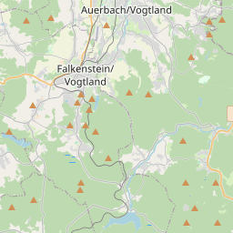
Auerbach na mapie
Źródła danych i metodologia
Nasze prognozy pogody są zasilane przez profesjonalnego dostawcę danych pogodowych, który agreguje dane z krajowych służb meteorologicznych, obserwacji satelitarnych, sieci radarowych i ponad 80 000 stacji meteorologicznych na całym świecie. Dane prognostyczne są aktualizowane wielokrotnie w ciągu dnia. Przetwarzamy surowe dane na czytelne podsumowania — prędkość wiatru w m/s, ciśnienie w mm Hg — abyście Państwo mogli planować dzień z pewnością.