
5 päeva ilmaprognoos Auerbach 24. okt 2026
 8°
8°Ilmaprognoos Auerbach laupäev 24. okt 2026: kohati kerge vihm võimalik, temperatuur 4 °C kuni 8 °C.
Sademete tõenäosus 26%. Tuul kuni 6.61 m/s (iilid 13.72 m/s). Õhuniiskus 69–86%, õhurõhk 762–766 mm Hg, UV-indeks kuni 3.
Ilmahoiatused
Moderate Wind Related Impact
SE wind with gusts between 15 and 20 m/s (55 to 70 km/h).
Possible complications in the energy industry, forestry, and transport. Possible damage to trees and forests. Minor damage to energy infrastructure, property (especially older buildings). Risk of injury from flying or falling objects, especially broken branches. Minor travel delays due to debris and outages.
Secure windows, doors, remove or anchor loosely stored objects, tents, greenhouses, etc. Watch out for falling objects such as branches or roof tiles. When driving, watch out for strong crosswinds at exposed points such as bridges, drive slowly. In the mountains, limit hikes and avoid ridge areas in particular.
Moderate Wind Related Impact
SE wind with gusts between 15 and 20 m/s (55 to 70 km/h).
Possible complications in the energy industry, forestry, and transport. Possible damage to trees and forests. Minor damage to energy infrastructure, property (especially older buildings). Risk of injury from flying or falling objects, especially broken branches. Minor travel delays due to debris and outages.
Secure windows, doors, remove or anchor loosely stored objects, tents, greenhouses, etc. Watch out for falling objects such as branches or roof tiles. When driving, watch out for strong crosswinds at exposed points such as bridges, drive slowly. In the mountains, limit hikes and avoid ridge areas in particular.
Moderate Wind Related Impact
SE wind with gusts between 15 and 20 m/s (55 to 70 km/h).
Possible complications in the energy industry, forestry, and transport. Possible damage to trees and forests. Minor damage to energy infrastructure, property (especially older buildings). Risk of injury from flying or falling objects, especially broken branches. Minor travel delays due to debris and outages.
Secure windows, doors, remove or anchor loosely stored objects, tents, greenhouses, etc. Watch out for falling objects such as branches or roof tiles. When driving, watch out for strong crosswinds at exposed points such as bridges, drive slowly. In the mountains, limit hikes and avoid ridge areas in particular.
Moderate Wind Related Impact
SE wind with gusts between 15 and 20 m/s (55 to 70 km/h).
Possible complications in the energy industry, forestry, and transport. Possible damage to trees and forests. Minor damage to energy infrastructure, property (especially older buildings). Risk of injury from flying or falling objects, especially broken branches. Minor travel delays due to debris and outages.
Secure windows, doors, remove or anchor loosely stored objects, tents, greenhouses, etc. Watch out for falling objects such as branches or roof tiles. When driving, watch out for strong crosswinds at exposed points such as bridges, drive slowly. In the mountains, limit hikes and avoid ridge areas in particular.
5 päeva ühe pilguga — puuduta päeva, et see avada
Päikesetõus 07:47
Päikeseloojang 18:00
Päikeseloojang 18:00
Täiskuu100% valgustatud
Kuutõus 16:58 · Kuuloojang 05:42
Kuutõus 16:58 · Kuuloojang 05:42
Graafik
Tabel
| Aeg | Ilm | Temperatuur | Vihma tõenäosus | Pilvisus | Niiskus | Rõhk | Tuul | UV-indeks |
|---|---|---|---|---|---|---|---|---|
| 00:00 |  Pilvine | 6 °C | 24% | 100% | 80% | 762 mm Hg | SSW 211° 6.31 (13.11) m/s | 0 |
| 01:00 |  Pilves | 7 °C | 16% | 78% | 74% | 762 mm Hg | SW 214° 6.31 (13) m/s | 0 |
| 02:00 |  Kohati kerge vihm võimalik | 6 °C | 19% (0.02 mm/h) | 73% | 77% | 762 mm Hg | SSW 210° 6.11 (12.92) m/s | 0 |
| 03:00 | Kohati kerge vihm võimalik | 5 °C | 20% (0.01 mm/h) | 80% | 77% | 762 mm Hg | SSW 207° 6.11 (13.19) m/s | 0 |
| 04:00 | Kohati kerge vihm võimalik | 5 °C | 18% (0.01 mm/h) | 71% | 80% | 762 mm Hg | SSW 209° 5.89 (12.92) m/s | 0 |
| 05:00 | Kohati kerge vihm võimalik | 5 °C | 22% (0.01 mm/h) | 88% | 80% | 763 mm Hg | SSW 210° 6 (13.31) m/s | 0 |
| 06:00 | Pilvine | 5 °C | 21% | 96% | 76% | 762 mm Hg | SSW 209° 6.31 (12.72) m/s | 0 |
| 07:00 | Kohati kerge vihm võimalik | 5 °C | 18% (0.01 mm/h) | 84% | 75% | 762 mm Hg | SSW 208° 6.39 (13.31) m/s | 0 |
| 08:00 | Kohati kerge vihm võimalik | 5 °C | 22% (0.01 mm/h) | 96% | 77% | 763 mm Hg | SSW 212° 6.11 (13.31) m/s | 0 |
| 09:00 |  Osaliselt pilves | 5 °C | 13% | 48% | 77% | 763 mm Hg | SSW 192° 5.69 (13.72) m/s | 0.1 |
| 10:00 | Kohati kerge vihm võimalik | 6 °C | 26% (0.04 mm/h) | 100% | 77% | 764 mm Hg | SSW 194° 5.89 (12.72) m/s | 0.3 |
| 11:00 | Osaliselt pilves | 5 °C | 18% | 61% | 84% | 764 mm Hg | SSW 199° 5.5 (11.72) m/s | 0.2 |
| 12:00 | Kohati kerge vihm võimalik | 7 °C | 13% (0.02 mm/h) | 55% | 71% | 764 mm Hg | SSW 208° 6.19 (11.81) m/s | 0.7 |
| 13:00 | Kohati kerge vihm võimalik | 7 °C | 17% (0.04 mm/h) | 74% | 70% | 764 mm Hg | SW 215° 6.61 (11.72) m/s | 0.4 |
| 14:00 | Kohati kerge vihm võimalik | 7 °C | 22% (0.03 mm/h) | 94% | 74% | 764 mm Hg | SSW 211° 6.19 (12) m/s | 0.7 |
| 15:00 | Kohati kerge vihm võimalik | 7 °C | 18% (0.02 mm/h) | 82% | 72% | 764 mm Hg | SSW 209° 5.5 (10.83) m/s | 2 |
| 16:00 | Kohati kerge vihm võimalik | 8 °C | 17% (0.06 mm/h) | 66% | 69% | 763 mm Hg | SSW 212° 5.89 (11.81) m/s | 2 |
| 17:00 | Kohati kerge vihm võimalik | 6 °C | 21% (0.01 mm/h) | 81% | 79% | 764 mm Hg | SSW 209° 5.31 (10.89) m/s | 2 |
| 18:00 |  Päikesepaisteline | 5 °C | 10% | 16% | 80% | 764 mm Hg | SSW 213° 5.39 (11.81) m/s | 3 |
| 19:00 |  Selge | 5 °C | 11% | 5% | 83% | 765 mm Hg | SSW 207° 5 (12) m/s | 0 |
| 20:00 | Selge | 4 °C | 10% | 5% | 82% | 765 mm Hg | SSW 210° 5.11 (11.81) m/s | 0 |
| 21:00 | Selge | 4 °C | 13% | 24% | 83% | 765 mm Hg | SSW 213° 5.11 (11.81) m/s | 0 |
| 22:00 |  Osaliselt pilves | 4 °C | 18% | 56% | 86% | 766 mm Hg | SW 216° 5 (11.39) m/s | 0 |
| 23:00 | Osaliselt pilves | 4 °C | 18% | 53% | 86% | 766 mm Hg | SW 219° 4.69 (10.72) m/s | 0 |
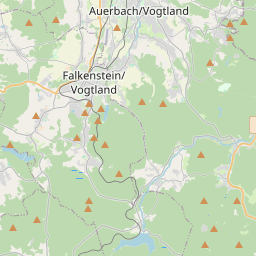
Auerbach kaardil
Andmeallikad ja metoodika
Meie ilmaprognoosid põhinevad professionaalsel ilmaandmete pakkujal, mis koondab andmeid riiklikelt ilmateenistustelt, satelliidivaatlustelt, radarivõrkudelt ja enam kui 80 000 ilmajaamalt üle maailma. Prognoosiandmeid uuendatakse mitu korda päevas. Me teisendame toorandmed selgeteks kokkuvõteteks – tuulekiirus m/s-des, rõhk mmHg-des – et saaksite oma päeva enesekindlalt planeerida.