5 päeva ilmaprognoos Auerbach 24-08-2026

Ilmaprognoos Auerbach esmaspäev, 24. august 24.08.2026: päikesepaisteline, temperatuur 8 °C kuni 16 °C.

Sademete tõenäosus 26%. Tuul kuni 2.61 m/s (iilid 7.61 m/s). Õhuniiskus 46–93%, õhurõhk 766–769 mm Hg, UV-indeks kuni 5.4.

Ilmahoiatused

Peida hoiatused
Severe20. aug, 18:1022. aug, 01:59Tõlgi Google'iga
Major Thunderstorm Impact
Risk of very severe thunderstorms with torrential rain (around 40 mm in a short time), in combination with rain around 70 mm, wind gusts 20 to 25 m/s (70 to 90 km/h) and hail around 2 cm. Local property damage and complications, especially in the energy industry, transport, and agriculture. Potential for dangerous flooding, flash floods. Increased runoff from slopes, rapid flooding of low-lying areas, dry gullies, small streams, undercutting of roads. Significant wind damage to trees, parks, buildings, property, energy infrastructure etc. Power outages. Travel delays and disruptions. Driving conditions difficult due to wind gusts, reduced visibility, fallen trees/branches, high risk of hydroplaning. Extensive damage to vegetation, buildings, and property from hail. Risk of fire caused by lightning strike. Risk of serious injury from flying or falling objects and lightning strikes.
Beware of lightning strikes, hail, and falling or windblown objects. Seek shelter in a building with lightning protection. Outdoors, take cover in dense forest or low vegetation; avoid water, hilltops, metal structures, isolated trees, and rock overhangs. Avoid stream courses in the mountains, as water and debris flows may occur there suddenly. Secure windows, doors, greenhouses, and loose objects. Be prepared for possible power outages. When driving, reduce speed, do not enter or drive into flowing water or flooded areas. Stay informed of the driving conditions. Observe weather warnings, weather radar (www.chmi.cz or mobile apps) and flash flood risk https://produkty.chmi.cz/ffi.
Moderate20. aug, 18:1022. aug, 01:59Tõlgi Google'iga
Moderate Thunderstorm Impact
Risk of severe thunderstorms with torrential rain (around 40 mm in a short time), wind gusts up to 20 m/s (70 km/h) and hail up to 2 cm. Possible local property damage and complications, especially in the energy industry and transport. Potential for local flooding, especially of low-lying areas. Local wind damage to roofs, fences, soft shelters and trees. Local power outages. Some travel delays. Driving conditions difficult. Possible crop damage from small hail. Risk of fire caused by lightning strike. Risk of injury from flying or falling objects, and lightning strikes.
Beware of lightning strikes and flying or falling objects (especially branches). Seek shelter in a building equipped with lightning protection. Outdoors, take cover in dense forest or low vegetation; avoid water bodies, hilltops, metal structures, isolated trees, and rock overhangs. When driving reduce speed. Observe weather warnings, weather radar (www.chmi.cz or mobile apps) and local flood risk https://produkty.chmi.cz/ffi.
Severe20. aug, 18:1022. aug, 01:59Tõlgi Google'iga
Major Thunderstorm Impact
Risk of very severe thunderstorms with torrential rain (around 40 mm in a short time), in combination with rain around 70 mm, wind gusts 20 to 25 m/s (70 to 90 km/h) and hail around 2 cm. Local property damage and complications, especially in the energy industry, transport, and agriculture. Potential for dangerous flooding, flash floods. Increased runoff from slopes, rapid flooding of low-lying areas, dry gullies, small streams, undercutting of roads. Significant wind damage to trees, parks, buildings, property, energy infrastructure etc. Power outages. Travel delays and disruptions. Driving conditions difficult due to wind gusts, reduced visibility, fallen trees/branches, high risk of hydroplaning. Extensive damage to vegetation, buildings, and property from hail. Risk of fire caused by lightning strike. Risk of serious injury from flying or falling objects and lightning strikes.
Beware of lightning strikes, hail, and falling or windblown objects. Seek shelter in a building with lightning protection. Outdoors, take cover in dense forest or low vegetation; avoid water, hilltops, metal structures, isolated trees, and rock overhangs. Avoid stream courses in the mountains, as water and debris flows may occur there suddenly. Secure windows, doors, greenhouses, and loose objects. Be prepared for possible power outages. When driving, reduce speed, do not enter or drive into flowing water or flooded areas. Stay informed of the driving conditions. Observe weather warnings, weather radar (www.chmi.cz or mobile apps) and flash flood risk https://produkty.chmi.cz/ffi.
Moderate20. aug, 18:1022. aug, 01:59Tõlgi Google'iga
Moderate Thunderstorm Impact
Risk of severe thunderstorms with torrential rain (around 40 mm in a short time), wind gusts up to 20 m/s (70 km/h) and hail up to 2 cm. Possible local property damage and complications, especially in the energy industry and transport. Potential for local flooding, especially of low-lying areas. Local wind damage to roofs, fences, soft shelters and trees. Local power outages. Some travel delays. Driving conditions difficult. Possible crop damage from small hail. Risk of fire caused by lightning strike. Risk of injury from flying or falling objects, and lightning strikes.
Beware of lightning strikes and flying or falling objects (especially branches). Seek shelter in a building equipped with lightning protection. Outdoors, take cover in dense forest or low vegetation; avoid water bodies, hilltops, metal structures, isolated trees, and rock overhangs. When driving reduce speed. Observe weather warnings, weather radar (www.chmi.cz or mobile apps) and local flood risk https://produkty.chmi.cz/ffi.
Severe20. aug, 18:1022. aug, 01:59Tõlgi Google'iga
Major Thunderstorm Impact
Risk of very severe thunderstorms with torrential rain (around 40 mm in a short time), in combination with rain around 70 mm, wind gusts 20 to 25 m/s (70 to 90 km/h) and hail around 2 cm. Local property damage and complications, especially in the energy industry, transport, and agriculture. Potential for dangerous flooding, flash floods. Increased runoff from slopes, rapid flooding of low-lying areas, dry gullies, small streams, undercutting of roads. Significant wind damage to trees, parks, buildings, property, energy infrastructure etc. Power outages. Travel delays and disruptions. Driving conditions difficult due to wind gusts, reduced visibility, fallen trees/branches, high risk of hydroplaning. Extensive damage to vegetation, buildings, and property from hail. Risk of fire caused by lightning strike. Risk of serious injury from flying or falling objects and lightning strikes.
Beware of lightning strikes, hail, and falling or windblown objects. Seek shelter in a building with lightning protection. Outdoors, take cover in dense forest or low vegetation; avoid water, hilltops, metal structures, isolated trees, and rock overhangs. Avoid stream courses in the mountains, as water and debris flows may occur there suddenly. Secure windows, doors, greenhouses, and loose objects. Be prepared for possible power outages. When driving, reduce speed, do not enter or drive into flowing water or flooded areas. Stay informed of the driving conditions. Observe weather warnings, weather radar (www.chmi.cz or mobile apps) and flash flood risk https://produkty.chmi.cz/ffi.
5 päeva ühe pilguga — puuduta päeva, et see avada
Päikesetõus 06:12
Päikeseloojang 20:12
Kasvav kuu93% valgustatud
Kuutõus 19:03 · Kuuloojang 01:54
Graafik
Tabel
E, 24. august 2026

Prognoos 8 °C kuni 16 °C ja sademed

Temperatuur & Sademed
Aeg00:0001:0002:0003:0004:0005:0006:0007:0008:0009:0010:0011:0012:0013:0014:0015:0016:0017:0018:0019:0020:0021:0022:0023:00
Temperatuur (°C)12111111111111118101213141516161616151416141413
Sademed (mm/h)000000000000000000000000

Pilvisus ja sademete tõenäosus

Pilvisus & Vihma tõenäosus
Aeg00:0001:0002:0003:0004:0005:0006:0007:0008:0009:0010:0011:0012:0013:0014:0015:0016:0017:0018:0019:0020:0021:0022:0023:00
Pilvisus (%)469494749117320177664224000000
Vihma tõenäosus (%)132324212615151410754332212246676

Tuulekiirus ja -suund

Tuul & Tuuleiil
Aeg00:0001:0002:0003:0004:0005:0006:0007:0008:0009:0010:0011:0012:0013:0014:0015:0016:0017:0018:0019:0020:0021:0022:0023:00
Tuul (m/s)1.191.391.391.391.3110.890.690.611.191.892.392.612.52.52.52.612.52.52.312.112.192.192.31
Tuuleiil (m/s)1.226.391.421.421.421.1110.811.332.112.422.57.615.57.56.55.617.55.54.422.642.722.222.39
Tuule suund (°)SSW 211°SSW 205°SSW 208°SSW 211°SW 217°SW 226°SW 215°SSW 204°W 270°NW 311°NW 324°NNW 333°NNW 341°NNW 346°N 349°N 351°N 355°N 0°N 9°NNE 28°ENE 64°E 91°E 98°ESE 109°

Õhuniiskus

Niiskus
Aeg00:0001:0002:0003:0004:0005:0006:0007:0008:0009:0010:0011:0012:0013:0014:0015:0016:0017:0018:0019:0020:0021:0022:0023:00
Niiskus (%)778082858790939282746761565248464647506071727272

Õhurõhk

Rõhk
Aeg00:0001:0002:0003:0004:0005:0006:0007:0008:0009:0010:0011:0012:0013:0014:0015:0016:0017:0018:0019:0020:0021:0022:0023:00
Rõhk (mm Hg)769769769768768768768769768768768767767767767767767766766766766767766767

Ultraviolettkiirguse indeks

UV-indeks
Aeg00:0001:0002:0003:0004:0005:0006:0007:0008:0009:0010:0011:0012:0013:0014:0015:0016:0017:0018:0019:0020:0021:0022:0023:00
UV-indeks00000000.10.51.32.53.84.95.45.24.43.11.80.80.20000
E, 24. august 2026

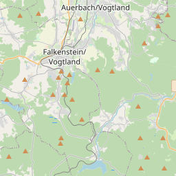
Auerbach kaardil

Andmeallikad ja metoodika

Meie ilmaprognoosid põhinevad professionaalsel ilmaandmete pakkujal, mis koondab andmeid riiklikelt ilmateenistustelt, satelliidivaatlustelt, radarivõrkudelt ja enam kui 80 000 ilmajaamalt üle maailma. Prognoosiandmeid uuendatakse mitu korda päevas. Me teisendame toorandmed selgeteks kokkuvõteteks – tuulekiirus m/s-des, rõhk mmHg-des – et saaksite oma päeva enesekindlalt planeerida.