
5 päeva ilmaprognoos Auerbach 21. okt 2026
 6°
6°Ilmaprognoos Auerbach täna 21. okt 2026: pilvine, temperatuur 5 °C kuni 12 °C.
Sademete tõenäosus 78%. Tuul kuni 5.69 m/s (iilid 11 m/s). Õhuniiskus 70–95%, õhurõhk 756–761 mm Hg, UV-indeks kuni 2.
Ilmahoiatused
Moderate Wind Related Impact
SE wind with gusts between 15 and 20 m/s (55 to 70 km/h).
Possible complications in the energy industry, forestry, and transport. Possible damage to trees and forests. Minor damage to energy infrastructure, property (especially older buildings). Risk of injury from flying or falling objects, especially broken branches. Minor travel delays due to debris and outages.
Secure windows, doors, remove or anchor loosely stored objects, tents, greenhouses, etc. Watch out for falling objects such as branches or roof tiles. When driving, watch out for strong crosswinds at exposed points such as bridges, drive slowly. In the mountains, limit hikes and avoid ridge areas in particular.
Moderate Wind Related Impact
SE wind with gusts between 15 and 20 m/s (55 to 70 km/h).
Possible complications in the energy industry, forestry, and transport. Possible damage to trees and forests. Minor damage to energy infrastructure, property (especially older buildings). Risk of injury from flying or falling objects, especially broken branches. Minor travel delays due to debris and outages.
Secure windows, doors, remove or anchor loosely stored objects, tents, greenhouses, etc. Watch out for falling objects such as branches or roof tiles. When driving, watch out for strong crosswinds at exposed points such as bridges, drive slowly. In the mountains, limit hikes and avoid ridge areas in particular.
Moderate Wind Related Impact
SE wind with gusts between 15 and 20 m/s (55 to 70 km/h).
Possible complications in the energy industry, forestry, and transport. Possible damage to trees and forests. Minor damage to energy infrastructure, property (especially older buildings). Risk of injury from flying or falling objects, especially broken branches. Minor travel delays due to debris and outages.
Secure windows, doors, remove or anchor loosely stored objects, tents, greenhouses, etc. Watch out for falling objects such as branches or roof tiles. When driving, watch out for strong crosswinds at exposed points such as bridges, drive slowly. In the mountains, limit hikes and avoid ridge areas in particular.
Moderate Wind Related Impact
SE wind with gusts between 15 and 20 m/s (55 to 70 km/h).
Possible complications in the energy industry, forestry, and transport. Possible damage to trees and forests. Minor damage to energy infrastructure, property (especially older buildings). Risk of injury from flying or falling objects, especially broken branches. Minor travel delays due to debris and outages.
Secure windows, doors, remove or anchor loosely stored objects, tents, greenhouses, etc. Watch out for falling objects such as branches or roof tiles. When driving, watch out for strong crosswinds at exposed points such as bridges, drive slowly. In the mountains, limit hikes and avoid ridge areas in particular.
5 päeva ühe pilguga — puuduta päeva, et see avada
Päikesetõus 07:42
Päikeseloojang 18:06
Päikeseloojang 18:06
Kasvav kuu86% valgustatud
Kuutõus 16:22 · Kuuloojang 02:10
Kuutõus 16:22 · Kuuloojang 02:10
Graafik
Tabel
K, 21. oktoober 2026
| Aeg | Ilm | Temperatuur | Vihma tõenäosus | Pilvisus | Niiskus | Rõhk | Tuul | UV-indeks |
|---|---|---|---|---|---|---|---|---|
| 00:00 |  Osaliselt pilves | 5 °C | 17% | 33% | 90% | 759 mm Hg | SSE 149° 2.69 (3.53) m/s | 0 |
| 01:00 | Osaliselt pilves | 6 °C | 16% | 28% | 90% | 759 mm Hg | SSE 152° 2.61 (3.61) m/s | 0 |
| 02:00 | Pilvine | 6 °C | 31% | 100% | 91% | 758 mm Hg | SE 136° 2.11 (2.19) m/s | 0 |
| 03:00 | Pilvine | 6 °C | 31% | 100% | 91% | 758 mm Hg | SE 136° 1.81 (1.81) m/s | 0 |
| 04:00 | Pilvine | 6 °C | 30% | 97% | 91% | 758 mm Hg | SSE 150° 2.11 (2.11) m/s | 0 |
| 05:00 | Pilvine | 6 °C | 31% | 100% | 92% | 758 mm Hg | SE 146° 2.11 (2.22) m/s | 0 |
| 06:00 | Pilvine | 6 °C | 31% | 100% | 92% | 758 mm Hg | SSE 147° 2.19 (2.5) m/s | 0 |
| 07:00 | Pilvine | 6 °C | 31% | 100% | 91% | 757 mm Hg | SSE 148° 1.89 (2.22) m/s | 0 |
| 08:00 |  Pilvine | 6 °C | 31% | 100% | 92% | 757 mm Hg | SSE 161° 2.11 (2.5) m/s | 0 |
| 09:00 | Pilvine | 8 °C | 27% | 100% | 85% | 757 mm Hg | SSE 150° 1 (1.72) m/s | 0.2 |
| 10:00 | Pilvine | 9 °C | 25% | 100% | 82% | 758 mm Hg | S 190° 1.31 (2.42) m/s | 0.6 |
| 11:00 | Pilvine | 11 °C | 22% | 100% | 76% | 757 mm Hg | SE 127° 1 (1.83) m/s | 1.2 |
| 12:00 | Pilvine | 11 °C | 21% | 100% | 75% | 757 mm Hg | SSW 192° 1.61 (2.81) m/s | 1.5 |
| 13:00 | Pilvine | 12 °C | 18% | 100% | 70% | 756 mm Hg | SSW 196° 1.31 (2.39) m/s | 2 |
| 14:00 | Pilvine | 12 °C | 19% | 100% | 70% | 756 mm Hg | SSW 211° 2.11 (3.31) m/s | 1.7 |
| 15:00 | Pilvine | 12 °C | 19% | 100% | 71% | 756 mm Hg | SW 214° 2.11 (3.14) m/s | 1.1 |
| 16:00 | Pilvine | 12 °C | 18% | 94% | 71% | 756 mm Hg | SW 218° 2.39 (3.97) m/s | 0.5 |
| 17:00 | Pilvine | 12 °C | 22% | 100% | 77% | 757 mm Hg | WSW 243° 2.39 (5.14) m/s | 0.1 |
| 18:00 | Pilvine | 10 °C | 27% | 100% | 84% | 758 mm Hg | WSW 254° 4.31 (7.64) m/s | 0 |
| 19:00 |  Kohati kerge vihm võimalik | 8 °C | 38% (0.07 mm/h) | 100% | 92% | 758 mm Hg | WSW 250° 4.5 (9.64) m/s | 0 |
| 20:00 | Kohati kerge vihm võimalik | 8 °C | 40% (0.1 mm/h) | 100% | 89% | 760 mm Hg | W 260° 5.69 (10.61) m/s | 0 |
| 21:00 |  Nõrk uduvihm | 7 °C | 72% (0.65 mm/h) | 100% | 92% | 760 mm Hg | WSW 258° 4.61 (11) m/s | 0 |
| 22:00 |  Nõrk vihm | 6 °C | 78% (1.28 mm/h) | 100% | 95% | 761 mm Hg | WSW 239° 3.19 (10.22) m/s | 0 |
| 23:00 | Nõrk vihm | 7 °C | 74% (0.88 mm/h) | 100% | 95% | 761 mm Hg | SW 234° 4.39 (10.31) m/s | 0 |
K, 21. oktoober 2026
Korduma kippuvad küsimused Auerbach 5 päeva ilma kohta
Milline on ilm Auerbach järgmise 5 päeva jooksul?
Järgmise 5 päeva jooksul on temperatuur Auerbach umbes 1 kuni 12 °C. Iga 5 päeva üksikasjalikku tunniprognoosi vaata ülal olevatelt graafikutelt.
Millistel järgmisest 5 päevast sajab Auerbach vihma?
Sademete tõenäosus Auerbach ulatub järgmise 5 päeva jooksul 85%-ni. Ülal olevalt 5 päeva sademetegraafikult näed täpselt, millistel päevadel ja tundidel sajab.
Kui täpne on Auerbach 5 päeva ilmaprognoos?
5 päeva prognoos on üsna usaldusväärne: esimesed 2–3 päeva on tavaliselt väga täpsed, päevad 4–5 võivad täpsustuda. Andmeid uuendatakse mitu korda päevas, seega vaata enne tähtsaid plaane uuesti.
Milline järgmisest 5 päevast on Auerbach kõige soojem ja milline kõige jahedam?
Järgmise 5 päeva jooksul kõigub temperatuur Auerbach umbes 1 kuni 12 °C. Kõige soojemat ja jahedamat päeva saad võrrelda ülal oleval temperatuurigraafikul.
Kas Auerbach on järgmise 5 päeva jooksul tuuline?
Järgmise 5 päeva jooksul tugevneb tuul Auerbach kuni 9 m/s. Kõige tuulisemad päevad on ülal oleval tuulegraafikul hästi näha.
Milline nädalapäev Auerbach sobib kõige paremini jalutuskäiguks või reisiks?
Jalutuskäiguks või reisiks vali väikseima sajutõenäosusega (kuni 85%) ja nõrga tuulega päevad – neid on lihtne võrrelda ülal olevatel 5 päeva graafikutel.
Kuidas Auerbach 5 päeva prognoosi kõige paremini kasutada?
Esimesed 2–3 päeva on kindlateks otsusteks piisavalt usaldusväärsed, päevad 4–5 on juhis, mis lähenedes täpsustub. Prognoosi uuendatakse mitu korda päevas, seega vaata enne tähtsaid plaane uuesti.
Kas mul on sel nädalal Auerbach vihmavarju või päikesekreemi vaja?
Vihma tõenäosus ulatub järgmise 5 päeva jooksul 85%-ni, seega võtke märgemate päevade jaoks midagi veekindlat — millised need on, näitab päevariba ülal. Tänane UV-indeks ulatub 2-ni; kreem tasub ära umbes alates 3-st.
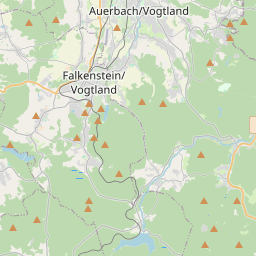
Auerbach kaardil
Andmeallikad ja metoodika
Meie ilmaprognoosid põhinevad professionaalsel ilmaandmete pakkujal, mis koondab andmeid riiklikelt ilmateenistustelt, satelliidivaatlustelt, radarivõrkudelt ja enam kui 80 000 ilmajaamalt üle maailma. Prognoosiandmeid uuendatakse mitu korda päevas. Me teisendame toorandmed selgeteks kokkuvõteteks – tuulekiirus m/s-des, rõhk mmHg-des – et saaksite oma päeva enesekindlalt planeerida.