
Pronóstico del tiempo a 5 días Limbach-Oberfrohna 17 oct 2026
 11°
11°Pronóstico del tiempo Limbach-Oberfrohna hoy 17 oct 2026: cubierto, temperatura de 8 °C a 13 °C.
Probabilidad de precipitaciones 64%. Viento de hasta 4.39 m/s (ráfagas 7 m/s). Humedad del aire 78–96%, presión atmosférica 764–767 mm Hg, índice UV de hasta 0.1.
Los 5 días de un vistazo — toca un día para abrirlo
Amanecer 07:35
Atardecer 18:13
Atardecer 18:13
Cuarto creciente47% iluminada
Salida de la luna 15:06 · Puesta de la luna 22:33
Salida de la luna 15:06 · Puesta de la luna 22:33
Gráfico
Tablasáb, 17 oct 2026
Pronóstico de 8 °C a 13 °C y precipitaciones
Nubosidad y probabilidad de precipitaciones
Velocidad y dirección del viento
Humedad del aire
Presión atmosférica
Índice ultravioleta
Calidad del aire y polen
sáb, 17 oct 2026
Preguntas frecuentes sobre el tiempo a 5 días en Limbach-Oberfrohna
¿Cómo será el tiempo en Limbach-Oberfrohna durante los próximos 5 días?
Durante los próximos 5 días en Limbach-Oberfrohna la temperatura oscilará aproximadamente entre 3 y 15 °C. Consulta la previsión horaria detallada de cada uno de los 5 días en los gráficos de arriba.
¿En cuáles de los próximos 5 días lloverá en Limbach-Oberfrohna?
La probabilidad de lluvia en Limbach-Oberfrohna en los próximos 5 días llega al 67%. Consulta el gráfico de precipitación a 5 días de arriba para ver qué días y horas traen lluvia.
¿Qué precisión tiene la previsión del tiempo a 5 días para Limbach-Oberfrohna?
Una previsión a 5 días es bastante fiable: los primeros 2–3 días suelen ser muy precisos, y los días 4–5 pueden ajustarse. Los datos se actualizan varias veces al día, así que vuelve a consultarlos antes de planes importantes.
¿Cuál de los próximos 5 días en Limbach-Oberfrohna será el más cálido y cuál el más frío?
Durante los próximos 5 días la temperatura en Limbach-Oberfrohna varía aproximadamente entre 3 y 15 °C. Compara el día más cálido y el más frío en el gráfico de temperatura de arriba.
¿Hará viento en Limbach-Oberfrohna durante los próximos 5 días?
Durante los próximos 5 días el viento en Limbach-Oberfrohna llega hasta 6 m/s. Los días más ventosos se ven fácilmente en el gráfico de viento de arriba.
¿Qué día de la semana en Limbach-Oberfrohna es mejor para pasear o viajar?
Para pasear o viajar, elige los días con menor probabilidad de lluvia (hasta 67%) y viento flojo, fáciles de comparar en los gráficos a 5 días de arriba.
¿Cómo aprovechar mejor la previsión a 5 días de Limbach-Oberfrohna?
Los primeros 2–3 días son bastante fiables para decisiones firmes, mientras que los días 4–5 son una guía que se afina al acercarse. La previsión se actualiza varias veces al día, así que vuelve a consultarla antes de planes importantes.
¿Necesitaré paraguas o protector solar en Limbach-Oberfrohna esta semana?
La probabilidad de lluvia llega al 67% en los próximos 5 días, así que lleva algo impermeable para los más húmedos — la tira de días de arriba muestra cuáles. El índice UV de hoy alcanza 0.1; el protector solar compensa a partir de 3 aproximadamente.
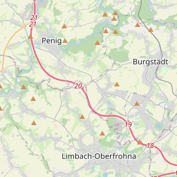
Limbach-Oberfrohna en el mapa
Fuentes de datos y metodología
Nuestros pronósticos meteorológicos se basan en un proveedor profesional de datos meteorológicos que agrega datos de servicios meteorológicos nacionales, observaciones satelitales, redes de radar y más de 80 000 estaciones meteorológicas en todo el mundo. Los datos de pronóstico se actualizan varias veces al día. Convertimos los datos en bruto en resúmenes claros — velocidad del viento en m/s, presión en mm Hg — para que pueda planificar su día con confianza.