
Pronóstico del tiempo a 5 días Bangkok 22 sept 2026

30°25–31° · Posible lluvia dispersa

Pronóstico del tiempo Bangkok hoy 22 sept 2026: chubasco de lluvia ligera, temperatura de 25 °C a 31 °C.

Probabilidad de precipitaciones 82%. Viento de hasta 3.89 m/s (ráfagas 8.81 m/s). Humedad del aire 63–95%, presión atmosférica 755–759 mm Hg, índice UV de hasta 10.1.

Alertas meteorológicas

Severe22 sept, 05:3022 sept, 18:00Traducir con Google
Heavy Rain Risk Area

Heavy Rain

The high-pressure system covering the upper North and the upper Northeast is weakening. Meanwhile, the monsoon trough lies across the Central and the East regions into an active low-pressure cell over the middle South China Sea with the moderate southwest monsoon prevails over the Andaman Sea, the South and the Gulf. Isolated heavy rain is likely in the lower Northeast, the lower Central including Bangkok and vicinity, the East and the South (east coast). The moderate wind and waves in the upper Andaman Sea are expected 1-2 meters high and above 2 meters high in thundershowers. In addition, During 23 – 27 September 2026, the active low-pressure cell over the middle coast of Vietnam will move to cover the lower Northeast, the East, the Central including Bangkok and vicinity along the monsoon trough lying across upper Thailand. Meanwhile the southwest monsoon prevailing across the Andaman Sea, Thailand and the Gulf will strengthen. Isolated heavy to very heavy rains are likely over the country especially in the North, the lower Northeast, the Central including Bangkok and vicinity, the East and the South regions. The initial impacts are expected over the lower Northeast and the East, with other regions forecast to be affected subsequently. The strengthened winds forces the wave in the upper Gulf up to 2 - 3 meters and above 3 meters high in thundershowers. The waves in the lower Gulf and the upper Andaman Sea are likely about 2 meters high with above 2 meters high in thundershowers.
People should beware of heavy rain and accumulation that may cause flash floods, overflows and landslides especially along the waterways near foothills and lowlands. All ships in the Andaman Sea and the Gulf should proceed with caution and keep off thundershowers
Severe22 sept, 05:3022 sept, 18:00Traducir con Google
พื้นที่เสี่ยงภัยฝนตกหนักบริเวณประเทศไทย

Heavy Rain

บริเวณภาคตะวันออกเฉียงเหนือตอนล่าง ภาคกลางตอนล่าง รวมทั้งกรุงเทพมหานครและปริมณฑล ภาคตะวันออก และภาคใต้ฝั่งตะวันออก ยังคงมีฝนตกหนักบางแห่ง เนื่องจากบริเวณความกดอากาศสูงหรือมวลอากาศเย็นที่ปกคลุมภาคเหนือตอนบน และภาคตะวันออกเฉียงเหนือตอนบนมีกำลังอ่อนลง ในขณะที่ร่องมรสุมยังคงพาดผ่านภาคกลาง และภาคตะวันออก เข้าสู่หย่อมความกดอากาศต่ำกำลังแรงบริเวณทะเลจีนใต้ตอนกลาง ประกอบกับมรสุมตะวันตกเฉียงใต้กำลังปานกลางพัดปกคลุมทะเลอันดามัน ภาคใต้ และอ่าวไทย สำหรับคลื่นลมบริเวณทะเลอันดามันตอนบนมีกำลังปานกลาง โดยมีคลื่นสูง 1–2 เมตร บริเวณที่มีฝนฟ้าคะนองคลื่นสูงมากกว่า 2 เมตร อนึ่ง ในช่วงวันที่ 23 – 27 ก.ย. 69 บริเวณภาคเหนือ ภาคตะวันออกเฉียงเหนือตอนล่าง ภาคกลางรวมทั้งกรุงเทพมหานครและปริมณฑล ภาคตะวันออก และภาคใต้ จะมีฝนตกหนักหลายพื้นที่และมีฝนตกหนักมากบางแห่ง โดยจะเริ่มในภาคตะวันออกเฉียงเหนือตอนล่างและภาคตะวันออกก่อน ส่วนภาคอื่นๆ จะได้รับผลกระทบในระยะถัดไป เนื่องจากหย่อมความกดอากาศต่ำกำลังแรงบริเวณชายฝั่งประเทศเวียดนามตอนกลางจะเคลื่อนเข้าปกคลุมภาคตะวันออกเฉียงเหนือตอนล่าง ภาคตะวันออก ภาคกลาง รวมทั้งกรุงเทพมหานครและปริมณฑล ตามแนวร่องมรสุมที่พาดผ่านประเทศไทยตอนบน ในขณะที่มรสุมตะวันตกเฉียงใต้ที่พัดปกลุมทะเลอันดามัน ประเทศไทย และอ่าวไทยจะมีกำลังแรงขึ้น สำหรับบริเวณอ่าวไทยตอนบนมีคลื่นสูง 2-3 เมตร บริเวณฝนฟ้าคะนองคลื่นสูงมากกว่า 3 เมตร ส่วนอ่าวไทยตอนล่าง และทะเลอันดามันตอนบน มีคลื่นสูงประมาณ 2 เมตร บริเวณฝนฟ้าคะนองคลื่นสูงมากกว่า 2 เมตร ชาวเรือบริเวณอ่าวไทย และทะเลอันดามันควรเดินเรือด้วยความระมัดระวัง และหลีกเลี่ยงการเดินเรือในบริเวณที่มีฝนฟ้าคะนอง เรือเล็กบริเวณอ่าวไทยตอนบนควรงดออกจากฝั่งในช่วงวันที่ 23 – 27 ก.ย. 69
ขอให้ประชาชนระวังอันตรายจากฝนตกหนักและฝนที่ตกสะสม ซึ่งอาจทำให้เกิดน้ำท่วมฉับพลันและน้ำป่าไหลหลาก รวมทั้งดินโคลนถล่ม โดยเฉพาะพื้นที่ลาดเชิงเขาใกล้ทางน้ำไหลผ่านและพื้นที่ลุ่ม ควรหลีกเลี่ยงการเดินทางผ่านเส้นทางที่มีปัญหาน้ำท่วมซ้ำซาก โดยเฉพาะพื้นที่ลุ่มต่ำซึ่งอาจเกิดน้ำท่วมขังในระยะสั้นได้ ขอให้ชาวเรือบริเวณทะเลอันดามันและอ่าวไทยหลีกเลี่ยงการเดินเรือในบริเวณที่มีฝนฟ้าคะนองไว้ด้วย
Los 5 días de un vistazo — toca un día para abrirlo
Amanecer 06:07
Atardecer 18:14
Gibosa creciente89% iluminada
Salida de la luna 15:32 · Puesta de la luna 02:27
Gráfico
Tabla
mar, 22 sept 2026

Pronóstico de 25 °C a 31 °C y precipitaciones

Temperatura & Precipitaciones
Hora00:0001:0002:0003:0004:0005:0006:0007:0008:0009:0010:0011:0012:0013:0014:0015:0016:0017:0018:0019:0020:0021:0022:0023:00
Temperatura (°C)262625252525252526272829303131312929282828282727
Precipitaciones (mm/h)2.311.260.740.150.160.330.280.0500.0100.020.020.020.030.090.170.170.1500.040.21.050.48

Nubosidad y probabilidad de precipitaciones

Nubosidad & Probabilidad de lluvia
Hora00:0001:0002:0003:0004:0005:0006:0007:0008:0009:0010:0011:0012:0013:0014:0015:0016:0017:0018:0019:0020:0021:0022:0023:00
Nubosidad (%)1001001001001001001001009289859896100100100100100100100100100100100
Probabilidad de lluvia (%)827670514656534329251919181717233133332327407058

Velocidad y dirección del viento

Viento & Ráfaga de viento
Hora00:0001:0002:0003:0004:0005:0006:0007:0008:0009:0010:0011:0012:0013:0014:0015:0016:0017:0018:0019:0020:0021:0022:0023:00
Viento (m/s)1.392.52.691.891.391.390.891.312.192.612.6133.393.313.53.813.893.392.691.811.51.51.310.81
Ráfaga de viento (m/s)1.813.753.692.421.611.691.312.113.393.813.613.53.643.337.58.817.893.613.813.222.722.6121.5
Dirección del viento (°)E 94°ESE 108°ESE 110°ESE 109°E 86°ENE 60°NNE 22°NNO 334°NO 317°NO 314°NO 304°NO 314°NO 321°NO 318°NO 309°ONO 295°ONO 285°ONO 290°ONO 296°NO 306°NO 309°NO 317°NNO 345°NNE 21°

Humedad del aire

Humedad
Hora00:0001:0002:0003:0004:0005:0006:0007:0008:0009:0010:0011:0012:0013:0014:0015:0016:0017:0018:0019:0020:0021:0022:0023:00
Humedad (%)929295949495959491867872686563667375777980828587

Presión atmosférica

Presión
Hora00:0001:0002:0003:0004:0005:0006:0007:0008:0009:0010:0011:0012:0013:0014:0015:0016:0017:0018:0019:0020:0021:0022:0023:00
Presión (mm Hg)759758758758758758758758759759759759758757756755755756756757758758758758

Índice ultravioleta

Índice UV
Hora00:0001:0002:0003:0004:0005:0006:0007:0008:0009:0010:0011:0012:0013:0014:0015:0016:0017:0018:0019:0020:0021:0022:0023:00
Índice UV00000000.10.93.26.79.610.19.68.141.60.7000000

Calidad del aire y polen

Calidad del aire
Hora00:0001:0002:0003:0004:0005:0006:0007:0008:0009:0010:0011:0012:0013:0014:0015:0016:0017:0018:0019:0020:0021:0022:0023:00
PM2.5 (µg/m³)10.39.18.27.677.17.58.49.611.110.812.312.714.216.117.317.217.918.91513.816.118.215.6
PM10 (µg/m³)10.79.58.687.37.57.98.79.911.210.912.312.714.316.217.517.317.9191513.916.118.315.7
Ozono (O₃) (µg/m³)293233343432293139506689116135141139131115927255413130
NO₂ (µg/m³)25.723.520.417.115.316.318.82122.323.323.22117.816.217.620.623.926.529.333.541.350.555.351.5
SO₂ (µg/m³)7.97.77.47.17.27.78.59.510.812.313.313.312.812.512.913.413.713.212.412.113.214.915.614.3
CO (µg/m³)3677417040993727330929102466204416491275972726551542787119716042023243926352455205616901437
mar, 22 sept 2026

Preguntas frecuentes sobre el tiempo a 5 días en Bangkok

¿Cómo será el tiempo en Bangkok durante los próximos 5 días?

Durante los próximos 5 días en Bangkok la temperatura oscilará aproximadamente entre 24 y 31 °C. Consulta la previsión horaria detallada de cada uno de los 5 días en los gráficos de arriba.

¿En cuáles de los próximos 5 días lloverá en Bangkok?

La probabilidad de lluvia en Bangkok en los próximos 5 días llega al 94%. Consulta el gráfico de precipitación a 5 días de arriba para ver qué días y horas traen lluvia.

¿Qué precisión tiene la previsión del tiempo a 5 días para Bangkok?

Una previsión a 5 días es bastante fiable: los primeros 2–3 días suelen ser muy precisos, y los días 4–5 pueden ajustarse. Los datos se actualizan varias veces al día, así que vuelve a consultarlos antes de planes importantes.

¿Cuál de los próximos 5 días en Bangkok será el más cálido y cuál el más frío?

Durante los próximos 5 días la temperatura en Bangkok varía aproximadamente entre 24 y 31 °C. Compara el día más cálido y el más frío en el gráfico de temperatura de arriba.

¿Hará viento en Bangkok durante los próximos 5 días?

Durante los próximos 5 días el viento en Bangkok llega hasta 5 m/s. Los días más ventosos se ven fácilmente en el gráfico de viento de arriba.

¿Qué día de la semana en Bangkok es mejor para pasear o viajar?

Para pasear o viajar, elige los días con menor probabilidad de lluvia (hasta 94%) y viento flojo, fáciles de comparar en los gráficos a 5 días de arriba.

¿Cómo aprovechar mejor la previsión a 5 días de Bangkok?

Los primeros 2–3 días son bastante fiables para decisiones firmes, mientras que los días 4–5 son una guía que se afina al acercarse. La previsión se actualiza varias veces al día, así que vuelve a consultarla antes de planes importantes.

¿Necesitaré paraguas o protector solar en Bangkok esta semana?

La probabilidad de lluvia llega al 94% en los próximos 5 días, así que lleva algo impermeable para los más húmedos — la tira de días de arriba muestra cuáles. El índice UV de hoy alcanza 10.1; el protector solar compensa a partir de 3 aproximadamente.

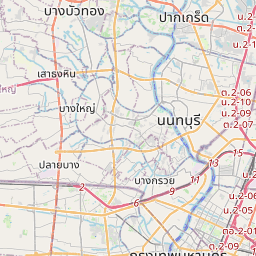
Bangkok en el mapa
Fuentes de datos y metodología

Nuestros pronósticos meteorológicos se basan en un proveedor profesional de datos meteorológicos que agrega datos de servicios meteorológicos nacionales, observaciones satelitales, redes de radar y más de 80 000 estaciones meteorológicas en todo el mundo. Los datos de pronóstico se actualizan varias veces al día. Convertimos los datos en bruto en resúmenes claros — velocidad del viento en m/s, presión en mm Hg — para que pueda planificar su día con confianza.