Pronóstico del tiempo a 5 días Bangkok 14 sept 2026

26°24° · Chubasco de lluvia ligera

Pronóstico del tiempo Bangkok lunes 14 sept 2026: chubasco de lluvia ligera, temperatura de 24 °C a 26 °C.

Probabilidad de precipitaciones 81%. Viento de hasta 2.61 m/s (ráfagas 5.61 m/s). Humedad del aire 78–94%, presión atmosférica 756–759 mm Hg, índice UV de hasta 8.3.

Alertas meteorológicas

Severe12 sept, 05:3412 sept, 18:00Traducir con Google
Heavy Rain Risk Area

Heavy Rain

The high-pressure system from China extends to the upper North and the upper Northeast of Thailand with the monsoon trough lies across the lower Central, the upper South, the upper Gulf and the East into an active low-pressure cell over the coast of middle Vietnam. Meanwhile, the moderate southwest monsoon prevails over the Andaman Sea, the South and the Gulf. More rain and isolated heavy to very heavy rains are likely in the upper South while isolated heavy rains are possible in the lower Northeast, the lower Central including Bangkok and vicinity, the East and the South regions. The moderate winds and waves in the upper Andaman Sea are expected about 2 meters high and above 2 meters high in thundershowers.
People should beware of heavy to very heavy rains and accumulation that may cause flash floods, overflows and landslides especially along the waterways near foothills and lowlands. All ships should proceed with caution and keep off thundershowers. In addition, 11-13 September, 2026, an active low-pressure cell over the middle South China Sea is expected to intensify to tropical storm and will move near the coast of upper Vietnam during 13-14 September 2026. Please stay tuned for the weather update.
Severe12 sept, 05:3412 sept, 18:00Traducir con Google
พื้นที่เสี่ยงภัยฝนตกหนักบริเวณประเทศไทย

Heavy Rain

ภาคใต้มีฝนเพิ่มขึ้นและมีฝนตกหนักถึงหนักมากบางพื้นที่ ส่วนภาคตะวันออกเฉียงเหนือตอนล่าง ภาคกลาง รวมทั้งกรุงเทพมหานครและปริมณฑล และภาคตะวันออกมีฝนตกหนักบางแห่ง ทั้งนี้เนื่องจากบริเวณความกดอากาศสูงหรือมวลอากาศเย็นแผ่ลงมาปกคลุมภาคเหนือตอนบน และภาคตะวันออกเฉียงเหนือตอนบน ในขณะที่ร่องมรสุมพาดผ่าน ภาคกลางตอนล่าง ภาคใต้ตอนบน อ่าวไทยตอนบน และภาคตะวันออก เข้าสู่หย่อมความกดอากาศต่ำกำลังแรงบริเวณชายฝั่งประเทศเวียดนามตอนกลาง ประกอบกับมรสุมตะวันตกเฉียงใต้กำลังปานกลางพัดปกคลุมทะเลอันดามัน ภาคใต้ และอ่าวไทย สำหรับคลื่นลมบริเวณทะเลอันดามันและอ่าวไทยมีกำลังปานกลาง โดยทะเลอันดามันตอนบนมีคลื่นสูงประมาณ 2 เมตร บริเวณที่มีฝนฟ้าคะนองคลื่นสูงมากกว่า 2 เมตร ขอให้ชาวเรือบริเวณทะเลอันดามันและอ่าวไทยเดินเรือด้วยความระมัดระวัง และหลีกเลี่ยงการเดินเรือในบริเวณที่มีฝนฟ้าคะนอง
ขอให้ประชาชนในบริเวณดังกล่าวระวังอันตรายจากฝนตกหนักถึงหนักมากและฝนที่ตกสะสมซึ่งอาจทำให้เกิดน้ำท่วมฉับพลัน และน้ำป่าไหลหลาก รวมทั้งดินโคลนถล่ม โดยเฉพาะพื้นที่ตามลุ่มน้ำโขง พื้นที่ลาดเชิงเขาใกล้ทางน้ำไหลผ่าน และพื้นที่ลุ่ม ควรหลีกเลี่ยงการเดินทางผ่านเส้นทาง ที่มีปัญหาน้ำท่วมซ้ำซาก โดยเฉพาะพื้นที่ลุ่มต่ำซึ่งอาจเกิดน้ำท่วมขังในระยะสั้นได้ ขอให้ชาวเรือบริเวณทะเลอันดามันและอ่าวไทยเดินเรือด้วยความระมัดระวัง และหลีกเลี่ยงการเดินเรือในบริเวณที่มีฝนฟ้าคะนอง อนึ่ง ในช่วงวันที่ 12-13 ก.ย. 69 หย่อมความกดอากาศต่ำกำลังแรงบริเวณชายฝั่งประเทศเวียดนามตอนกลาง มีแนวโน้มจะทวีกำลังแรงขึ้นเป็นพายุหมุนเขตร้อน และคาดว่าจะเคลื่อนเข้าใกล้ชายฝั่งประเทศเวียดนามตอนบนในช่วงวันที่ 13-14 ก.ย. 69 ขอให้ประชาชนติดตามข่าวพยากรณ์อากาศอย่างต่อเนื่องในระยะนี้ไว้ด้วย
Los 5 días de un vistazo — toca un día para abrirlo
Amanecer 06:06
Atardecer 18:20
Luna creciente14% iluminada
Salida de la luna 08:40 · Puesta de la luna 20:30
Gráfico
Tabla

Pronóstico de 24 °C a 26 °C y precipitaciones

Temperatura & Precipitaciones
Hora00:0001:0002:0003:0004:0005:0006:0007:0008:0009:0010:0011:0012:0013:0014:0015:0016:0017:0018:0019:0020:0021:0022:0023:00
Temperatura (°C)262525252525252525252424242425252525252525252525
Precipitaciones (mm/h)0.010.01000000.010.021.392.291.031.911.030.460.080.670.650.0400.080.520.120.53

Nubosidad y probabilidad de precipitaciones

Nubosidad & Probabilidad de lluvia
Hora00:0001:0002:0003:0004:0005:0006:0007:0008:0009:0010:0011:0012:0013:0014:0015:0016:0017:0018:0019:0020:0021:0022:0023:00
Nubosidad (%)100100100100100100100100100100100100100100100100100100100931001009898
Probabilidad de lluvia (%)232523232323242426708175817560386667363040644264

Velocidad y dirección del viento

Viento & Ráfaga de viento
Hora00:0001:0002:0003:0004:0005:0006:0007:0008:0009:0010:0011:0012:0013:0014:0015:0016:0017:0018:0019:0020:0021:0022:0023:00
Viento (m/s)2.612.311.611.310.110.311.111.391.51.891.510.610.810.8911.111.311.3110.890.390.390.61
Ráfaga de viento (m/s)4.423.52.111.610.310.641.221.421.54.894.545.610.811.221.721.832.031.811.111.110.690.50.72
Dirección del viento (°)ESE 103°ESE 108°E 88°ENE 71°ESE 105°E 81°NE 49°NE 52°ENE 61°ENE 63°E 81°ESE 115°SE 134°SSE 166°S 190°SO 217°O 266°OSO 248°SO 220°S 186°SSE 161°S 172°SE 133°NE 46°

Humedad del aire

Humedad
Hora00:0001:0002:0003:0004:0005:0006:0007:0008:0009:0010:0011:0012:0013:0014:0015:0016:0017:0018:0019:0020:0021:0022:0023:00
Humedad (%)788079807979808080819193949392919193949393939393

Presión atmosférica

Presión
Hora00:0001:0002:0003:0004:0005:0006:0007:0008:0009:0010:0011:0012:0013:0014:0015:0016:0017:0018:0019:0020:0021:0022:0023:00
Presión (mm Hg)758758757757757757757758758759759758758757757756756756757757758758758758

Índice ultravioleta

Índice UV
Hora00:0001:0002:0003:0004:0005:0006:0007:0008:0009:0010:0011:0012:0013:0014:0015:0016:0017:0018:0019:0020:0021:0022:0023:00
Índice UV00000000.210.81.84.48.37.56.852.10.5000000

Calidad del aire y polen

Calidad del aire
Hora00:0001:0002:0003:0004:0005:0006:0007:0008:0009:0010:0011:0012:0013:0014:0015:0016:0017:0018:0019:0020:0021:0022:0023:00
PM2.5 (µg/m³)20.52120.619.317.816.615.716.819.422.82629.332.433.635.439.340.940.742.64338.933.825.419.3
PM10 (µg/m³)20.621.120.819.417.916.815.91719.62326.329.632.834.135.939.841.341.242.843.339.13425.619.4
Ozono (O₃) (µg/m³)605758626562576281109140176215247272292296277242214201193182162
NO₂ (µg/m³)29.329.626.62218.617.718.119.221.925.326.523.217.71413.715.31823.229.632.127.118.311.810.6
SO₂ (µg/m³)12.513.512.911.610.6109.710.312.71618.318.317.216.617.218.219.220.521.721.418.113.39.47.6
CO (µg/m³)52242035531231135744457781310951252116294680478082910111424197024182693287029352878

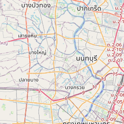
Bangkok en el mapa

Fuentes de datos y metodología

Nuestros pronósticos meteorológicos se basan en un proveedor profesional de datos meteorológicos que agrega datos de servicios meteorológicos nacionales, observaciones satelitales, redes de radar y más de 80 000 estaciones meteorológicas en todo el mundo. Los datos de pronóstico se actualizan varias veces al día. Convertimos los datos en bruto en resúmenes claros — velocidad del viento en m/s, presión en mm Hg — para que pueda planificar su día con confianza.