Pronóstico del tiempo a 5 días San Francisco 14-06-2026

Pronóstico del tiempo San Francisco hoy 14.06.2026: cubierto, temperatura de 13 °C a 20 °C.

Probabilidad de precipitaciones 35%. Viento de hasta 5.81 m/s (ráfagas 8.11 m/s). Humedad del aire 70–100%, presión atmosférica 758–761 mm Hg, índice UV de hasta 9.8.

Alertas meteorológicas

Ocultar alertas
ModerateJun 13, 09:23 PMJun 14, 01:00 PMTraducir con Google
Beach Hazards Statement issued June 13 at 2:23PM PDT until June 17 at 3:00AM PDT by NWS San Francisco CA

Beach Hazards Statement

* WHAT...For the Coastal Flood Advisory, up to 2.0 ft of inundation above ground level is possible in low-lying areas near shorelines and tidal waterways. For the Beach Hazards Statement, increased risk of sneaker waves and strong rip currents expected. * WHERE...Low-lying coastal and bayshore areas in San Francisco. * WHEN...For the Coastal Flood Advisory, until 3 AM PDT Wednesday. For the Beach Hazards Statement, from 3 AM PDT Sunday through 3 AM PDT Wednesday. * IMPACTS...Flooding of lots, parks, and roads with only isolated road closures expected. Dangerous conditions are forecast along the shoreline. Hazards include sneaker waves, strong rip currents, and large breaking waves. * ADDITIONAL DETAILS...At the San Francisco tidal gauge, high tide is expected to be 1.9 ft above normal (7.8 ft MLLW) at 10:20 PM on Saturday the 13th, 2.0 ft above normal (7.8 ft MLLW) at 11:10 PM on Sunday the 14th, 1.9 ft above normal (7.8 ft MLLW) at 12:02 AM on Tuesday the 16th, and 1.6 ft above normal (7.4 ft MLLW) at 12:56 AM on Wednesday the 17th. High tide varies up to 90 minutes earlier or later along the Pacific Coast and through the San Francisco Bay, respectively.
If travel is required, allow extra time as some roads may be closed. Do not drive around barricades or through water of unknown depth. Take the necessary actions to protect flood-prone property. Stay off of jetties, piers, rocks, and other waterside infrastructure. Remain out of the water to avoid hazardous surf and NEVER turn your back on the ocean. Monitor local weather, surf and tide forecasts at www.weather.gov/mtr.
MinorJun 13, 09:23 PMJun 14, 01:00 PMTraducir con Google
Coastal Flood Advisory issued June 13 at 2:23PM PDT until June 17 at 3:00AM PDT by NWS San Francisco CA

Coastal Flood Advisory

* WHAT...For the Coastal Flood Advisory, up to 2.0 ft of inundation above ground level is possible in low-lying areas near shorelines and tidal waterways. For the Beach Hazards Statement, increased risk of sneaker waves and strong rip currents expected. * WHERE...Low-lying coastal and bayshore areas in San Francisco. * WHEN...For the Coastal Flood Advisory, until 3 AM PDT Wednesday. For the Beach Hazards Statement, from 3 AM PDT Sunday through 3 AM PDT Wednesday. * IMPACTS...Flooding of lots, parks, and roads with only isolated road closures expected. Dangerous conditions are forecast along the shoreline. Hazards include sneaker waves, strong rip currents, and large breaking waves. * ADDITIONAL DETAILS...At the San Francisco tidal gauge, high tide is expected to be 1.9 ft above normal (7.8 ft MLLW) at 10:20 PM on Saturday the 13th, 2.0 ft above normal (7.8 ft MLLW) at 11:10 PM on Sunday the 14th, 1.9 ft above normal (7.8 ft MLLW) at 12:02 AM on Tuesday the 16th, and 1.6 ft above normal (7.4 ft MLLW) at 12:56 AM on Wednesday the 17th. High tide varies up to 90 minutes earlier or later along the Pacific Coast and through the San Francisco Bay, respectively.
If travel is required, allow extra time as some roads may be closed. Do not drive around barricades or through water of unknown depth. Take the necessary actions to protect flood-prone property. Stay off of jetties, piers, rocks, and other waterside infrastructure. Remain out of the water to avoid hazardous surf and NEVER turn your back on the ocean. Monitor local weather, surf and tide forecasts at www.weather.gov/mtr.
MinorJun 14, 12:54 PMJun 15, 04:00 AMTraducir con Google
Coastal Flood Advisory issued June 14 at 5:54AM PDT until June 17 at 3:00AM PDT by NWS San Francisco CA

Coastal Flood Advisory

* WHAT...For the Coastal Flood Advisory, up to 2.0 ft of inundation above ground level is possible in low-lying areas near shorelines and tidal waterways. For the Beach Hazards Statement, increased risk of sneaker waves and strong rip currents expected. * WHERE...Low-lying coastal and bayshore areas in San Francisco. * WHEN...For the Coastal Flood Advisory, until 3 AM PDT Wednesday. For the Beach Hazards Statement, through late Tuesday night. * IMPACTS...Flooding of lots, parks, and roads with only isolated road closures expected. Dangerous conditions are forecast along the shoreline. Hazards include sneaker waves, strong rip currents, and large breaking waves. * ADDITIONAL DETAILS...At the San Francisco tidal gauge, high tide is expected to be 2.0 ft above normal (7.8 ft MLLW) at 11:10 PM on Sunday the 14th, 1.9 ft above normal (7.8 ft MLLW) at 12:02 AM on Tuesday the 16th, and 1.6 ft above normal (7.4 ft MLLW) at 12:56 AM on Wednesday the 17th. High tide varies up to 90 minutes earlier or later along the Pacific Coast and through the San Francisco Bay, respectively.
If travel is required, allow extra time as some roads may be closed. Do not drive around barricades or through water of unknown depth. Take the necessary actions to protect flood-prone property. Stay off of jetties, piers, rocks, and other waterside infrastructure. Remain out of the water to avoid hazardous surf and NEVER turn your back on the ocean. Monitor local weather, surf and tide forecasts at www.weather.gov/mtr.
ModerateJun 14, 12:54 PMJun 15, 04:00 AMTraducir con Google
Beach Hazards Statement issued June 14 at 5:54AM PDT until June 17 at 3:00AM PDT by NWS San Francisco CA

Beach Hazards Statement

* WHAT...For the Coastal Flood Advisory, up to 2.0 ft of inundation above ground level is possible in low-lying areas near shorelines and tidal waterways. For the Beach Hazards Statement, increased risk of sneaker waves and strong rip currents expected. * WHERE...Low-lying coastal and bayshore areas in San Francisco. * WHEN...For the Coastal Flood Advisory, until 3 AM PDT Wednesday. For the Beach Hazards Statement, through late Tuesday night. * IMPACTS...Flooding of lots, parks, and roads with only isolated road closures expected. Dangerous conditions are forecast along the shoreline. Hazards include sneaker waves, strong rip currents, and large breaking waves. * ADDITIONAL DETAILS...At the San Francisco tidal gauge, high tide is expected to be 2.0 ft above normal (7.8 ft MLLW) at 11:10 PM on Sunday the 14th, 1.9 ft above normal (7.8 ft MLLW) at 12:02 AM on Tuesday the 16th, and 1.6 ft above normal (7.4 ft MLLW) at 12:56 AM on Wednesday the 17th. High tide varies up to 90 minutes earlier or later along the Pacific Coast and through the San Francisco Bay, respectively.
If travel is required, allow extra time as some roads may be closed. Do not drive around barricades or through water of unknown depth. Take the necessary actions to protect flood-prone property. Stay off of jetties, piers, rocks, and other waterside infrastructure. Remain out of the water to avoid hazardous surf and NEVER turn your back on the ocean. Monitor local weather, surf and tide forecasts at www.weather.gov/mtr.
MinorJun 13, 09:23 PMJun 14, 01:00 PMTraducir con Google
Coastal Flood Advisory issued June 13 at 2:23PM PDT until June 16 at 3:00AM PDT by NWS San Francisco CA

Coastal Flood Advisory

* WHAT...For the Coastal Flood Advisory, up to 2.0 ft of inundation above ground level is possible in low-lying areas near shorelines and tidal waterways. For the Beach Hazards Statement, increased risk of sneaker waves and strong rip currents expected. * WHERE...Pacific Coast Beaches. * WHEN...For the Coastal Flood Advisory, from 7 PM PDT Saturday to 3 AM PDT Tuesday. For the Beach Hazards Statement, from 3 AM PDT Sunday through 3 AM PDT Wednesday. * IMPACTS...High tide flooding of lots, parks, and roads with only isolated road closures expected. Dangerous swimming and surfing conditions and localized beach erosion can be expected. Sneaker waves can sweep across the shoreline without warning, pulling people into the sea from rocks, jetties and beaches. * ADDITIONAL DETAILS...At the San Francisco tidal gauge, high tide is expected to be 1.9 ft above normal (7.8 ft MLLW) at 10:20 PM on Saturday the 13th, 2.0 ft above normal (7.8 ft MLLW) at 11:10 PM on Sunday the 14th, 1.9 ft above normal (7.8 ft MLLW) at 12:02 AM on Tuesday the 16th. High tide varies up to 90 minutes earlier or later along the Pacific Coast and through the San Francisco Bay, respectively.
If travel is required, allow extra time as some roads may be closed. Do not drive around barricades or through water of unknown depth. Take the necessary actions to protect flood-prone property. Stay off of jetties, piers, rocks, and other waterside infrastructure. Remain out of the water to avoid hazardous surf and NEVER turn your back on the ocean. Monitor local weather, surf and tide forecasts at www.weather.gov/mtr.
Amanecer 05:47
Atardecer 20:32
Luna nueva0% iluminada
Salida de la luna 04:40 · Puesta de la luna 20:30
Gráfico
Tabla
dom, 14 jun 2026

Pronóstico de 13 °C a 20 °C y precipitaciones

Temperatura & Precipitaciones
Hora00:0001:0002:0003:0004:0005:0006:0007:0008:0009:0010:0011:0012:0013:0014:0015:0016:0017:0018:0019:0020:0021:0022:0023:00
Temperatura (°C)141414141414131314151719181920191917161514151515
Precipitaciones (mm/h)000000000000000000000000

Nubosidad y probabilidad de precipitaciones

Nubosidad & Probabilidad de lluvia
Hora00:0001:0002:0003:0004:0005:0006:0007:0008:0009:0010:0011:0012:0013:0014:0015:0016:0017:0018:0019:0020:0021:0022:0023:00
Nubosidad (%)10010010010082839310010090455015151514214683949710022
Probabilidad de lluvia (%)3535353529293235342918121010991117252932321212

Velocidad y dirección del viento

Viento & Ráfaga de viento
Hora00:0001:0002:0003:0004:0005:0006:0007:0008:0009:0010:0011:0012:0013:0014:0015:0016:0017:0018:0019:0020:0021:0022:0023:00
Viento (m/s)2.192.612.692.692.52.52.392.112.112.192.893.614.114.815.315.615.815.55.194.814.1132.52.5
Ráfaga de viento (m/s)4.114.814.284.223.923.893.693.032.862.923.834.675.286.256.927.478.117.947.727.336.535.034.254.36
Dirección del viento (°)OSO 243°OSO 252°OSO 254°OSO 258°OSO 255°OSO 250°OSO 250°OSO 250°OSO 242°OSO 246°OSO 252°OSO 256°O 261°O 260°OSO 258°OSO 258°OSO 257°OSO 255°OSO 254°OSO 256°O 260°O 259°OSO 255°OSO 251°

Humedad del aire

Humedad
Hora00:0001:0002:0003:0004:0005:0006:0007:0008:0009:0010:0011:0012:0013:0014:0015:0016:0017:0018:0019:0020:0021:0022:0023:00
Humedad (%)10010099100969696100100938970807877778085909296988687

Presión atmosférica

Presión
Hora00:0001:0002:0003:0004:0005:0006:0007:0008:0009:0010:0011:0012:0013:0014:0015:0016:0017:0018:0019:0020:0021:0022:0023:00
Presión (mm Hg)758758759759759760760761761761761761761761761761760760760760761761761761

Índice ultravioleta

Índice UV
Hora00:0001:0002:0003:0004:0005:0006:0007:0008:0009:0010:0011:0012:0013:0014:0015:0016:0017:0018:0019:0020:0021:0022:0023:00
Índice UV00000000.31.12.74.97.199.89.47.95.73.41.60.50000

Calidad del aire y polen

Calidad del aire
Hora00:0001:0002:0003:0004:0005:0006:0007:0008:0009:0010:0011:0012:0013:0014:0015:0016:0017:0018:0019:0020:0021:0022:0023:00
PM2.5 (µg/m³)13.713.51312.511.911.511.21111.21212.51313.213.313.312.912.412.312.412.612.712.913.213.5
PM10 (µg/m³)20.319.819.118.317.517.116.816.516.617.918.719.519.820.120.219.618.818.718.719.119.319.419.720.1
Ozono (O₃) (µg/m³)575859595858575657606468707273737169666259575555
NO₂ (µg/m³)10.69.48.47.87.47.27.47.87.97.46.65.854.13.53.23.23.85.78.310.211.111.310.9
SO₂ (µg/m³)1.41.51.51.51.41.41.41.41.41.41.51.51.51.41.41.31.31.21.11.11.11.11.21.3
CO (µg/m³)10210099989898991011031041041041031011009999100103106108107105103
dom, 14 jun 2026

Preguntas frecuentes sobre el tiempo en San Francisco

Hoy en San Francisco la temperatura oscila entre 13 °C y 20 °C, con viento de hasta 5.81 m/s. Consulte el pronóstico detallado por hora más arriba para obtener más información.

La probabilidad de precipitaciones en San Francisco hoy es del 35%. Consulte el pronóstico completo de varios días más arriba para ver las probabilidades de lluvia de cada día.

La velocidad del viento en San Francisco hoy alcanza hasta 5.81 m/s con ráfagas de hasta 8.11 m/s. Consulte el gráfico detallado del viento más arriba para datos por hora.

La humedad del aire en San Francisco hoy oscila entre 70% y 100%. Consulte el gráfico de humedad más arriba para detalles por hora.

El índice UV en San Francisco hoy alcanza hasta 9.8. Consulte el gráfico del índice UV más arriba para los valores por hora a lo largo del día.

La presión atmosférica en San Francisco hoy oscila entre 758 y 761 mm Hg. Consulte el gráfico de presión más arriba para las lecturas por hora.

La nubosidad en San Francisco hoy alcanza hasta 100%. Consulte el gráfico de nubosidad más arriba para detalles por hora a lo largo del día.

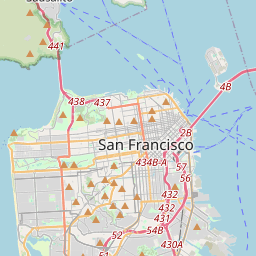
San Francisco en el mapa

Fuentes de datos y metodología

Nuestros pronósticos meteorológicos se basan en un proveedor profesional de datos meteorológicos que agrega datos de servicios meteorológicos nacionales, observaciones satelitales, redes de radar y más de 80 000 estaciones meteorológicas en todo el mundo. Los datos de pronóstico se actualizan varias veces al día. Convertimos los datos en bruto en resúmenes claros — velocidad del viento en m/s, presión en mm Hg — para que pueda planificar su día con confianza.