
5-day weather forecast Surry Hills Nov 12, 2026
 21°
Weather forecast Surry Hills Thursday Nov 12, 2026: patchy rain possible, temperature from 19 °C to 21 °C.
Precipitation probability 37%. Wind up to 9.69 m/s (gusts 11.22 m/s). Air humidity 72–93%, atmospheric pressure 763–767 mm Hg, UV index up to 7.6.
Weather Alerts
Hazardous Surf Warning for Byron Coast: Point Danger to Wooli, Coffs Coast: Wooli to Smoky Cape, Macquarie Coast: Smoky Cape to Seal Rocks, Hunter Coast: Seal Rocks to Broken Bay, Sydney Coast: Broken Bay to Port Hacking, Illawarra Coast: Port Hacking to Ulladulla, Batemans Coast: Ulladulla to Montague Island and Eden Coast: Montague Island to Gabo Island for 10 November
Large Coastal Surf
NSW Police Force, Marine Area Command advise that:
People should consider staying out of the water and avoid walking near surf-exposed areas.
Rock fishers should avoid coastal rock platforms exposed to the ocean and seek a safe location that is sheltered from the surf.
Boaters planning to cross shallow water and ocean bars should consider changing or delaying their voyage.
Boaters already on the water should carry the appropriate safety equipment and wear a lifejacket.
Boaters should remember to log on with their local Marine Rescue radio base, via VHF Radio or the Marine Rescue APP, and consider their safety management plan.
Hazardous Surf Warning for Byron Coast: Point Danger to Wooli, Coffs Coast: Wooli to Smoky Cape, Macquarie Coast: Smoky Cape to Seal Rocks, Hunter Coast: Seal Rocks to Broken Bay, Sydney Coast: Broken Bay to Port Hacking, Illawarra Coast: Port Hacking to Ulladulla, Batemans Coast: Ulladulla to Montague Island and Eden Coast: Montague Island to Gabo Island for 10 November
Large Coastal Surf
NSW Police Force, Marine Area Command advise that:
People should consider staying out of the water and avoid walking near surf-exposed areas.
Rock fishers should avoid coastal rock platforms exposed to the ocean and seek a safe location that is sheltered from the surf.
Boaters planning to cross shallow water and ocean bars should consider changing or delaying their voyage.
Boaters already on the water should carry the appropriate safety equipment and wear a lifejacket.
Boaters should remember to log on with their local Marine Rescue radio base, via VHF Radio or the Marine Rescue APP, and consider their safety management plan.
Hazardous Surf Warning for Byron Coast: Point Danger to Wooli, Coffs Coast: Wooli to Smoky Cape, Macquarie Coast: Smoky Cape to Seal Rocks, Hunter Coast: Seal Rocks to Broken Bay, Sydney Coast: Broken Bay to Port Hacking, Illawarra Coast: Port Hacking to Ulladulla, Batemans Coast: Ulladulla to Montague Island and Eden Coast: Montague Island to Gabo Island for 10 November
Large Coastal Surf
NSW Police Force, Marine Area Command advise that:
People should consider staying out of the water and avoid walking near surf-exposed areas.
Rock fishers should avoid coastal rock platforms exposed to the ocean and seek a safe location that is sheltered from the surf.
Boaters planning to cross shallow water and ocean bars should consider changing or delaying their voyage.
Boaters already on the water should carry the appropriate safety equipment and wear a lifejacket.
Boaters should remember to log on with their local Marine Rescue radio base, via VHF Radio or the Marine Rescue APP, and consider their safety management plan.
Hazardous Surf Warning for Byron Coast: Point Danger to Wooli, Coffs Coast: Wooli to Smoky Cape, Macquarie Coast: Smoky Cape to Seal Rocks, Hunter Coast: Seal Rocks to Broken Bay, Sydney Coast: Broken Bay to Port Hacking, Illawarra Coast: Port Hacking to Ulladulla, Batemans Coast: Ulladulla to Montague Island and Eden Coast: Montague Island to Gabo Island for 10 November
Large Coastal Surf
NSW Police Force, Marine Area Command advise that:
People should consider staying out of the water and avoid walking near surf-exposed areas.
Rock fishers should avoid coastal rock platforms exposed to the ocean and seek a safe location that is sheltered from the surf.
Boaters planning to cross shallow water and ocean bars should consider changing or delaying their voyage.
Boaters already on the water should carry the appropriate safety equipment and wear a lifejacket.
Boaters should remember to log on with their local Marine Rescue radio base, via VHF Radio or the Marine Rescue APP, and consider their safety management plan.
Hazardous Surf Warning for Byron Coast: Point Danger to Wooli, Coffs Coast: Wooli to Smoky Cape, Macquarie Coast: Smoky Cape to Seal Rocks, Hunter Coast: Seal Rocks to Broken Bay, Sydney Coast: Broken Bay to Port Hacking, Illawarra Coast: Port Hacking to Ulladulla, Batemans Coast: Ulladulla to Montague Island and Eden Coast: Montague Island to Gabo Island for 10 November
Large Coastal Surf
NSW Police Force, Marine Area Command advise that:
People should consider staying out of the water and avoid walking near surf-exposed areas.
Rock fishers should avoid coastal rock platforms exposed to the ocean and seek a safe location that is sheltered from the surf.
Boaters planning to cross shallow water and ocean bars should consider changing or delaying their voyage.
Boaters already on the water should carry the appropriate safety equipment and wear a lifejacket.
Boaters should remember to log on with their local Marine Rescue radio base, via VHF Radio or the Marine Rescue APP, and consider their safety management plan.
5 days at a glance — tap a day to open it
Sunrise 05:45
Sunset 19:33
Sunset 19:33
Waxing Crescent14% illuminated
Moonrise 07:31 · Moonset 22:48
Moonrise 07:31 · Moonset 22:48
Chart
TableForecast from 19 °C to 21 °C and precipitation
Cloud cover and precipitation probability
Wind speed and direction
Air humidity
Atmospheric pressure
Ultraviolet index
Air quality & pollen
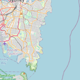
Surry Hills on the map
Data Sources & Methodology
Our weather forecasts are powered by a professional weather data provider that aggregates data from national weather services, satellite observations, radar networks, and over 80,000 weather stations worldwide. Forecast data is updated multiple times daily. We convert raw data into clear summaries — wind speed in m/s, pressure in mmHg — so you can plan your day with confidence.