5-day weather forecast Sunderland Nov 7, 2026

10°9° · Patchy rain possible

Weather forecast Sunderland Saturday Nov 7, 2026: patchy rain possible, temperature from 9 °C to 10 °C.

Precipitation probability 40%. Wind up to 3.61 m/s (gusts 5.92 m/s). Air humidity 75–88%, atmospheric pressure 767–769 mm Hg, UV index up to 0.4.

5 days at a glance — tap a day to open it
Sunrise 07:21
Sunset 16:17
New Moon2% illuminated
Moonrise 05:12 · Moonset 15:02
Chart
Table

Forecast from 9 °C to 10 °C and precipitation

Temperature & Precipitation
Time00:0001:0002:0003:0004:0005:0006:0007:0008:0009:0010:0011:0012:0013:0014:0015:0016:0017:0018:0019:0020:0021:0022:0023:00
Temperature (°C)1010101010101099101010101010101010999999
Precipitation (mm/hr)00.020.020.010.070.090.060.130.080.020.070.10.060.130.10.070.080.050.070.080.080.120.030.03

Cloud cover and precipitation probability

Cloud cover & Rain chance
Time00:0001:0002:0003:0004:0005:0006:0007:0008:0009:0010:0011:0012:0013:0014:0015:0016:0017:0018:0019:0020:0021:0022:0023:00
Cloud cover (%)10010010010010010010010010010010010010010010099100999798100100100100
Rain chance (%)222323233135293833263133293534323330333334402930

Wind speed and direction

Wind & Wind gust
Time00:0001:0002:0003:0004:0005:0006:0007:0008:0009:0010:0011:0012:0013:0014:0015:0016:0017:0018:0019:0020:0021:0022:0023:00
Wind (m/s)2.612.612.392.312.52.892.693.393.312.193.313.612.313.613.612.193.112.691.692.812.811.112.52.61
Wind gust (m/s)4.424.724.54.334.815.424.725.925.814.255.225.224.565.535.864.395.925.613.865.695.813.725.395.5
Wind direction (°)NE 50°NE 38°NNE 30°NE 39°NNE 19°NNE 24°NE 36°NNE 21°NNE 17°NNE 22°N 5°N 9°NE 36°N 10°N 7°NNE 26°N 0°N 358°NNE 18°N 351°NNW 344°N 3°NNW 329°NW 323°

Air humidity

Humidity
Time00:0001:0002:0003:0004:0005:0006:0007:0008:0009:0010:0011:0012:0013:0014:0015:0016:0017:0018:0019:0020:0021:0022:0023:00
Humidity (%)767576778083808483808079788182828382858384888586

Atmospheric pressure

Pressure
Time00:0001:0002:0003:0004:0005:0006:0007:0008:0009:0010:0011:0012:0013:0014:0015:0016:0017:0018:0019:0020:0021:0022:0023:00
Pressure (mm Hg)769769769768768768768768768768768768767767767767767767767767767767767767

Ultraviolet index

UV Index
Time00:0001:0002:0003:0004:0005:0006:0007:0008:0009:0010:0011:0012:0013:0014:0015:0016:0017:0018:0019:0020:0021:0022:0023:00
UV Index0000000000.10.20.40.40.40.30.100000000

Air quality & pollen

Air quality
Time00:0001:0002:0003:0004:0005:0006:0007:0008:0009:0010:0011:0012:0013:0014:0015:0016:0017:0018:0019:0020:0021:0022:0023:00
PM2.5 (µg/m³)4.24.34.44.74.74.85.45.86.25.55.14.74.53.83.63.43.33.33.1332.88.614.5
PM10 (µg/m³)9.89.81010.110.310.811.51212.111.610.910.39.58.98.58.38.17.97.67.176.813.420.2
Ozone (O₃) (µg/m³)676769696969676565666869717274767578798078766860
NO₂ (µg/m³)2.82.72.52.32.22.122.12.22.32.22.122.12.12.22.121.91.81.71.74.88.1
SO₂ (µg/m³)0.70.70.70.60.60.60.60.50.50.40.30.20.20.20.20.10.10.10.10.10.10.10.71.2
CO (µg/m³)157159157158159159159163162159157155154152150147145145144144143143145152.5

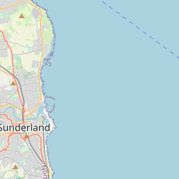
Sunderland on the map

Data Sources & Methodology

Our weather forecasts are powered by a professional weather data provider that aggregates data from national weather services, satellite observations, radar networks, and over 80,000 weather stations worldwide. Forecast data is updated multiple times daily. We convert raw data into clear summaries — wind speed in m/s, pressure in mmHg — so you can plan your day with confidence.