
5-day weather forecast Sunderland Nov 9, 2026

11°7° · Patchy rain possible

Weather forecast Sunderland Monday Nov 9, 2026: patchy rain possible, temperature from 7 °C to 11 °C.

Precipitation probability 32%. Wind up to 3 m/s (gusts 6.89 m/s). Air humidity 66–91%, atmospheric pressure 764–767 mm Hg, UV index up to 3.

5 days at a glance — tap a day to open it
Sunrise 07:25
Sunset 16:13
New Moon0% illuminated
Moonrise 08:12 · Moonset 15:33
Chart
Table
Mon, Nov 9, 2026

Forecast from 7 °C to 11 °C and precipitation

Temperature & Precipitation
Time00:0001:0002:0003:0004:0005:0006:0007:0008:0009:0010:0011:0012:0013:0014:0015:0016:0017:0018:0019:0020:0021:0022:0023:00
Temperature (°C)877777777791010111110109999999
Precipitation (mm/hr)0000.05000.030.040.0400.010.010.010.020.020000000.0100

Cloud cover and precipitation probability

Cloud cover & Rain chance
Time00:0001:0002:0003:0004:0005:0006:0007:0008:0009:0010:0011:0012:0013:0014:0015:0016:0017:0018:0019:0020:0021:0022:0023:00
Cloud cover (%)88979777999992971009699948189765855606059595550
Rain chance (%)26272629262632302929252418181510910131415161515

Wind speed and direction

Wind & Wind gust
Time00:0001:0002:0003:0004:0005:0006:0007:0008:0009:0010:0011:0012:0013:0014:0015:0016:0017:0018:0019:0020:0021:0022:0023:00
Wind (m/s)2.111.691.812.311.811.692.191.691.6121.51.692.892.392.312.51.611.612.52.692.8132.812.61
Wind gust (m/s)2.722.722.722.812.892.812.692.812.722.52.834.113.723.443.533.331.691.895.55.695.8166.56.89
Wind direction (°)NW 324°WNW 298°WNW 301°NW 324°NW 309°NW 313°NW 313°NW 314°NW 315°NW 320°N 357°NNE 16°NE 42°NE 51°ENE 57°ENE 73°E 83°ESE 102°E 84°E 87°E 89°E 92°E 100°ESE 107°

Air humidity

Humidity
Time00:0001:0002:0003:0004:0005:0006:0007:0008:0009:0010:0011:0012:0013:0014:0015:0016:0017:0018:0019:0020:0021:0022:0023:00
Humidity (%)888685908484918483908080737168667779737577798080

Atmospheric pressure

Pressure
Time00:0001:0002:0003:0004:0005:0006:0007:0008:0009:0010:0011:0012:0013:0014:0015:0016:0017:0018:0019:0020:0021:0022:0023:00
Pressure (mm Hg)766766766766766765766766766767766765766765764766764764766766766766766766

Ultraviolet index

UV Index
Time00:0001:0002:0003:0004:0005:0006:0007:0008:0009:0010:0011:0012:0013:0014:0015:0016:0017:0018:0019:0020:0021:0022:0023:00
UV Index0000000000.20.30.50.533330000000

Air quality & pollen

Air quality is available for the first three days only.

Mon, Nov 9, 2026

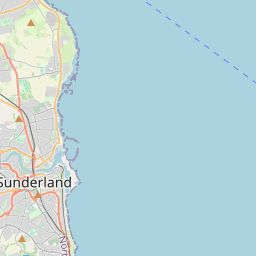
Sunderland on the map
Data Sources & Methodology

Our weather forecasts are powered by a professional weather data provider that aggregates data from national weather services, satellite observations, radar networks, and over 80,000 weather stations worldwide. Forecast data is updated multiple times daily. We convert raw data into clear summaries — wind speed in m/s, pressure in mmHg — so you can plan your day with confidence.