5-day weather forecast Serramanna Nov 17, 2026

22°15° · Partly cloudy

Weather forecast Serramanna Tuesday Nov 17, 2026: partly cloudy, temperature from 15 °C to 22 °C.

Precipitation probability 23%. Wind up to 4.69 m/s (gusts 9.14 m/s). Air humidity 59–91%, atmospheric pressure 759–764 mm Hg, UV index up to 2.3.

Sunrise 07:10
Sunset 17:08
First Quarter63% illuminated
Moonrise 13:23 · Moonset does not set today
Chart
Table

Forecast from 15 °C to 22 °C and precipitation

Temperature & Precipitation
Time00:0001:0002:0003:0004:0005:0006:0007:0008:0009:0010:0011:0012:0013:0014:0015:0016:0017:0018:0019:0020:0021:0022:0023:00
Temperature (°C)161615151515151516181920212222212019191818181818
Precipitation (mm/hr)000000000000000000000000

Cloud cover and precipitation probability

Cloud cover & Rain chance
Time00:0001:0002:0003:0004:0005:0006:0007:0008:0009:0010:0011:0012:0013:0014:0015:0016:0017:0018:0019:0020:0021:0022:0023:00
Cloud cover (%)5848525661552089111421253040619998979693908789
Rain chance (%)201819202120151413119765691720222323232222

Wind speed and direction

Wind & Wind gust
Time00:0001:0002:0003:0004:0005:0006:0007:0008:0009:0010:0011:0012:0013:0014:0015:0016:0017:0018:0019:0020:0021:0022:0023:00
Wind (m/s)2.692.521.51.190.890.610.50.50.50.811.813.114.54.694.3943.112.3921.891.8922.81
Wind gust (m/s)6.085.674.473.172.472.3121.722.252.974.395.616.948.318.788.899.146.695.365.225.175.565.067.31
Wind direction (°)WNW 287°WNW 291°WNW 300°WNW 296°WNW 294°WNW 295°WNW 282°WSW 239°SW 214°SSW 198°SSW 200°SW 231°WSW 242°WSW 248°WSW 253°WSW 249°WSW 251°WSW 255°WSW 254°W 264°W 265°W 262°W 261°W 261°

Air humidity

Humidity
Time00:0001:0002:0003:0004:0005:0006:0007:0008:0009:0010:0011:0012:0013:0014:0015:0016:0017:0018:0019:0020:0021:0022:0023:00
Humidity (%)888889909190909087827770645959626774788182828382

Atmospheric pressure

Pressure
Time00:0001:0002:0003:0004:0005:0006:0007:0008:0009:0010:0011:0012:0013:0014:0015:0016:0017:0018:0019:0020:0021:0022:0023:00
Pressure (mm Hg)764764763763763763763763763763762762761761761760760760760760760759759759

Ultraviolet index

UV Index
Time00:0001:0002:0003:0004:0005:0006:0007:0008:0009:0010:0011:0012:0013:0014:0015:0016:0017:0018:0019:0020:0021:0022:0023:00
UV Index0000000000.51.11.82.32.31.810.40000000

Air quality & pollen

Air quality
Time00:0001:0002:0003:0004:0005:0006:0007:0008:0009:0010:0011:0012:0013:0014:0015:0016:0017:0018:0019:0020:0021:0022:0023:00
PM2.5 (µg/m³)5.25.56.16.46.777.68.39.39.910.410.410.91212.612.512.412.712.411.9121212.111.5
PM10 (µg/m³)10.810.29.910.410.811.312.113.214.615.516.516.818.12020.820.119.11918.517.8181818.617.6
Ozone (O₃) (µg/m³)6873.577777676767778798082848688899089888788909191
NO₂ (µg/m³)321.31.31.41.51.61.822.22.52.83.23.53.84.14.44.75.15.14.63.83.12.7
SO₂ (µg/m³)0.80.80.80.80.80.80.80.911.11.31.622.22.22.121.81.71.51.41.31.21.1
CO (µg/m³)143148.3149143140146155161158150144142141139132125129159201227219195176172

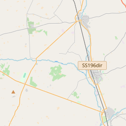
Serramanna on the map

Data Sources & Methodology

Our weather forecasts are powered by a professional weather data provider that aggregates data from national weather services, satellite observations, radar networks, and over 80,000 weather stations worldwide. Forecast data is updated multiple times daily. We convert raw data into clear summaries — wind speed in m/s, pressure in mmHg — so you can plan your day with confidence.