5-day weather forecast Serramanna Nov 16, 2026

21°15° · Patchy rain possible

Weather forecast Serramanna tomorrow Nov 16, 2026: patchy rain possible, temperature from 15 °C to 21 °C.

Precipitation probability 35%. Wind up to 4.5 m/s (gusts 8.03 m/s). Air humidity 60–91%, atmospheric pressure 764–765 mm Hg, UV index up to 2.2.

Sunrise 07:09
Sunset 17:08
First Quarter52% illuminated
Moonrise 12:59 · Moonset 23:33
Chart
Table

Forecast from 15 °C to 21 °C and precipitation

Temperature & Precipitation
Time00:0001:0002:0003:0004:0005:0006:0007:0008:0009:0010:0011:0012:0013:0014:0015:0016:0017:0018:0019:0020:0021:0022:0023:00
Temperature (°C)161616161616161516181920212121212019171616161515
Precipitation (mm/hr)000.010.050.030.040.010.010.010.010.020.030.030.030.020.0100000000

Cloud cover and precipitation probability

Cloud cover & Rain chance
Time00:0001:0002:0003:0004:0005:0006:0007:0008:0009:0010:0011:0012:0013:0014:0015:0016:0017:0018:0019:0020:0021:0022:0023:00
Cloud cover (%)9297989910089738980828279586078504663819391847360
Rain chance (%)2729303534322427242219161110128712192525242220

Wind speed and direction

Wind & Wind gust
Time00:0001:0002:0003:0004:0005:0006:0007:0008:0009:0010:0011:0012:0013:0014:0015:0016:0017:0018:0019:0020:0021:0022:0023:00
Wind (m/s)1.391.311.391.611.892.312.392.1922.613.113.313.894.54.394.113.612.691.891.51.692.112.312.61
Wind gust (m/s)2.972.253.034.55.395.925.815.365.396.146.316.757.368.037.867.256.535.254.173.283.333.834.285.08
Wind direction (°)WSW 248°SW 230°WSW 240°WSW 255°W 264°W 270°W 275°W 281°W 279°WNW 282°WNW 290°WNW 289°W 281°W 279°WNW 282°WNW 286°WNW 289°WNW 288°WNW 293°WNW 295°WNW 292°WNW 296°WNW 293°WNW 286°

Air humidity

Humidity
Time00:0001:0002:0003:0004:0005:0006:0007:0008:0009:0010:0011:0012:0013:0014:0015:0016:0017:0018:0019:0020:0021:0022:0023:00
Humidity (%)899090919190888987827669646060616471788486878888

Atmospheric pressure

Pressure
Time00:0001:0002:0003:0004:0005:0006:0007:0008:0009:0010:0011:0012:0013:0014:0015:0016:0017:0018:0019:0020:0021:0022:0023:00
Pressure (mm Hg)765765764764764764764764764764764764764764764764764764764764764764764764

Ultraviolet index

UV Index
Time00:0001:0002:0003:0004:0005:0006:0007:0008:0009:0010:0011:0012:0013:0014:0015:0016:0017:0018:0019:0020:0021:0022:0023:00
UV Index0000000000.51.11.82.22.11.60.90.40000000

Air quality & pollen

Air quality
Time00:0001:0002:0003:0004:0005:0006:0007:0008:0009:0010:0011:0012:0013:0014:0015:0016:0017:0018:0019:0020:0021:0022:0023:00
PM2.5 (µg/m³)8.58.56.76.25.45.14.85.15.853.84.63.43.23.33.33.94.45.865.85.55.15.3
PM10 (µg/m³)15.114.714.213.111.610.610.510.611.110.8109.47.76.56.87.19.211.813.815.716.315.213.811.8
Ozone (O₃) (µg/m³)484951535757565249566168727779787574716868686665.3
NO₂ (µg/m³)12.112.69.39.16.66.37.612.41612.16.52.92.121.71.92.53.24.25.35.354.33.8
SO₂ (µg/m³)1.81.81.61.51.41.41.41.62.11.91.510.80.60.60.50.50.50.60.60.60.60.70.8
CO (µg/m³)159154136132126124125129133127125123119117118118118120124129128128129136.5

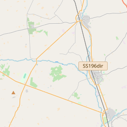
Serramanna on the map

Data Sources & Methodology

Our weather forecasts are powered by a professional weather data provider that aggregates data from national weather services, satellite observations, radar networks, and over 80,000 weather stations worldwide. Forecast data is updated multiple times daily. We convert raw data into clear summaries — wind speed in m/s, pressure in mmHg — so you can plan your day with confidence.