
5-day weather forecast Santarem Nov 19, 2026

17°12° · Patchy rain possible

Weather forecast Santarem Thursday Nov 19, 2026: patchy rain possible, temperature from 12 °C to 17 °C.

Precipitation probability 40%. Wind up to 5.5 m/s (gusts 10.44 m/s). Air humidity 59–91%, atmospheric pressure 760–766 mm Hg, UV index up to 2.5.

Sunrise 07:22
Sunset 17:17
Waxing Gibbous81% illuminated
Moonrise 14:16 · Moonset 01:46
Chart
Table

Forecast from 12 °C to 17 °C and precipitation

Temperature & Precipitation
Time00:0001:0002:0003:0004:0005:0006:0007:0008:0009:0010:0011:0012:0013:0014:0015:0016:0017:0018:0019:0020:0021:0022:0023:00
Temperature (°C)161515141414141313141516171717171615141313121212
Precipitation (mm/hr)0.230.150.080.030.010.020000.010.030.030.040.040.080.140.070.01000000

Cloud cover and precipitation probability

Cloud cover & Rain chance
Time00:0001:0002:0003:0004:0005:0006:0007:0008:0009:0010:0011:0012:0013:0014:0015:0016:0017:0018:0019:0020:0021:0022:0023:00
Cloud cover (%)738482885277304929858851546361778083847733262219
Rain chance (%)404034291822131613222010101117201917202014141414

Wind speed and direction

Wind & Wind gust
Time00:0001:0002:0003:0004:0005:0006:0007:0008:0009:0010:0011:0012:0013:0014:0015:0016:0017:0018:0019:0020:0021:0022:0023:00
Wind (m/s)5.194.814.314.1143.612.812.312.312.53.54.615.315.55.55.314.1132.191.891.811.691.611.5
Wind gust (m/s)10.449.8998.257.727.085.725.424.898.448.6488.369.178.948.758.257.033.782.612.252.192.031.75
Wind direction (°)W 278°W 277°W 280°WNW 287°WNW 287°W 279°W 279°W 267°WSW 249°WSW 249°W 272°W 279°WNW 284°WNW 283°WNW 282°WNW 286°WNW 285°W 280°W 268°W 263°WSW 249°WSW 245°WSW 239°SW 235°

Air humidity

Humidity
Time00:0001:0002:0003:0004:0005:0006:0007:0008:0009:0010:0011:0012:0013:0014:0015:0016:0017:0018:0019:0020:0021:0022:0023:00
Humidity (%)909191898683838484827364595960626973798284868889

Atmospheric pressure

Pressure
Time00:0001:0002:0003:0004:0005:0006:0007:0008:0009:0010:0011:0012:0013:0014:0015:0016:0017:0018:0019:0020:0021:0022:0023:00
Pressure (mm Hg)760760760761761761761762763764764764764764764764764764764765765766766766

Ultraviolet index

UV Index
Time00:0001:0002:0003:0004:0005:0006:0007:0008:0009:0010:0011:0012:0013:0014:0015:0016:0017:0018:0019:0020:0021:0022:0023:00
UV Index0000000000.41.11.92.52.51.91.10.50000000

Air quality & pollen

Air quality is available for the first three days only.

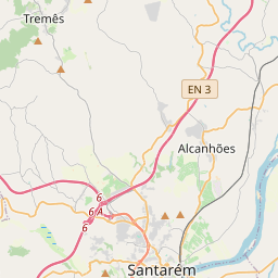
Santarem on the map
Data Sources & Methodology

Our weather forecasts are powered by a professional weather data provider that aggregates data from national weather services, satellite observations, radar networks, and over 80,000 weather stations worldwide. Forecast data is updated multiple times daily. We convert raw data into clear summaries — wind speed in m/s, pressure in mmHg — so you can plan your day with confidence.