5-day weather forecast Lynn Lake Nov 20, 2026

-2°-7° · Light snow

Weather forecast Lynn Lake Friday Nov 20, 2026: light snow, temperature from -7 °C to -2 °C.

Precipitation probability 59%. Wind up to 4.5 m/s (gusts 9 m/s). Air humidity 86–93%, atmospheric pressure 762–765 mm Hg, UV index up to 0.2.

Sunrise 09:35
Sunset 17:24
Waxing Gibbous89% illuminated
Moonrise 15:32 · Moonset 04:26
Chart
Table

Forecast from -7 °C to -2 °C and precipitation

Temperature & Precipitation
Time00:0001:0002:0003:0004:0005:0006:0007:0008:0009:0010:0011:0012:0013:0014:0015:0016:0017:0018:0019:0020:0021:0022:0023:00
Temperature (°C)-4-4-4-4-4-4-4-4-4-4-4-3-3-3-3-2-2-3-3-4-5-5-6-7
Precipitation (mm/hr)000000.010.010.020.050.060.080.140.230.340.230.160.080.070.060.030.030.050.030.03

Cloud cover and precipitation probability

Cloud cover & Rain chance
Time00:0001:0002:0003:0004:0005:0006:0007:0008:0009:0010:0011:0012:0013:0014:0015:0016:0017:0018:0019:0020:0021:0022:0023:00
Cloud cover (%)10010010010010010010099100100100100100100100100999810098100999999
Rain chance (%)303031313132333437394346505949443835363332353231

Wind speed and direction

Wind & Wind gust
Time00:0001:0002:0003:0004:0005:0006:0007:0008:0009:0010:0011:0012:0013:0014:0015:0016:0017:0018:0019:0020:0021:0022:0023:00
Wind (m/s)2.812.892.892.812.812.692.612.52.612.692.812.892.812.812.812.893.193.193.53.814.114.394.54.39
Wind gust (m/s)5.475.835.925.7565.565.425.365.365.365.475.395.335.425.425.55.756.146.6177.818.598.72
Wind direction (°)SE 128°SE 130°SE 135°SE 134°SE 139°SE 131°SE 126°SE 124°ESE 120°ESE 116°ESE 114°ESE 116°ESE 114°ESE 110°E 100°E 89°E 80°ENE 73°ENE 67°ENE 61°NE 56°NE 52°NE 48°NE 45°

Air humidity

Humidity
Time00:0001:0002:0003:0004:0005:0006:0007:0008:0009:0010:0011:0012:0013:0014:0015:0016:0017:0018:0019:0020:0021:0022:0023:00
Humidity (%)899090919292929293939391908988878688899089898887

Atmospheric pressure

Pressure
Time00:0001:0002:0003:0004:0005:0006:0007:0008:0009:0010:0011:0012:0013:0014:0015:0016:0017:0018:0019:0020:0021:0022:0023:00
Pressure (mm Hg)765765765764764764764764764763763763763763763762762763763763764764764765

Ultraviolet index

UV Index
Time00:0001:0002:0003:0004:0005:0006:0007:0008:0009:0010:0011:0012:0013:0014:0015:0016:0017:0018:0019:0020:0021:0022:0023:00
UV Index00000000000.10.20.20.20.20.100000000

Air quality & pollen

Air quality
Time00:0001:0002:0003:0004:0005:0006:0007:0008:0009:0010:0011:0012:0013:0014:0015:0016:0017:0018:0019:0020:0021:0022:0023:00
PM2.5 (µg/m³)0.10.10.10.10.10.10.10.10.10.10.10.10.1000000000.10.10.2
PM10 (µg/m³)0.10.10.10.10.10.10.10.10.10.10.10.10.10.10000000.10.10.20.4
Ozone (O₃) (µg/m³)696970707069686767666665656566666666666563626365
NO₂ (µg/m³)0.30.20.10.10.10.10.20.30.40.40.40.30.30.30.30.30.30.40.40.40.30.20.20.1
SO₂ (µg/m³)0.10.10.10.10.10.10.10.10.10.10.10.20.20.20.20.20.20.20.20.20.20.20.20.1
CO (µg/m³)103102103103104104105105105105105105105105105105105106106106106107108110

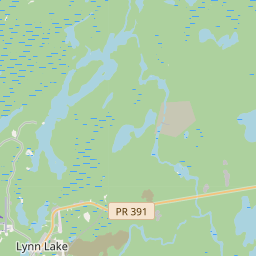
Lynn Lake on the map

Data Sources & Methodology

Our weather forecasts are powered by a professional weather data provider that aggregates data from national weather services, satellite observations, radar networks, and over 80,000 weather stations worldwide. Forecast data is updated multiple times daily. We convert raw data into clear summaries — wind speed in m/s, pressure in mmHg — so you can plan your day with confidence.