5-day weather forecast Leticia Nov 20, 2026

32°24° · Light rain shower

Weather forecast Leticia tomorrow Nov 20, 2026: light rain shower, temperature from 24 °C to 32 °C.

Precipitation probability 88%. Wind up to 1.61 m/s (gusts 5.67 m/s). Air humidity 61–99%, atmospheric pressure 754–758 mm Hg, UV index up to 13.2.

Sunrise 05:15
Sunset 17:34
Waxing Gibbous89% illuminated
Moonrise 14:12 · Moonset 01:47
Chart
Table

Forecast from 24 °C to 32 °C and precipitation

Temperature & Precipitation
Time00:0001:0002:0003:0004:0005:0006:0007:0008:0009:0010:0011:0012:0013:0014:0015:0016:0017:0018:0019:0020:0021:0022:0023:00
Temperature (°C)252525252525262729313232323232322826252424242424
Precipitation (mm/hr)0.21000000.0100.040.080.120.240.370.490.330.170.333.42.892.951.9310.080.05

Cloud cover and precipitation probability

Cloud cover & Rain chance
Time00:0001:0002:0003:0004:0005:0006:0007:0008:0009:0010:0011:0012:0013:0014:0015:0016:0017:0018:0019:0020:0021:0022:0023:00
Cloud cover (%)100100100100100587649715461698283569398989910010099100100
Rain chance (%)504239424228321819171723363736315287878883775148

Wind speed and direction

Wind & Wind gust
Time00:0001:0002:0003:0004:0005:0006:0007:0008:0009:0010:0011:0012:0013:0014:0015:0016:0017:0018:0019:0020:0021:0022:0023:00
Wind (m/s)0.50.610.890.890.89111.111.111.111.191.110.890.690.891.110.690.390.51.611.1910.810.81
Wind gust (m/s)1.51.561.671.941.892.252.893.173.5844.314.083.783.814.283.975.674.974.833.833.362.971.971.97
Wind direction (°)SE 128°E 88°E 91°E 96°E 97°E 88°E 89°E 88°ENE 74°ENE 60°NE 50°NE 49°NE 37°NNE 28°NE 43°NNW 344°NW 304°NNW 341°NNW 329°NW 318°NNW 329°NNE 14°ENE 58°NNE 24°

Air humidity

Humidity
Time00:0001:0002:0003:0004:0005:0006:0007:0008:0009:0010:0011:0012:0013:0014:0015:0016:0017:0018:0019:0020:0021:0022:0023:00
Humidity (%)969797979796948977686363626165678394989998989897

Atmospheric pressure

Pressure
Time00:0001:0002:0003:0004:0005:0006:0007:0008:0009:0010:0011:0012:0013:0014:0015:0016:0017:0018:0019:0020:0021:0022:0023:00
Pressure (mm Hg)757757756756756757758758758758758757756755754754754755756756757757758757

Ultraviolet index

UV Index
Time00:0001:0002:0003:0004:0005:0006:0007:0008:0009:0010:0011:0012:0013:0014:0015:0016:0017:0018:0019:0020:0021:0022:0023:00
UV Index0000000.11.13.158.111.213.28.72.51.61.20.4000000

Air quality & pollen

Air quality
Time00:0001:0002:0003:0004:0005:0006:0007:0008:0009:0010:0011:0012:0013:0014:0015:0016:0017:0018:0019:0020:0021:0022:0023:00
PM2.5 (µg/m³)5.65.65.65.45.254.94.84.74.955.15.25.35.85.34.74.23.93.63.93.83.63.5
PM10 (µg/m³)5.85.85.85.65.45.25.154.95.25.35.55.55.66.25.54.94.443.7443.83.6
Ozone (O₃) (µg/m³)131312111010111214171920212122222220171515151514
NO₂ (µg/m³)0.70.60.60.60.60.60.50.40.30.20.10.10.10.10.10.20.30.50.80.90.80.60.50.4
SO₂ (µg/m³)0.10.10.10.10.10.10.10.10.10.10.10.10.10.10.10.10.10.10.10.10.10.10.10.1
CO (µg/m³)127120116114113113114115115114114114114115118122124124123122120118116116

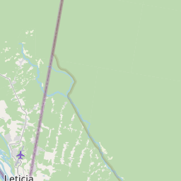
Leticia on the map

Data Sources & Methodology

Our weather forecasts are powered by a professional weather data provider that aggregates data from national weather services, satellite observations, radar networks, and over 80,000 weather stations worldwide. Forecast data is updated multiple times daily. We convert raw data into clear summaries — wind speed in m/s, pressure in mmHg — so you can plan your day with confidence.