5-day weather forecast Kitengela Nov 21, 2026

25°16° · Light rain shower

Weather forecast Kitengela Saturday Nov 21, 2026: light rain shower, temperature from 16 °C to 25 °C.

Precipitation probability 54%. Wind up to 4.89 m/s (gusts 8.19 m/s). Air humidity 56–97%, atmospheric pressure 760–764 mm Hg, UV index up to 12.1.

Sunrise 06:12
Sunset 18:23
Waxing Gibbous95% illuminated
Moonrise 15:34 · Moonset 03:09
Chart
Table

Forecast from 16 °C to 25 °C and precipitation

Temperature & Precipitation
Time00:0001:0002:0003:0004:0005:0006:0007:0008:0009:0010:0011:0012:0013:0014:0015:0016:0017:0018:0019:0020:0021:0022:0023:00
Temperature (°C)171717171716161719202223242424252322211919181818
Precipitation (mm/hr)0.040.070.120.160.110.060.010.120.230.340.250.180.220.450.440.390.40.310.750.560.470.240.150.12

Cloud cover and precipitation probability

Cloud cover & Rain chance
Time00:0001:0002:0003:0004:0005:0006:0007:0008:0009:0010:0011:0012:0013:0014:0015:0016:0017:0018:0019:0020:0021:0022:0023:00
Cloud cover (%)636363636469787285726276948357505871837583896060
Rain chance (%)273640394037353441382722263636363636545254463539

Wind speed and direction

Wind & Wind gust
Time00:0001:0002:0003:0004:0005:0006:0007:0008:0009:0010:0011:0012:0013:0014:0015:0016:0017:0018:0019:0020:0021:0022:0023:00
Wind (m/s)2.392.312.192.1121.891.8122.392.893.393.814.194.694.614.694.894.894.694.113.613.313.112.89
Wind gust (m/s)4.0343.9743.673.473.114.064.755.536.036.476.897.447.587.787.867.978.197.817.366.756.535.67
Wind direction (°)NE 44°NE 41°NE 38°NE 37°NNE 33°NNE 32°NNE 25°NE 34°NE 41°NE 47°NE 49°NE 51°NE 56°ENE 66°ENE 66°ENE 66°ENE 68°ENE 70°ENE 73°ENE 71°ENE 67°ENE 60°NE 53°NE 46°

Air humidity

Humidity
Time00:0001:0002:0003:0004:0005:0006:0007:0008:0009:0010:0011:0012:0013:0014:0015:0016:0017:0018:0019:0020:0021:0022:0023:00
Humidity (%)949495959696979184767064605958566269778488929495

Atmospheric pressure

Pressure
Time00:0001:0002:0003:0004:0005:0006:0007:0008:0009:0010:0011:0012:0013:0014:0015:0016:0017:0018:0019:0020:0021:0022:0023:00
Pressure (mm Hg)764764763763763763764764764764764763762761761760760760761761762763763763

Ultraviolet index

UV Index
Time00:0001:0002:0003:0004:0005:0006:0007:0008:0009:0010:0011:0012:0013:0014:0015:0016:0017:0018:0019:0020:0021:0022:0023:00
UV Index00000000.21.23.77.210.112.110.59.473.91.10.200000

Air quality & pollen

Air quality
Time00:0001:0002:0003:0004:0005:0006:0007:0008:0009:0010:0011:0012:0013:0014:0015:0016:0017:0018:0019:0020:0021:0022:0023:00
PM2.5 (µg/m³)5.74.84.13.73.63.64.86.45.76.15.65.14.543.73.84.14.14.55.46.676.66.2
PM10 (µg/m³)5.954.23.83.83.856.766.565.54.84.44.14.24.54.54.95.87.17.57.16.8
Ozone (O₃) (µg/m³)333334343128294056697578797876726659534742393839
NO₂ (µg/m³)8.57.46.35.76.16.97.164.22.71.91.51.21.11.11.52.43.64.85.977.57.26.3
SO₂ (µg/m³)4.44.243.944.14.34.655.14.74.13.63.332.92.92.933.23.43.53.43.2
CO (µg/m³)240222194176174182190200211216211201191182174170174182191201211216212203

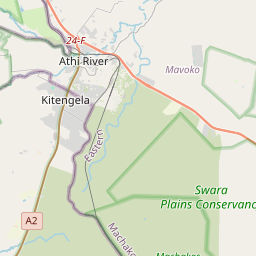
Kitengela on the map

Data Sources & Methodology

Our weather forecasts are powered by a professional weather data provider that aggregates data from national weather services, satellite observations, radar networks, and over 80,000 weather stations worldwide. Forecast data is updated multiple times daily. We convert raw data into clear summaries — wind speed in m/s, pressure in mmHg — so you can plan your day with confidence.