5-day weather forecast Auerbach 23-08-2026

Weather forecast Auerbach Sunday, August 23 23.08.2026: sunny, temperature from 7 °C to 15 °C.

Precipitation probability 29%. Wind up to 4.31 m/s (gusts 7.19 m/s). Air humidity 41–94%, atmospheric pressure 767–768 mm Hg, UV index up to 4.8.

Weather Alerts

Hide alerts
SevereAug 20, 06:10 PMAug 22, 01:59 AMTranslate with Google
Major Thunderstorm Impact
Risk of very severe thunderstorms with torrential rain (around 40 mm in a short time), in combination with rain around 70 mm, wind gusts 20 to 25 m/s (70 to 90 km/h) and hail around 2 cm. Local property damage and complications, especially in the energy industry, transport, and agriculture. Potential for dangerous flooding, flash floods. Increased runoff from slopes, rapid flooding of low-lying areas, dry gullies, small streams, undercutting of roads. Significant wind damage to trees, parks, buildings, property, energy infrastructure etc. Power outages. Travel delays and disruptions. Driving conditions difficult due to wind gusts, reduced visibility, fallen trees/branches, high risk of hydroplaning. Extensive damage to vegetation, buildings, and property from hail. Risk of fire caused by lightning strike. Risk of serious injury from flying or falling objects and lightning strikes.
Beware of lightning strikes, hail, and falling or windblown objects. Seek shelter in a building with lightning protection. Outdoors, take cover in dense forest or low vegetation; avoid water, hilltops, metal structures, isolated trees, and rock overhangs. Avoid stream courses in the mountains, as water and debris flows may occur there suddenly. Secure windows, doors, greenhouses, and loose objects. Be prepared for possible power outages. When driving, reduce speed, do not enter or drive into flowing water or flooded areas. Stay informed of the driving conditions. Observe weather warnings, weather radar (www.chmi.cz or mobile apps) and flash flood risk https://produkty.chmi.cz/ffi.
ModerateAug 20, 06:10 PMAug 22, 01:59 AMTranslate with Google
Moderate Thunderstorm Impact
Risk of severe thunderstorms with torrential rain (around 40 mm in a short time), wind gusts up to 20 m/s (70 km/h) and hail up to 2 cm. Possible local property damage and complications, especially in the energy industry and transport. Potential for local flooding, especially of low-lying areas. Local wind damage to roofs, fences, soft shelters and trees. Local power outages. Some travel delays. Driving conditions difficult. Possible crop damage from small hail. Risk of fire caused by lightning strike. Risk of injury from flying or falling objects, and lightning strikes.
Beware of lightning strikes and flying or falling objects (especially branches). Seek shelter in a building equipped with lightning protection. Outdoors, take cover in dense forest or low vegetation; avoid water bodies, hilltops, metal structures, isolated trees, and rock overhangs. When driving reduce speed. Observe weather warnings, weather radar (www.chmi.cz or mobile apps) and local flood risk https://produkty.chmi.cz/ffi.
SevereAug 20, 06:10 PMAug 22, 01:59 AMTranslate with Google
Major Thunderstorm Impact
Risk of very severe thunderstorms with torrential rain (around 40 mm in a short time), in combination with rain around 70 mm, wind gusts 20 to 25 m/s (70 to 90 km/h) and hail around 2 cm. Local property damage and complications, especially in the energy industry, transport, and agriculture. Potential for dangerous flooding, flash floods. Increased runoff from slopes, rapid flooding of low-lying areas, dry gullies, small streams, undercutting of roads. Significant wind damage to trees, parks, buildings, property, energy infrastructure etc. Power outages. Travel delays and disruptions. Driving conditions difficult due to wind gusts, reduced visibility, fallen trees/branches, high risk of hydroplaning. Extensive damage to vegetation, buildings, and property from hail. Risk of fire caused by lightning strike. Risk of serious injury from flying or falling objects and lightning strikes.
Beware of lightning strikes, hail, and falling or windblown objects. Seek shelter in a building with lightning protection. Outdoors, take cover in dense forest or low vegetation; avoid water, hilltops, metal structures, isolated trees, and rock overhangs. Avoid stream courses in the mountains, as water and debris flows may occur there suddenly. Secure windows, doors, greenhouses, and loose objects. Be prepared for possible power outages. When driving, reduce speed, do not enter or drive into flowing water or flooded areas. Stay informed of the driving conditions. Observe weather warnings, weather radar (www.chmi.cz or mobile apps) and flash flood risk https://produkty.chmi.cz/ffi.
ModerateAug 20, 06:10 PMAug 22, 01:59 AMTranslate with Google
Moderate Thunderstorm Impact
Risk of severe thunderstorms with torrential rain (around 40 mm in a short time), wind gusts up to 20 m/s (70 km/h) and hail up to 2 cm. Possible local property damage and complications, especially in the energy industry and transport. Potential for local flooding, especially of low-lying areas. Local wind damage to roofs, fences, soft shelters and trees. Local power outages. Some travel delays. Driving conditions difficult. Possible crop damage from small hail. Risk of fire caused by lightning strike. Risk of injury from flying or falling objects, and lightning strikes.
Beware of lightning strikes and flying or falling objects (especially branches). Seek shelter in a building equipped with lightning protection. Outdoors, take cover in dense forest or low vegetation; avoid water bodies, hilltops, metal structures, isolated trees, and rock overhangs. When driving reduce speed. Observe weather warnings, weather radar (www.chmi.cz or mobile apps) and local flood risk https://produkty.chmi.cz/ffi.
SevereAug 20, 06:10 PMAug 22, 01:59 AMTranslate with Google
Major Thunderstorm Impact
Risk of very severe thunderstorms with torrential rain (around 40 mm in a short time), in combination with rain around 70 mm, wind gusts 20 to 25 m/s (70 to 90 km/h) and hail around 2 cm. Local property damage and complications, especially in the energy industry, transport, and agriculture. Potential for dangerous flooding, flash floods. Increased runoff from slopes, rapid flooding of low-lying areas, dry gullies, small streams, undercutting of roads. Significant wind damage to trees, parks, buildings, property, energy infrastructure etc. Power outages. Travel delays and disruptions. Driving conditions difficult due to wind gusts, reduced visibility, fallen trees/branches, high risk of hydroplaning. Extensive damage to vegetation, buildings, and property from hail. Risk of fire caused by lightning strike. Risk of serious injury from flying or falling objects and lightning strikes.
Beware of lightning strikes, hail, and falling or windblown objects. Seek shelter in a building with lightning protection. Outdoors, take cover in dense forest or low vegetation; avoid water, hilltops, metal structures, isolated trees, and rock overhangs. Avoid stream courses in the mountains, as water and debris flows may occur there suddenly. Secure windows, doors, greenhouses, and loose objects. Be prepared for possible power outages. When driving, reduce speed, do not enter or drive into flowing water or flooded areas. Stay informed of the driving conditions. Observe weather warnings, weather radar (www.chmi.cz or mobile apps) and flash flood risk https://produkty.chmi.cz/ffi.
Sunrise 06:11
Sunset 20:14
Waxing Gibbous86% illuminated
Moonrise 18:34 · Moonset 00:49
Chart
Table

Forecast from 7 °C to 15 °C and precipitation

Temperature & Precipitation
Time00:0001:0002:0003:0004:0005:0006:0007:0008:0009:0010:0011:0012:0013:0014:0015:0016:0017:0018:0019:0020:0021:0022:0023:00
Temperature (°C)1312121111101011791012131414151515141415131212
Precipitation (mm/hr)0.0200.01000000000.01000000000000

Cloud cover and precipitation probability

Cloud cover & Rain chance
Time00:0001:0002:0003:0004:0005:0006:0007:0008:0009:0010:0011:0012:0013:0014:0015:0016:0017:0018:0019:0020:0021:0022:0023:00
Cloud cover (%)825783514245492528674905511182484105
Rain chance (%)2915271515161515182212139101112225778

Wind speed and direction

Wind & Wind gust
Time00:0001:0002:0003:0004:0005:0006:0007:0008:0009:0010:0011:0012:0013:0014:0015:0016:0017:0018:0019:0020:0021:0022:0023:00
Wind (m/s)1.8121.811.811.611.51.51.391.311.892.893.393.89444.314.314.11432.50.690.691.11
Wind gust (m/s)22.424.812.111.691.531.535.392.924.394.925.335.425.645.816.116.396.56.536.897.1910.891.22
Wind direction (°)SSW 212°SSW 206°SW 226°SW 225°SW 228°SW 225°SSW 213°SSW 203°WSW 239°W 275°WNW 289°WNW 291°WNW 294°WNW 295°WNW 298°NW 306°NW 308°NW 314°NW 319°NW 315°NNW 342°NNW 327°SW 217°SW 217°

Air humidity

Humidity
Time00:0001:0002:0003:0004:0005:0006:0007:0008:0009:0010:0011:0012:0013:0014:0015:0016:0017:0018:0019:0020:0021:0022:0023:00
Humidity (%)929392939394949387807360524743424141455167757575

Atmospheric pressure

Pressure
Time00:0001:0002:0003:0004:0005:0006:0007:0008:0009:0010:0011:0012:0013:0014:0015:0016:0017:0018:0019:0020:0021:0022:0023:00
Pressure (mm Hg)767767767767767767767768768767767767767767767767767767767767767768768768

Ultraviolet index

UV Index
Time00:0001:0002:0003:0004:0005:0006:0007:0008:0009:0010:0011:0012:0013:0014:0015:0016:0017:0018:0019:0020:0021:0022:0023:00
UV Index00000000.10.51.42.644.74.84.64.231.70.80.20000

Air quality & pollen

Air quality
Time00:0001:0002:0003:0004:0005:0006:0007:0008:0009:0010:0011:0012:0013:0014:0015:0016:0017:0018:0019:0020:0021:0022:0023:00
PM2.5 (µg/m³)4.655.25.65.96.86.76.15.75.254.74.343.83.74.34.23.83.94.24.655.1
PM10 (µg/m³)6.97.177.78.29.39.18.27.87.66.86.96.96.46.265.86.16.66.77.28.28.48.6
Ozone (O₃) (µg/m³)605856535150495254606364707172757777777674716461
NO₂ (µg/m³)3.13.43.43.63.53.43.73.52.61.81.30.90.80.70.60.60.50.60.81.11.722.53
SO₂ (µg/m³)0.20.30.30.30.30.30.30.30.30.40.30.30.20.10.10.10.10.10.20.20.30.30.30.4
CO (µg/m³)146147149151150150149147147149152151151150149148150151152153154160159165

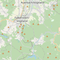
Auerbach on the map

Data Sources & Methodology

Our weather forecasts are powered by a professional weather data provider that aggregates data from national weather services, satellite observations, radar networks, and over 80,000 weather stations worldwide. Forecast data is updated multiple times daily. We convert raw data into clear summaries — wind speed in m/s, pressure in mmHg — so you can plan your day with confidence.