Prognoza pogody na 5 dni Surry Hills 11 lis 2026

22°17° · Słonecznie

Prognoza pogody — Surry Hills, środa, 11 lis 2026: słonecznie, temperatura od 17 °C do 22 °C.

Prawdopodobieństwo opadów 40%. Wiatr do 9.81 m/s (porywy 12.72 m/s). Wilgotność powietrza 63–87%, ciśnienie atmosferyczne 756–763 mm Hg, indeks UV do 8.6.

Ostrzeżenia pogodowe

Moderate9 lis, 00:00 — 10 lis, 00:00Przetłumacz przez Google
Hazardous Surf Warning for Byron Coast: Point Danger to Wooli, Coffs Coast: Wooli to Smoky Cape, Macquarie Coast: Smoky Cape to Seal Rocks, Hunter Coast: Seal Rocks to Broken Bay, Sydney Coast: Broken Bay to Port Hacking, Illawarra Coast: Port Hacking to Ulladulla, Batemans Coast: Ulladulla to Montague Island and Eden Coast: Montague Island to Gabo Island for 09 November

Large Coastal Surf

NSW Police Force, Marine Area Command advise that: People should consider staying out of the water and avoid walking near surf-exposed areas. Rock fishers should avoid coastal rock platforms exposed to the ocean and seek a safe location that is sheltered from the surf. Boaters planning to cross shallow water and ocean bars should consider changing or delaying their voyage. Boaters already on the water should carry the appropriate safety equipment and wear a lifejacket. Boaters should remember to log on with their local Marine Rescue radio base, via VHF Radio or the Marine Rescue APP, and consider their safety management plan.
Moderate9 lis, 00:00 — 10 lis, 00:00Przetłumacz przez Google
Hazardous Surf Warning for Byron Coast: Point Danger to Wooli, Coffs Coast: Wooli to Smoky Cape, Macquarie Coast: Smoky Cape to Seal Rocks, Hunter Coast: Seal Rocks to Broken Bay, Sydney Coast: Broken Bay to Port Hacking, Illawarra Coast: Port Hacking to Ulladulla, Batemans Coast: Ulladulla to Montague Island and Eden Coast: Montague Island to Gabo Island for 09 November

Large Coastal Surf

NSW Police Force, Marine Area Command advise that: People should consider staying out of the water and avoid walking near surf-exposed areas. Rock fishers should avoid coastal rock platforms exposed to the ocean and seek a safe location that is sheltered from the surf. Boaters planning to cross shallow water and ocean bars should consider changing or delaying their voyage. Boaters already on the water should carry the appropriate safety equipment and wear a lifejacket. Boaters should remember to log on with their local Marine Rescue radio base, via VHF Radio or the Marine Rescue APP, and consider their safety management plan.
Moderate9 lis, 00:00 — 10 lis, 00:00Przetłumacz przez Google
Hazardous Surf Warning for Byron Coast: Point Danger to Wooli, Coffs Coast: Wooli to Smoky Cape, Macquarie Coast: Smoky Cape to Seal Rocks, Hunter Coast: Seal Rocks to Broken Bay, Sydney Coast: Broken Bay to Port Hacking, Illawarra Coast: Port Hacking to Ulladulla, Batemans Coast: Ulladulla to Montague Island and Eden Coast: Montague Island to Gabo Island for 09 November

Large Coastal Surf

NSW Police Force, Marine Area Command advise that: People should consider staying out of the water and avoid walking near surf-exposed areas. Rock fishers should avoid coastal rock platforms exposed to the ocean and seek a safe location that is sheltered from the surf. Boaters planning to cross shallow water and ocean bars should consider changing or delaying their voyage. Boaters already on the water should carry the appropriate safety equipment and wear a lifejacket. Boaters should remember to log on with their local Marine Rescue radio base, via VHF Radio or the Marine Rescue APP, and consider their safety management plan.
Moderate9 lis, 00:00 — 10 lis, 00:00Przetłumacz przez Google
Strong Wind Warning for coastal waters between Point Danger and Montague Island and for Sydney Enclosed Waters for 09 November

Wind

Moderate9 lis, 00:00 — 10 lis, 00:00Przetłumacz przez Google
Strong Wind Warning for coastal waters between Point Danger and Montague Island and for Sydney Enclosed Waters for 09 November

Wind

Wschód słońca 05:45
Zachód słońca 19:32
Przybywający sierp7% oświetlenia
Wschód księżyca 06:39 · Zachód księżyca 21:52
Wykres
Tabela

Prognoza od 17 °C do 22 °C i opady

Temperatura & Opady
Czas00:0001:0002:0003:0004:0005:0006:0007:0008:0009:0010:0011:0012:0013:0014:0015:0016:0017:0018:0019:0020:0021:0022:0023:00
Temperatura (°C)191918191917171718181921212021202022212120202020
Opady (mm/godz.)00000000.020.120.240.390.170.030.440.04000.01000000

Zachmurzenie i prawdopodobieństwo opadów

Zachmurzenie & Szansa na deszcz
Czas00:0001:0002:0003:0004:0005:0006:0007:0008:0009:0010:0011:0012:0013:0014:0015:0016:0017:0018:0019:0020:0021:0022:0023:00
Zachmurzenie (%)88391915407010098100100767677720180571453756
Szansa na deszcz (%)7814101116212832364021133816671791716131012

Prędkość i kierunek wiatru

Wiatr & Porywy wiatru
Czas00:0001:0002:0003:0004:0005:0006:0007:0008:0009:0010:0011:0012:0013:0014:0015:0016:0017:0018:0019:0020:0021:0022:0023:00
Wiatr (m/s)42.610.813.611.891.53.313.8933.51.890.312.815.194.317.119.814.57.397.612.392.313.55.39
Porywy wiatru (m/s)5.814.222.586.113.722.928.313.894.363.692.313.4439.197.14812.728.539.510.725.862.813.727.22
Kierunek wiatru (°)NE 38°NNE 15°N 354°NNE 22°N 359°WNW 290°WNW 290°WNW 284°W 281°WNW 285°W 278°S 181°NE 51°ENE 67°E 89°ESE 116°ENE 62°E 97°ENE 64°NE 39°SE 135°ESE 106°SSE 154°SSE 168°

Wilgotność powietrza

Wilgotność
Czas00:0001:0002:0003:0004:0005:0006:0007:0008:0009:0010:0011:0012:0013:0014:0015:0016:0017:0018:0019:0020:0021:0022:0023:00
Wilgotność (%)747583808287868478746863647070737573797985818287

Ciśnienie atmosferyczne

Ciśnienie
Czas00:0001:0002:0003:0004:0005:0006:0007:0008:0009:0010:0011:0012:0013:0014:0015:0016:0017:0018:0019:0020:0021:0022:0023:00
Ciśnienie (mm Hg)762761761760760761760761761761761761759759759757756759758758761761761763

Indeks ultrafioletowy

Indeks UV
Czas00:0001:0002:0003:0004:0005:0006:0007:0008:0009:0010:0011:0012:0013:0014:0015:0016:0017:0018:0019:0020:0021:0022:0023:00
Indeks UV00000000.312.5577.98.6763.91.90.70.20000

Jakość powietrza i pyłki

Jakość powietrza
Czas00:0001:0002:0003:0004:0005:0006:0007:0008:0009:0010:0011:0012:0013:0014:0015:0016:0017:0018:0019:0020:0021:0022:0023:00
PM2.5 (µg/m³)13.712.411.511.913.214.817.220.316.315.616.817.617.41616.215.113.912.510.59.210.21212.412.4
PM10 (µg/m³)17.115.113.914.315.817.319.822.718.918.920.822.622.821.422.221.219.617.915.514.114.916.216.917.6
Ozon (O₃) (µg/m³)433732272219192127385266829810810910497877567666872
NO₂ (µg/m³)20.921.12224.527.729.930.429.928.827.224.921.917.612.797.477.71013.315.917.117.617.2
SO₂ (µg/m³)666.36.77.38.410.312.714.515.415.815.614.61311.39.78.16.75.64.74.144.14.3
CO (µg/m³)1191511741811791761771771731591411291311401451391291221221241211088975

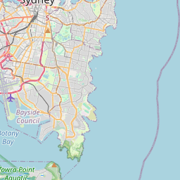
Surry Hills na mapie

Źródła danych i metodologia

Nasze prognozy pogody są zasilane przez profesjonalnego dostawcę danych pogodowych, który agreguje dane z krajowych służb meteorologicznych, obserwacji satelitarnych, sieci radarowych i ponad 80 000 stacji meteorologicznych na całym świecie. Dane prognostyczne są aktualizowane wielokrotnie w ciągu dnia. Przetwarzamy surowe dane na czytelne podsumowania — prędkość wiatru w m/s, ciśnienie w mm Hg — abyście Państwo mogli planować dzień z pewnością.