Prognoza pogody na 5 dni Surry Hills 10 lis 2026

20°13° · Słonecznie

Prognoza pogody — Surry Hills, jutro, 10 lis 2026: słonecznie, temperatura od 13 °C do 20 °C.

Prawdopodobieństwo opadów 21%. Wiatr do 8.69 m/s (porywy 12.69 m/s). Wilgotność powietrza 54–80%, ciśnienie atmosferyczne 760–764 mm Hg, indeks UV do 10.1.

Ostrzeżenia pogodowe

Moderate9 lis, 00:00 — 10 lis, 00:00Przetłumacz przez Google
Hazardous Surf Warning for Byron Coast: Point Danger to Wooli, Coffs Coast: Wooli to Smoky Cape, Macquarie Coast: Smoky Cape to Seal Rocks, Hunter Coast: Seal Rocks to Broken Bay, Sydney Coast: Broken Bay to Port Hacking, Illawarra Coast: Port Hacking to Ulladulla, Batemans Coast: Ulladulla to Montague Island and Eden Coast: Montague Island to Gabo Island for 09 November

Large Coastal Surf

NSW Police Force, Marine Area Command advise that: People should consider staying out of the water and avoid walking near surf-exposed areas. Rock fishers should avoid coastal rock platforms exposed to the ocean and seek a safe location that is sheltered from the surf. Boaters planning to cross shallow water and ocean bars should consider changing or delaying their voyage. Boaters already on the water should carry the appropriate safety equipment and wear a lifejacket. Boaters should remember to log on with their local Marine Rescue radio base, via VHF Radio or the Marine Rescue APP, and consider their safety management plan.
Moderate9 lis, 00:00 — 10 lis, 00:00Przetłumacz przez Google
Hazardous Surf Warning for Byron Coast: Point Danger to Wooli, Coffs Coast: Wooli to Smoky Cape, Macquarie Coast: Smoky Cape to Seal Rocks, Hunter Coast: Seal Rocks to Broken Bay, Sydney Coast: Broken Bay to Port Hacking, Illawarra Coast: Port Hacking to Ulladulla, Batemans Coast: Ulladulla to Montague Island and Eden Coast: Montague Island to Gabo Island for 09 November

Large Coastal Surf

NSW Police Force, Marine Area Command advise that: People should consider staying out of the water and avoid walking near surf-exposed areas. Rock fishers should avoid coastal rock platforms exposed to the ocean and seek a safe location that is sheltered from the surf. Boaters planning to cross shallow water and ocean bars should consider changing or delaying their voyage. Boaters already on the water should carry the appropriate safety equipment and wear a lifejacket. Boaters should remember to log on with their local Marine Rescue radio base, via VHF Radio or the Marine Rescue APP, and consider their safety management plan.
Moderate9 lis, 00:00 — 10 lis, 00:00Przetłumacz przez Google
Hazardous Surf Warning for Byron Coast: Point Danger to Wooli, Coffs Coast: Wooli to Smoky Cape, Macquarie Coast: Smoky Cape to Seal Rocks, Hunter Coast: Seal Rocks to Broken Bay, Sydney Coast: Broken Bay to Port Hacking, Illawarra Coast: Port Hacking to Ulladulla, Batemans Coast: Ulladulla to Montague Island and Eden Coast: Montague Island to Gabo Island for 09 November

Large Coastal Surf

NSW Police Force, Marine Area Command advise that: People should consider staying out of the water and avoid walking near surf-exposed areas. Rock fishers should avoid coastal rock platforms exposed to the ocean and seek a safe location that is sheltered from the surf. Boaters planning to cross shallow water and ocean bars should consider changing or delaying their voyage. Boaters already on the water should carry the appropriate safety equipment and wear a lifejacket. Boaters should remember to log on with their local Marine Rescue radio base, via VHF Radio or the Marine Rescue APP, and consider their safety management plan.
Moderate9 lis, 00:00 — 10 lis, 00:00Przetłumacz przez Google
Strong Wind Warning for coastal waters between Point Danger and Montague Island and for Sydney Enclosed Waters for 09 November

Wind

Moderate9 lis, 00:00 — 10 lis, 00:00Przetłumacz przez Google
Strong Wind Warning for coastal waters between Point Danger and Montague Island and for Sydney Enclosed Waters for 09 November

Wind

Wschód słońca 05:46
Zachód słońca 19:31
Nów3% oświetlenia
Wschód księżyca 05:54 · Zachód księżyca 20:50
Wykres
Tabela

Prognoza od 13 °C do 20 °C i opady

Temperatura & Opady
Czas00:0001:0002:0003:0004:0005:0006:0007:0008:0009:0010:0011:0012:0013:0014:0015:0016:0017:0018:0019:0020:0021:0022:0023:00
Temperatura (°C)171614151413131315151719181719191920191919191919
Opady (mm/godz.)000000000000000000000000

Zachmurzenie i prawdopodobieństwo opadów

Zachmurzenie & Szansa na deszcz
Czas00:0001:0002:0003:0004:0005:0006:0007:0008:0009:0010:0011:0012:0013:0014:0015:0016:0017:0018:0019:0020:0021:0022:0023:00
Zachmurzenie (%)1007438951000562520035054100100429210049
Szansa na deszcz (%)1511111769666933354559181811182114

Prędkość i kierunek wiatru

Wiatr & Porywy wiatru
Czas00:0001:0002:0003:0004:0005:0006:0007:0008:0009:0010:0011:0012:0013:0014:0015:0016:0017:0018:0019:0020:0021:0022:0023:00
Wiatr (m/s)4.113.693.53.613.3933.113.893.112.892.392.395.117.617.198.698.196.698.196.694.695.694.693.31
Porywy wiatru (m/s)4.423.924.836.618.394.286.117.894.613.533.614.258.1110.619.3912.698.339.949.197.817.067.116.725.97
Kierunek wiatru (°)SSW 205°SW 229°WSW 250°WSW 249°WSW 254°W 268°WNW 284°WNW 294°WNW 290°NW 311°N 352°NE 45°ENE 69°ENE 62°NE 56°NE 56°ENE 61°ENE 57°NE 53°NE 55°NE 50°NNE 32°NNE 24°NNE 18°

Wilgotność powietrza

Wilgotność
Czas00:0001:0002:0003:0004:0005:0006:0007:0008:0009:0010:0011:0012:0013:0014:0015:0016:0017:0018:0019:0020:0021:0022:0023:00
Wilgotność (%)616475687080727270625654606762676766697074737580

Ciśnienie atmosferyczne

Ciśnienie
Czas00:0001:0002:0003:0004:0005:0006:0007:0008:0009:0010:0011:0012:0013:0014:0015:0016:0017:0018:0019:0020:0021:0022:0023:00
Ciśnienie (mm Hg)764764764763763764764764764764764763762761761760760761760761762762762763

Indeks ultrafioletowy

Indeks UV
Czas00:0001:0002:0003:0004:0005:0006:0007:0008:0009:0010:0011:0012:0013:0014:0015:0016:0017:0018:0019:0020:0021:0022:0023:00
Indeks UV00000000.31.22.95.37.89.510.19.37.44.92.60.90.20000

Jakość powietrza i pyłki

Jakość powietrza
Czas00:0001:0002:0003:0004:0005:0006:0007:0008:0009:0010:0011:0012:0013:0014:0015:0016:0017:0018:0019:0020:0021:0022:0023:00
PM2.5 (µg/m³)12.712.612.512.211.811.712.413.813.39.71011.112.313.214.31617.317.617.417.51818.418.316.2
PM10 (µg/m³)15.71514.413.713.212.913.715.215.913.213.414.916.517.919.622.224.124.624.324.224.62524.821
Ozon (O₃) (µg/m³)1916141199121826374961728187868277747066605246
NO₂ (µg/m³)21.923.72526.327.326.723.819.415.311.98.86.55.45.15.56.78.710.813.115.517.719.721.522.7
SO₂ (µg/m³)4.355.76.26.67.28.39.610.19.27.66.46.16.279.21213.713.211.59.88.46.95.9
CO (µg/m³)878693114143168189206208184144111938174727578818588888795

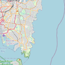
Surry Hills na mapie

Źródła danych i metodologia

Nasze prognozy pogody są zasilane przez profesjonalnego dostawcę danych pogodowych, który agreguje dane z krajowych służb meteorologicznych, obserwacji satelitarnych, sieci radarowych i ponad 80 000 stacji meteorologicznych na całym świecie. Dane prognostyczne są aktualizowane wielokrotnie w ciągu dnia. Przetwarzamy surowe dane na czytelne podsumowania — prędkość wiatru w m/s, ciśnienie w mm Hg — abyście Państwo mogli planować dzień z pewnością.