5-day weather forecast Watertown Nov 20, 2026

13°5° · Patchy rain possible

Weather forecast Watertown Friday Nov 20, 2026: patchy rain possible, temperature from 5 °C to 13 °C.

Precipitation probability 40%. Wind up to 8 m/s (gusts 14.11 m/s). Air humidity 65–97%, atmospheric pressure 752–764 mm Hg, UV index up to 0.4.

5 days at a glance — tap a day to open it
Sunrise 07:32
Sunset 16:55
Waxing Gibbous89% illuminated
Moonrise 14:32 · Moonset 02:59
Chart
Table

Forecast from 5 °C to 13 °C and precipitation

Temperature & Precipitation
Time00:0001:0002:0003:0004:0005:0006:0007:0008:0009:0010:0011:0012:0013:0014:0015:0016:0017:0018:0019:0020:0021:0022:0023:00
Temperature (°C)56677788910101111121213131313121211109
Precipitation (mm/hr)000000000.010.070.050.060.110.080.050.030.030.010.0100000

Cloud cover and precipitation probability

Cloud cover & Rain chance
Time00:0001:0002:0003:0004:0005:0006:0007:0008:0009:0010:0011:0012:0013:0014:0015:0016:0017:0018:0019:0020:0021:0022:0023:00
Cloud cover (%)999399991001001001001001001001001001001001009590846961506375
Rain chance (%)171823262932343434393636403531272523211815142025

Wind speed and direction

Wind & Wind gust
Time00:0001:0002:0003:0004:0005:0006:0007:0008:0009:0010:0011:0012:0013:0014:0015:0016:0017:0018:0019:0020:0021:0022:0023:00
Wind (m/s)4.54.614.895.195.55.816.116.316.696.817.117.397.697.697.6987.897.697.397.116.115.54.613.89
Wind gust (m/s)9.089.4210.1110.5811.0311.511.9712.0812.0812.4212.9413.4213.8913.7813.7213.8313.7813.9714.1113.4212.3111.2210.568.89
Wind direction (°)SE 124°SE 130°SE 137°SE 145°SSE 150°SSE 153°SSE 158°SSE 158°SSE 162°SSE 165°SSE 168°S 170°S 175°S 179°S 181°S 185°S 188°S 188°S 189°SSW 197°SSW 208°SSW 212°SW 226°WSW 239°

Air humidity

Humidity
Time00:0001:0002:0003:0004:0005:0006:0007:0008:0009:0010:0011:0012:0013:0014:0015:0016:0017:0018:0019:0020:0021:0022:0023:00
Humidity (%)657178848993979695939291898684818081818178798792

Atmospheric pressure

Pressure
Time00:0001:0002:0003:0004:0005:0006:0007:0008:0009:0010:0011:0012:0013:0014:0015:0016:0017:0018:0019:0020:0021:0022:0023:00
Pressure (mm Hg)764764763762761760759758758757756755755753752752752752752752752752753754

Ultraviolet index

UV Index
Time00:0001:0002:0003:0004:0005:0006:0007:0008:0009:0010:0011:0012:0013:0014:0015:0016:0017:0018:0019:0020:0021:0022:0023:00
UV Index00000000000.10.30.40.30.30.30.10000000

Air quality & pollen

Air quality
Time00:0001:0002:0003:0004:0005:0006:0007:0008:0009:0010:0011:0012:0013:0014:0015:0016:0017:0018:0019:0020:0021:0022:0023:00
PM2.5 (µg/m³)2.43.24.97.28.79.79.89.48.98.37.46.65.85.35.14.65.56.26.34.74.44.44.44.2
PM10 (µg/m³)2.83.75.27.38.89.89.99.69.18.57.66.865.55.34.85.76.46.64.94.64.54.54.2
Ozone (O₃) (µg/m³)394041434752565859606264666767676766656361564838
NO₂ (µg/m³)4.54.7554.53.73.12.92.82.72.52.42.32.32.42.42.32.122222.12.2
SO₂ (µg/m³)0.50.711.21.31.21.21.11.11111110.90.80.70.60.60.50.50.40.3
CO (µg/m³)127131138144148152154153150147146144144145146146144142140139138137137137

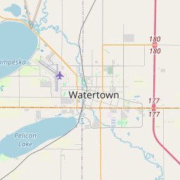
Watertown on the map

Data Sources & Methodology

Our weather forecasts are powered by a professional weather data provider that aggregates data from national weather services, satellite observations, radar networks, and over 80,000 weather stations worldwide. Forecast data is updated multiple times daily. We convert raw data into clear summaries — wind speed in m/s, pressure in mmHg — so you can plan your day with confidence.