5-day weather forecast Uztárroz – Uztarrotze 12-08-2026

Weather forecast Uztárroz – Uztarrotze today 12.08.2026: sunny, temperature from 16 °C to 27 °C.

Precipitation probability 9%. Wind up to 2.5 m/s (gusts 4.61 m/s). Air humidity 33–66%, atmospheric pressure 766–768 mm Hg, UV index up to 6.

Weather Alerts

Hide alerts
ModerateAug 11, 12:12 PMAug 12, 08:59 PMTranslate with Google
Moderate high-temperature warning. Pirineo oscense

Moderate high-temperature warning

Maximum temperature: 34 ºC. En umbral se alcanzará en valles orientados al sur.
Be aware, keep up to date with the latest weather forecast. Moderate damages to people and properties may occur, especially to those vulnerable or in exposed areas.
SevereAug 11, 11:30 AMAug 13, 08:59 PMTranslate with Google
Severe high-temperature warning. Pirineo navarro

Severe high-temperature warning

Maximum temperature: 37 ºC.
Be prepared. Take precautions and keep up to date with the latest weather forecast. Severe damages to people and properties may occur, especially to those vulnerable or in exposed areas.
ModerateAug 11, 11:30 AMAug 13, 08:59 PMTranslate with Google
Moderate high-temperature warning. Pirineo oscense

Moderate high-temperature warning

Maximum temperature: 36 ºC. En el sistema Ibérico de Teruel el umbral se alcanzará en zonas bajas y valles, y en la capital turolense.
Be aware, keep up to date with the latest weather forecast. Moderate damages to people and properties may occur, especially to those vulnerable or in exposed areas.
ModerateAug 11, 11:24 AMAug 12, 08:59 PMTranslate with Google
Moderate high-temperature warning. Pirineo navarro

Moderate high-temperature warning

Maximum temperature: 35 ºC.
Be aware, keep up to date with the latest weather forecast. Moderate damages to people and properties may occur, especially to those vulnerable or in exposed areas.
ModerateAug 11, 11:50 PMAug 14, 08:59 PMTranslate with Google
Moderate high-temperature warning. Pirineo oscense

Moderate high-temperature warning

Maximum temperature: 34 ºC.
Be aware, keep up to date with the latest weather forecast. Moderate damages to people and properties may occur, especially to those vulnerable or in exposed areas.
Sunrise 07:06
Sunset 21:10
New Moon0% illuminated
Moonrise 06:06 · Moonset 21:03
Chart
Table
Wed, Aug 12, 2026

Forecast from 16 °C to 27 °C and precipitation

Temperature & Precipitation
Time00:0001:0002:0003:0004:0005:0006:0007:0008:0009:0010:0011:0012:0013:0014:0015:0016:0017:0018:0019:0020:0021:0022:0023:00
Temperature (°C)181919171616161618212425262727252324242423212119
Precipitation (mm/hr)00000000000000000.010000000

Cloud cover and precipitation probability

Cloud cover & Rain chance
Time00:0001:0002:0003:0004:0005:0006:0007:0008:0009:0010:0011:0012:0013:0014:0015:0016:0017:0018:0019:0020:0021:0022:0023:00
Cloud cover (%)8151311118544331110111617751212121214129
Rain chance (%)444555544211111292223333

Wind speed and direction

Wind & Wind gust
Time00:0001:0002:0003:0004:0005:0006:0007:0008:0009:0010:0011:0012:0013:0014:0015:0016:0017:0018:0019:0020:0021:0022:0023:00
Wind (m/s)2.111.310.8111.191.391.51.51.390.810.111.191.892.521.692.392.391.691.391.392.1922.19
Wind gust (m/s)4.422.641.532.112.532.943.143.142.941.080.111.392.192.892.3123.473.082.171.862.444.424.194.61
Wind direction (°)NE 51°E 85°ESE 117°ESE 109°E 98°E 87°ENE 76°ENE 72°ENE 71°ENE 65°ENE 72°SW 216°SW 229°WSW 237°W 267°NNW 336°NNE 33°ENE 57°NE 37°NE 52°ENE 57°ENE 64°NE 55°ENE 57°

Air humidity

Humidity
Time00:0001:0002:0003:0004:0005:0006:0007:0008:0009:0010:0011:0012:0013:0014:0015:0016:0017:0018:0019:0020:0021:0022:0023:00
Humidity (%)626059656665656461504137343335425350474652555558

Atmospheric pressure

Pressure
Time00:0001:0002:0003:0004:0005:0006:0007:0008:0009:0010:0011:0012:0013:0014:0015:0016:0017:0018:0019:0020:0021:0022:0023:00
Pressure (mm Hg)766766766767767767767767767767766766766766766766767767767767767767767768

Ultraviolet index

UV Index
Time00:0001:0002:0003:0004:0005:0006:0007:0008:0009:0010:0011:0012:0013:0014:0015:0016:0017:0018:0019:0020:0021:0022:0023:00
UV Index000000000.20.71.83.44.35.562.20.70.30.40.30.1000

Air quality & pollen

Air quality
Time00:0001:0002:0003:0004:0005:0006:0007:0008:0009:0010:0011:0012:0013:0014:0015:0016:0017:0018:0019:0020:0021:0022:0023:00
PM2.5 (µg/m³)8.57.88.28.28.48.58.48.38.28.17.57.16.96.86.66.96.877.37.37.56.96.66.7
PM10 (µg/m³)17.614.314.214.214.214.215.21616.21615.815.315.314.914.414.314.41313.61415.214.713.213
Ozone (O₃) (µg/m³)697476777675737272748890939495959698989896827871
NO₂ (µg/m³)10.90.80.80.80.80.811.210.50.40.30.30.30.30.30.30.30.40.60.911
SO₂ (µg/m³)0.30.30.30.30.30.30.30.30.30.30.40.30.30.30.30.30.30.20.20.30.30.30.20.2
CO (µg/m³)111111111111111111111112112112112112112113115116117117118119121125125126
Wed, Aug 12, 2026

Frequently asked questions about the 5-day weather in Uztárroz – Uztarrotze

Over the next 5 days in Uztárroz – Uztarrotze the temperature is expected to range from about 12 to 29 °C. See the detailed hourly forecast for each of the 5 days in the charts above.

The chance of rain in Uztárroz – Uztarrotze over the next 5 days reaches 90%. Check the 5-day precipitation chart above to see exactly which days and hours bring rain.

A 5-day forecast is fairly reliable: the first 2–3 days are usually very accurate, while days 4–5 may be refined. The data is updated several times a day, so check back before important plans.

Over the next 5 days the temperature in Uztárroz – Uztarrotze ranges from about 12 to 29 °C. Compare the warmest and coolest day on the temperature chart above.

Over the next 5 days the wind in Uztárroz – Uztarrotze picks up to 6 m/s. The windiest days are easy to spot on the wind chart above.

For a walk or a trip, pick the days with the lowest chance of rain (up to 90%) and light wind — easy to compare on the 5-day charts above.

The first 2–3 days are reliable enough for firm decisions, while days 4–5 are a guide that sharpens as they approach. The forecast is updated several times a day, so check again before important plans.

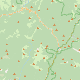
Uztárroz – Uztarrotze on the map

Data Sources & Methodology

Our weather forecasts are powered by a professional weather data provider that aggregates data from national weather services, satellite observations, radar networks, and over 80,000 weather stations worldwide. Forecast data is updated multiple times daily. We convert raw data into clear summaries — wind speed in m/s, pressure in mmHg — so you can plan your day with confidence.