5-day weather forecast Nightcliff Nov 13, 2026

33°27° · Patchy rain possible

Weather forecast Nightcliff Friday Nov 13, 2026: patchy rain possible, temperature from 27 °C to 33 °C.

Precipitation probability 51%. Wind up to 3.39 m/s (gusts 6.31 m/s). Air humidity 60–84%, atmospheric pressure 758–761 mm Hg, UV index up to 12.3.

Sunrise 06:10
Sunset 18:50
Waxing Crescent22% illuminated
Moonrise 09:18 · Moonset 22:36
Chart
Table

Forecast from 27 °C to 33 °C and precipitation

Temperature & Precipitation
Time00:0001:0002:0003:0004:0005:0006:0007:0008:0009:0010:0011:0012:0013:0014:0015:0016:0017:0018:0019:0020:0021:0022:0023:00
Temperature (°C)282828282727272930313232333332323231303029292928
Precipitation (mm/hr)000.550.710000.010.030.040.10.170.250.220.20.190.120.060000.0500

Cloud cover and precipitation probability

Cloud cover & Rain chance
Time00:0001:0002:0003:0004:0005:0006:0007:0008:0009:0010:0011:0012:0013:0014:0015:0016:0017:0018:0019:0020:0021:0022:0023:00
Cloud cover (%)8576655759333584645884537255677253714735973914
Rain chance (%)20195051181414201512201724182021171710108221011

Wind speed and direction

Wind & Wind gust
Time00:0001:0002:0003:0004:0005:0006:0007:0008:0009:0010:0011:0012:0013:0014:0015:0016:0017:0018:0019:0020:0021:0022:0023:00
Wind (m/s)1.812.112.191.691.391.611.1911.311.311.191.391.612.393.193.19333.393.313.112.692.111.89
Wind gust (m/s)2.832.973.112.392.142.422.062.583.393.943.974.174.585.195.475.565.835.676.316.175.785.114.223.61
Wind direction (°)NNW 330°NNW 339°N 349°N 352°N 355°N 3°N 0°NNE 14°NE 51°NE 55°NE 48°NNE 21°N 5°NNW 347°NNW 336°NW 321°NW 310°WNW 284°W 277°W 259°W 264°W 265°WNW 287°NW 306°

Air humidity

Humidity
Time00:0001:0002:0003:0004:0005:0006:0007:0008:0009:0010:0011:0012:0013:0014:0015:0016:0017:0018:0019:0020:0021:0022:0023:00
Humidity (%)808183848484847873686462606062626568727578808183

Atmospheric pressure

Pressure
Time00:0001:0002:0003:0004:0005:0006:0007:0008:0009:0010:0011:0012:0013:0014:0015:0016:0017:0018:0019:0020:0021:0022:0023:00
Pressure (mm Hg)760760759759759760760761761761761761760759758758758758758758759759759759

Ultraviolet index

UV Index
Time00:0001:0002:0003:0004:0005:0006:0007:0008:0009:0010:0011:0012:0013:0014:0015:0016:0017:0018:0019:0020:0021:0022:0023:00
UV Index00000000.31.64.77.910.912.39.76.63.82.50.90.200000

Air quality & pollen

Air quality
Time00:0001:0002:0003:0004:0005:0006:0007:0008:0009:0010:0011:0012:0013:0014:0015:0016:0017:0018:0019:0020:0021:0022:0023:00
PM2.5 (µg/m³)6.56.66.977.17.37.47.37.2777.17.37.47.37.2776.96.66.25.75.55.6
PM10 (µg/m³)88.59.19.49.710.110.410.310.29.79.69.49.69.59.59.39.19.29.18.57.97.16.76.9
Ozone (O₃) (µg/m³)424140393838394245495357606366676766646056525050
NO₂ (µg/m³)2.62.42.11.91.91.91.81.410.60.50.50.50.50.50.50.70.91.11.21.21.21.31.4
SO₂ (µg/m³)0.60.60.50.50.50.50.50.50.60.60.70.70.80.80.90.90.90.80.80.80.80.80.80.7
CO (µg/m³)113110106104104106107108109110112113114113112111111112114117120122123123

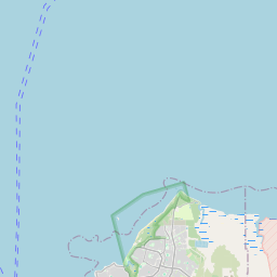
Nightcliff on the map

Data Sources & Methodology

Our weather forecasts are powered by a professional weather data provider that aggregates data from national weather services, satellite observations, radar networks, and over 80,000 weather stations worldwide. Forecast data is updated multiple times daily. We convert raw data into clear summaries — wind speed in m/s, pressure in mmHg — so you can plan your day with confidence.