5-day weather forecast Nightcliff Nov 12, 2026

32°26° · Patchy rain possible

Weather forecast Nightcliff tomorrow Nov 12, 2026: patchy rain possible, temperature from 26 °C to 32 °C.

Precipitation probability 80%. Wind up to 2.61 m/s (gusts 5.69 m/s). Air humidity 59–89%, atmospheric pressure 758–761 mm Hg, UV index up to 10.8.

Sunrise 06:10
Sunset 18:50
Waxing Crescent14% illuminated
Moonrise 08:23 · Moonset 21:44
Chart
Table

Forecast from 26 °C to 32 °C and precipitation

Temperature & Precipitation
Time00:0001:0002:0003:0004:0005:0006:0007:0008:0009:0010:0011:0012:0013:0014:0015:0016:0017:0018:0019:0020:0021:0022:0023:00
Temperature (°C)282827262626262728293031323232323231313029292929
Precipitation (mm/hr)0.021.923.224.813.241.660.080.060.03000.010.040.240.010.010.010000000

Cloud cover and precipitation probability

Cloud cover & Rain chance
Time00:0001:0002:0003:0004:0005:0006:0007:0008:0009:0010:0011:0012:0013:0014:0015:0016:0017:0018:0019:0020:0021:0022:0023:00
Cloud cover (%)555272627180999999999590868176676051526667929088
Rain chance (%)156376807871373125191614142411998101315222121

Wind speed and direction

Wind & Wind gust
Time00:0001:0002:0003:0004:0005:0006:0007:0008:0009:0010:0011:0012:0013:0014:0015:0016:0017:0018:0019:0020:0021:0022:0023:00
Wind (m/s)1.3911.391.811.811.611.51.611.611.611.51.51.112.312.612.392.312.192.111.812.312.312.312
Wind gust (m/s)2.833.253.974.644.113.252.943.253.533.673.894.113.835.225.365.694.894.944.423.7843.783.643.14
Wind direction (°)N 350°NNE 29°ENE 73°E 96°E 98°ESE 107°E 96°ESE 110°SE 126°SE 142°SE 125°ESE 122°E 91°NNE 14°N 354°NNW 337°NNW 332°WNW 286°WNW 288°WNW 298°NW 306°NW 311°NW 317°NW 320°

Air humidity

Humidity
Time00:0001:0002:0003:0004:0005:0006:0007:0008:0009:0010:0011:0012:0013:0014:0015:0016:0017:0018:0019:0020:0021:0022:0023:00
Humidity (%)798285878888898479736864596061606266717477808080

Atmospheric pressure

Pressure
Time00:0001:0002:0003:0004:0005:0006:0007:0008:0009:0010:0011:0012:0013:0014:0015:0016:0017:0018:0019:0020:0021:0022:0023:00
Pressure (mm Hg)760760759759760760761761761761761761760759758758758758758758759760760760

Ultraviolet index

UV Index
Time00:0001:0002:0003:0004:0005:0006:0007:0008:0009:0010:0011:0012:0013:0014:0015:0016:0017:0018:0019:0020:0021:0022:0023:00
UV Index00000000.51.94.67.710.110.8106.94.82.80.90.200000

Air quality & pollen

Air quality
Time00:0001:0002:0003:0004:0005:0006:0007:0008:0009:0010:0011:0012:0013:0014:0015:0016:0017:0018:0019:0020:0021:0022:0023:00
PM2.5 (µg/m³)7.37.57.77.77.2777.16.96.56.265.95.85.55.65.55.55.65.85.85.96.16.4
PM10 (µg/m³)9.59.79.99.598.88.88.78.58.17.77.47.27.16.86.96.86.86.97.17.17.27.57.8
Ozone (O₃) (µg/m³)333334353638414551555759606162626058555249464443
NO₂ (µg/m³)3.33.43.53.53.43.22.92.41.71.20.90.70.60.50.40.50.711.31.72.22.52.62.7
SO₂ (µg/m³)0.60.811.11.11.11.11.21.31.41.51.51.51.41.210.80.70.60.50.50.50.50.6
CO (µg/m³)111113116118120121123126129130129126124123123123123123123122120118116115

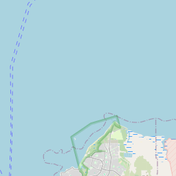
Nightcliff on the map

Data Sources & Methodology

Our weather forecasts are powered by a professional weather data provider that aggregates data from national weather services, satellite observations, radar networks, and over 80,000 weather stations worldwide. Forecast data is updated multiple times daily. We convert raw data into clear summaries — wind speed in m/s, pressure in mmHg — so you can plan your day with confidence.