5-day weather forecast Niagara Falls 25-07-2026

Weather forecast Niagara Falls Saturday, July 25 25.07.2026: sunny, temperature from 18 °C to 28 °C.

Precipitation probability 9%. Wind up to 4.89 m/s (gusts 7.11 m/s). Air humidity 40–77%, atmospheric pressure 760–764 mm Hg, UV index up to 7.

Weather Alerts

Hide alerts
ModerateJul 21, 12:01 PMJul 21, 11:59 PMTranslate with Google
yellow watch - severe thunderstorm - in effect

thunderstorm

Conditions are favourable for the development of severe thunderstorms that may be capable of producing strong wind gusts, large hail and heavy rain. Hazards: Torrential downpours. Local rainfall amounts in excess of 50 mm. Wind gusts of 90 to 110 km/h. Quarter to ping pong ball size hail. Timing: Late this morning through early this evening. Additional information: The main hazards will be heavy rainfall and damaging wind gusts. Local rainfall amounts in excess of 50 mm may occur for areas that receive multiple thunderstorms. The greatest likelihood for damaging wind gusts is expected to be over southwestern Ontario. A few instances of large hail are possible. ### Local utility outages are possible. Damage to roofs, fences, branches or soft shelters is possible. Heavy rain can cause flash flooding and significant reductions to visibility. Please continue to monitor alerts and forecasts issued by Environment Canada. To report severe weather, send an email to ONstorm@ec.gc.ca or post reports on X using #ONStorm. For more information: https://www.ontario.ca/page/be-prepared-emergency.
When thunder roars, go indoors! Lightning kills and injures Canadians every year. Emergency Management Ontario recommends that you take cover immediately if threatening weather approaches.
ModerateJul 21, 09:56 AMJul 22, 12:02 AMTranslate with Google
yellow watch - severe thunderstorm - in effect

thunderstorm

Conditions are favourable for the development of severe thunderstorms that may be capable of producing strong wind gusts, large hail and heavy rain. Hazards: Torrential downpours. Local rainfall amounts in excess of 50 mm. Wind gusts of 90 to 110 km/h. Quarter to ping pong ball size hail. Timing: Late this morning through early this evening. Additional information: The main hazards will be heavy rainfall and damaging wind gusts. Local rainfall amounts in excess of 50 mm may occur for areas that receive multiple thunderstorms. The greatest likelihood for damaging wind gusts is expected to be over southwestern Ontario. A few instances of large hail are possible. ### Local utility outages are possible. Damage to roofs, fences, branches or soft shelters is possible. Heavy rain can cause flash flooding and significant reductions to visibility. Please continue to monitor alerts and forecasts issued by Environment Canada. To report severe weather, send an email to ONstorm@ec.gc.ca or post reports on X using #ONStorm. For more information: https://www.ontario.ca/page/be-prepared-emergency.
When thunder roars, go indoors! Lightning kills and injures Canadians every year. Emergency Management Ontario recommends that you take cover immediately if threatening weather approaches.
ModerateJul 21, 12:01 PMJul 21, 11:59 PMTranslate with Google
yellow watch - severe thunderstorm - in effect

thunderstorm

Conditions are favourable for the development of severe thunderstorms that may be capable of producing strong wind gusts, large hail and heavy rain. ### Local utility outages are possible. Damage to roofs, fences, branches or soft shelters is possible. Heavy rain can cause flash flooding and significant reductions to visibility. Please continue to monitor alerts and forecasts issued by Environment Canada. To report severe weather, send an email to ONstorm@ec.gc.ca or post reports on X using #ONStorm. For more information: https://www.ontario.ca/page/be-prepared-emergency.
When thunder roars, go indoors! Lightning kills and injures Canadians every year. Emergency Management Ontario recommends that you take cover immediately if threatening weather approaches.
MinorJul 21, 09:41 AMJul 21, 08:00 PMTranslate with Google
Small Craft Advisory issued July 21 at 9:41AM EDT until July 21 at 9:00PM EDT by NWS Buffalo NY

Small Craft Advisory

* WHAT...Southwest winds 15 to 20 knots expected. * WHERE...The Upper Niagara River and Buffalo Harbor. * WHEN...Until 9 PM EDT Tuesday. * IMPACTS...Winds and/or waves will cause hazardous conditions that could capsize or damage small craft.
Inexperienced mariners, especially those operating smaller vessels, should avoid navigating in hazardous conditions.
Sunrise 05:59
Sunset 20:45
Waxing Gibbous90% illuminated
Moonrise 18:44 · Moonset 02:09
Chart
Table
Sat, Jul 25, 2026

Forecast from 18 °C to 28 °C and precipitation

Temperature & Precipitation
Time00:0001:0002:0003:0004:0005:0006:0007:0008:0009:0010:0011:0012:0013:0014:0015:0016:0017:0018:0019:0020:0021:0022:0023:00
Temperature (°C)191919191918181921232426262727282828272624232222
Precipitation (mm/hr)000000000000000000000000

Cloud cover and precipitation probability

Cloud cover & Rain chance
Time00:0001:0002:0003:0004:0005:0006:0007:0008:0009:0010:0011:0012:0013:0014:0015:0016:0017:0018:0019:0020:0021:0022:0023:00
Cloud cover (%)101311111099910111212121213191914151111122725
Rain chance (%)998876644322211221223466

Wind speed and direction

Wind & Wind gust
Time00:0001:0002:0003:0004:0005:0006:0007:0008:0009:0010:0011:0012:0013:0014:0015:0016:0017:0018:0019:0020:0021:0022:0023:00
Wind (m/s)2.3933.392.812.392.392.52.813.54.194.54.694.894.894.814.193.813.613.392.51.391.812.112.5
Wind gust (m/s)5.036.317.115.785.035.035.225.255.395.55.585.475.645.645.534.834.584.674.783.812.583.694.395.06
Wind direction (°)SE 143°S 184°S 191°SSW 197°S 190°S 178°S 170°SSE 168°S 174°S 188°S 191°SSW 196°SSW 197°SSW 203°SSW 205°SSW 207°SSW 207°SSW 213°SW 220°SW 224°SSW 204°S 191°SSW 206°SSW 194°

Air humidity

Humidity
Time00:0001:0002:0003:0004:0005:0006:0007:0008:0009:0010:0011:0012:0013:0014:0015:0016:0017:0018:0019:0020:0021:0022:0023:00
Humidity (%)777775747370686459524844434241414040434957616467

Atmospheric pressure

Pressure
Time00:0001:0002:0003:0004:0005:0006:0007:0008:0009:0010:0011:0012:0013:0014:0015:0016:0017:0018:0019:0020:0021:0022:0023:00
Pressure (mm Hg)764764764764764764764764764764763763763762762761761761761760760760760760

Ultraviolet index

UV Index
Time00:0001:0002:0003:0004:0005:0006:0007:0008:0009:0010:0011:0012:0013:0014:0015:0016:0017:0018:0019:0020:0021:0022:0023:00
UV Index00000000.20.9667777777776000
Sat, Jul 25, 2026

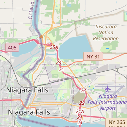
Niagara Falls on the map

Data Sources & Methodology

Our weather forecasts are powered by a professional weather data provider that aggregates data from national weather services, satellite observations, radar networks, and over 80,000 weather stations worldwide. Forecast data is updated multiple times daily. We convert raw data into clear summaries — wind speed in m/s, pressure in mmHg — so you can plan your day with confidence.