5-day weather forecast Niagara Falls 12-04-2026

Weather forecast Niagara Falls Sunday, April 12 12.04.2026: overcast, temperature from 1 °C to 16 °C.

Precipitation probability 100%. Wind up to 9 m/s (gusts 18.69 m/s). Air humidity 62–97%, atmospheric pressure 760–774 mm Hg, UV index up to 0.7.

Sunrise 06:39
Sunset 19:56
Waning Crescent33% illuminated
Moonrise 04:23 · Moonset 14:32
Chart
Table

Forecast from 1 °C to 16 °C and precipitation

Temperature & Precipitation
Time00:0001:0002:0003:0004:0005:0006:0007:0008:0009:0010:0011:0012:0013:0014:0015:0016:0017:0018:0019:0020:0021:0022:0023:00
Temperature (°C)1000011245789101213151515151616912
Precipitation (mm/hr)0000000000000000000000.650.970

Cloud cover and precipitation probability

Cloud cover & Rain chance
Time00:0001:0002:0003:0004:0005:0006:0007:0008:0009:0010:0011:0012:0013:0014:0015:0016:0017:0018:0019:0020:0021:0022:0023:00
Cloud cover (%)7588100100100100100100100100100100100100100100100100949188858351
Rain chance (%)0000000000000000000001001000

Wind speed and direction

Wind & Wind gust
Time00:0001:0002:0003:0004:0005:0006:0007:0008:0009:0010:0011:0012:0013:0014:0015:0016:0017:0018:0019:0020:0021:0022:0023:00
Wind (m/s)2.111.812.6122.52.692.891.51.392.111.691.812.69331.191.392.693.114.616.318.198.899
Wind gust (m/s)3.923.394.943.724.815.255.672.812.643.8933.224.925.284.612.172.945.286.59.6713.2217.2218.6918.42
Wind direction (°)SE 130°SE 136°SE 125°ESE 118°ESE 117°SE 131°SE 124°ESE 117°ESE 119°ESE 121°E 82°E 95°E 93°ESE 117°SSE 165°S 183°S 171°SSW 197°SSW 206°SSW 208°SSW 205°SSW 207°SW 217°SW 224°

Air humidity

Humidity
Time00:0001:0002:0003:0004:0005:0006:0007:0008:0009:0010:0011:0012:0013:0014:0015:0016:0017:0018:0019:0020:0021:0022:0023:00
Humidity (%)969696979797939189756862666870717272798285868696

Atmospheric pressure

Pressure
Time00:0001:0002:0003:0004:0005:0006:0007:0008:0009:0010:0011:0012:0013:0014:0015:0016:0017:0018:0019:0020:0021:0022:0023:00
Pressure (mm Hg)773773773773773772772772772770770769767766765764762761761761761760760774

Ultraviolet index

UV Index
Time00:0001:0002:0003:0004:0005:0006:0007:0008:0009:0010:0011:0012:0013:0014:0015:0016:0017:0018:0019:0020:0021:0022:0023:00
UV Index000000000.10.20.30.40.60.70.60.60.30.50.50.10000

Air quality & pollen

Air quality
Time00:0001:0002:0003:0004:0005:0006:0007:0008:0009:0010:0011:0012:0013:0014:0015:0016:0017:0018:0019:0020:0021:0022:0023:00
PM2.5 (µg/m³)2623.820.317.114.211.1109.39.29.29.71111.811.712.211.912.413.113.812.911.310.29.79.5
PM10 (µg/m³)26.32420.517.314.411.310.19.59.39.39.911.212.11212.412.212.613.414.113.211.610.5109.7
Ozone (O₃) (µg/m³)4750556165676766646262667276757171778795101106109108
NO₂ (µg/m³)21.518.716.714.913.61312.912.712.111.410.910.610.410.711.913.51412.39.57.36.35.95.85.8
SO₂ (µg/m³)4.84.64.343.83.63.43.43.84.44.95.15.25.24.94.54.143.93.93.93.93.93.8
CO (µg/m³)396.9369.9345.9322.9304.9292.9285.9281.9280.9281.9280.9273.9264.9260.9271.9286.9288.9260.9218.9187.9178.9180.9183.9184.9

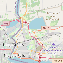
Niagara Falls on the map

Data Sources & Methodology

Our weather forecasts are powered by a professional weather data provider that aggregates data from national weather services, satellite observations, radar networks, and over 80,000 weather stations worldwide. Forecast data is updated multiple times daily. We convert raw data into clear summaries — wind speed in m/s, pressure in mmHg — so you can plan your day with confidence.