5-day weather forecast Hay River Nov 19, 2026

-2°-5° · Moderate snow

Weather forecast Hay River tomorrow Nov 19, 2026: moderate snow, temperature from -5 °C to -2 °C.

Precipitation probability 44%. Wind up to 4.31 m/s (gusts 10.17 m/s). Air humidity 87–91%, atmospheric pressure 759–764 mm Hg, UV index up to 0.1.

Sunrise 09:56
Sunset 16:59
Waxing Gibbous81% illuminated
Moonrise 15:24 · Moonset 03:08
Chart
Table

Forecast from -5 °C to -2 °C and precipitation

Temperature & Precipitation
Time00:0001:0002:0003:0004:0005:0006:0007:0008:0009:0010:0011:0012:0013:0014:0015:0016:0017:0018:0019:0020:0021:0022:0023:00
Temperature (°C)-5-5-5-4-4-4-4-5-5-5-5-4-3-3-2-2-2-2-2-3-3-3-4-4
Precipitation (mm/hr)00000.010.020.020.020.0100000.010.020.030.060.080.10.110.120.120.130.13

Cloud cover and precipitation probability

Cloud cover & Rain chance
Time00:0001:0002:0003:0004:0005:0006:0007:0008:0009:0010:0011:0012:0013:0014:0015:0016:0017:0018:0019:0020:0021:0022:0023:00
Cloud cover (%)40849299857056616671809010010010010010010010010010010010099
Rain chance (%)172527292624222323242628303132323540434343434443

Wind speed and direction

Wind & Wind gust
Time00:0001:0002:0003:0004:0005:0006:0007:0008:0009:0010:0011:0012:0013:0014:0015:0016:0017:0018:0019:0020:0021:0022:0023:00
Wind (m/s)0.810.810.891.1111.111.190.610.190.610.50.50.691.191.6122.613.54.3143.813.53.192.89
Wind gust (m/s)1.691.581.51.972.393.113.674.335.085.895.835.925.835.675.475.336.838.5810.1710.089.869.649.178.81
Wind direction (°)SSE 150°SE 129°ESE 110°E 90°E 91°E 94°E 94°E 79°N 11°WNW 300°NNW 328°NNE 21°NE 40°NE 44°NE 50°NE 53°NNE 29°NNE 19°N 11°N 11°N 10°N 10°N 10°N 10°

Air humidity

Humidity
Time00:0001:0002:0003:0004:0005:0006:0007:0008:0009:0010:0011:0012:0013:0014:0015:0016:0017:0018:0019:0020:0021:0022:0023:00
Humidity (%)878887888889909090919190909089888989898990898988

Atmospheric pressure

Pressure
Time00:0001:0002:0003:0004:0005:0006:0007:0008:0009:0010:0011:0012:0013:0014:0015:0016:0017:0018:0019:0020:0021:0022:0023:00
Pressure (mm Hg)759759759759759759760760761761761761761761761762762763763763764764764764

Ultraviolet index

UV Index
Time00:0001:0002:0003:0004:0005:0006:0007:0008:0009:0010:0011:0012:0013:0014:0015:0016:0017:0018:0019:0020:0021:0022:0023:00
UV Index000000000000.10.10.10.1000000000

Air quality & pollen

Air quality
Time00:0001:0002:0003:0004:0005:0006:0007:0008:0009:0010:0011:0012:0013:0014:0015:0016:0017:0018:0019:0020:0021:0022:0023:00
PM2.5 (µg/m³)0.50.40.40.40.50.40.40.40.40.40.30.30.20.20.20.20.20.10.10.10.10.10.10.1
PM10 (µg/m³)0.60.60.60.60.60.60.60.50.50.50.40.40.30.30.30.30.20.20.10.10.10.10.10.1
Ozone (O₃) (µg/m³)596060595958585858585959595959595959606162636566
NO₂ (µg/m³)0.70.70.60.60.50.50.50.60.60.60.60.60.60.50.50.60.70.80.70.60.50.40.30.2
SO₂ (µg/m³)0.10.10.10.10.10.10.10.10.10.10.10.10.10.10.10.10.10.10.100000
CO (µg/m³)119114110108108109112115118118118117117117116115114112110108107107107107

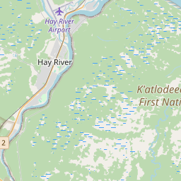
Hay River on the map

Data Sources & Methodology

Our weather forecasts are powered by a professional weather data provider that aggregates data from national weather services, satellite observations, radar networks, and over 80,000 weather stations worldwide. Forecast data is updated multiple times daily. We convert raw data into clear summaries — wind speed in m/s, pressure in mmHg — so you can plan your day with confidence.