5-day weather forecast Grožnjan 26-07-2026

Weather forecast Grožnjan Sunday, July 26 26.07.2026: sunny, temperature from 19 °C to 28 °C.

Precipitation probability 88%. Wind up to 9.31 m/s (gusts 16.53 m/s). Air humidity 62–88%, atmospheric pressure 756–759 mm Hg, UV index up to 7.

Weather Alerts

Hide alerts
SevereJul 23, 07:31 AMJul 27, 12:59 AMTranslate with Google
Severe Forestfire danger Warning (Degree 3/4) - Slovenia / South-West

Severe Forestfire danger Warning

There is a large risk of forest and bush fire.
Stay vigilant and be prepared there is a large risk of forest and bush fire. Immediately react to any developing fire. The public are asked to exercise extreme caution in the countryside, and immediately notify emergency services on any fire.
ModerateJul 24, 07:50 AMJul 25, 10:00 AMTranslate with Google
Yellow wind warning
Locally fresh NE wind. Maximum wind gusts 35-40 knots (65-75 km/h)
IMPACT: Although rather usual in this region, locally or potentially dangerous wind speeds are expected to produce dangerous wave conditions to small crafts. Inexperienced mariners, especially those operating smaller vessels, should avoid navigating in these conditions. Mariners should pay close attention to the marine forecast and consider wind and sea conditions in planning. It is possible that some ferry lines will not operate so follow traffic information if travelling.
ModerateJul 24, 07:50 AMJul 25, 09:00 AMTranslate with Google
Yellow wind warning
Locally fresh NE wind. Maximum wind gusts 35-40 knots (65-75 km/h)
IMPACT: Although rather usual in this region, locally or potentially dangerous wind speeds are expected to produce dangerous wave conditions to small crafts. Inexperienced mariners, especially those operating smaller vessels, should avoid navigating in these conditions. Mariners should pay close attention to the marine forecast and consider wind and sea conditions in planning. It is possible that some ferry lines will not operate so follow traffic information if travelling.
ModerateJul 24, 07:49 AMJul 24, 11:59 PMTranslate with Google
Yellow wind warning
Locally strong NE wind. Maximum wind gusts 35-50 knots (65-95 km/h)
IMPACT: Although rather usual in this region, locally or potentially dangerous wind speeds are expected to produce dangerous wave conditions to small crafts. Inexperienced mariners, especially those operating smaller vessels, should avoid navigating in these conditions. Mariners should pay close attention to the marine forecast and consider wind and sea conditions in planning. It is possible that some ferry lines will not operate so follow traffic information if travelling.
ModerateJul 24, 07:49 AMJul 24, 11:59 PMTranslate with Google
Yellow wind warning
Locally fresh and strong NE wind. Maximum wind gusts 35-50 knots (65-95 km/h)
IMPACT: Although rather usual in this region, locally or potentially dangerous wind speeds are expected to produce dangerous wave conditions to small crafts. Inexperienced mariners, especially those operating smaller vessels, should avoid navigating in these conditions. Mariners should pay close attention to the marine forecast and consider wind and sea conditions in planning. It is possible that some ferry lines will not operate so follow traffic information if travelling.
Sunrise 05:42
Sunset 20:40
Waxing Gibbous95% illuminated
Moonrise 19:20 · Moonset 02:24
Chart
Table

Forecast from 19 °C to 28 °C and precipitation

Temperature & Precipitation
Time00:0001:0002:0003:0004:0005:0006:0007:0008:0009:0010:0011:0012:0013:0014:0015:0016:0017:0018:0019:0020:0021:0022:0023:00
Temperature (°C)202020192020202124262727272728272727272524222120
Precipitation (mm/hr)000.02000000000000.070.10.140.140.3102.917.053.52.03

Cloud cover and precipitation probability

Cloud cover & Rain chance
Time00:0001:0002:0003:0004:0005:0006:0007:0008:0009:0010:0011:0012:0013:0014:0015:0016:0017:0018:0019:0020:0021:0022:0023:00
Cloud cover (%)6681667655981314689717673851668906680
Rain chance (%)54145556765455419182122361074887873

Wind speed and direction

Wind & Wind gust
Time00:0001:0002:0003:0004:0005:0006:0007:0008:0009:0010:0011:0012:0013:0014:0015:0016:0017:0018:0019:0020:0021:0022:0023:00
Wind (m/s)3.613.313.193.53.614.695.55.615.894.8156.8987.587.117.55.814.318.118.899.314.814.61
Wind gust (m/s)7.316.536.447.116.978.9410.179.177.835.865.757.949.198.649.198.178.727.425.5311.2512.6916.539.228.86
Wind direction (°)ESE 108°E 97°E 90°E 95°ESE 104°E 96°ESE 104°ESE 122°SE 136°SSE 157°S 182°S 180°S 175°S 174°S 174°S 170°SSE 167°SSE 160°SSE 162°SSE 151°SSE 166°SSW 207°SE 144°ESE 107°

Air humidity

Humidity
Time00:0001:0002:0003:0004:0005:0006:0007:0008:0009:0010:0011:0012:0013:0014:0015:0016:0017:0018:0019:0020:0021:0022:0023:00
Humidity (%)666464656567707271676364636264656770677983888786

Atmospheric pressure

Pressure
Time00:0001:0002:0003:0004:0005:0006:0007:0008:0009:0010:0011:0012:0013:0014:0015:0016:0017:0018:0019:0020:0021:0022:0023:00
Pressure (mm Hg)758758758758758758758758758758758758758758758757757757756756758758758759

Ultraviolet index

UV Index
Time00:0001:0002:0003:0004:0005:0006:0007:0008:0009:0010:0011:0012:0013:0014:0015:0016:0017:0018:0019:0020:0021:0022:0023:00
UV Index00000000.30.92.13.75.36.576.45.43.82.310.40000

Air quality & pollen

Air quality
Time00:0001:0002:0003:0004:0005:0006:0007:0008:0009:0010:0011:0012:0013:0014:0015:0016:0017:0018:0019:0020:0021:0022:0023:00
PM2.5 (µg/m³)4.54.34.44.24.14.13.844.34.14.24.44.74.74.44.95.14.84.43.944.24.54.3
PM10 (µg/m³)8.48.17.87.97.97.47.78.38.68.58.89.19910.41010.398.78.28.58.57.18.1
Ozone (O₃) (µg/m³)788081828281838785868990919293979898969796939087
NO₂ (µg/m³)2.21.91.81.71.61.51.51.41.31.110.90.90.70.70.70.70.70.81.11.41.61.81.9
SO₂ (µg/m³)0.20.20.20.20.20.20.20.20.20.20.20.20.20.20.20.20.10.10.10.10.10.10.10.1
CO (µg/m³)121121121121122122122123123122122122123120121122123123124123125128126128

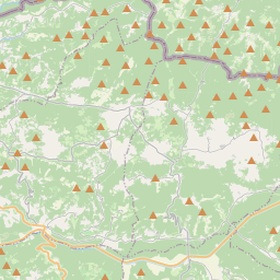
Grožnjan on the map

Data Sources & Methodology

Our weather forecasts are powered by a professional weather data provider that aggregates data from national weather services, satellite observations, radar networks, and over 80,000 weather stations worldwide. Forecast data is updated multiple times daily. We convert raw data into clear summaries — wind speed in m/s, pressure in mmHg — so you can plan your day with confidence.