
5-day weather forecast Münster Nov 16, 2026
 10°
Weather forecast Münster Monday Nov 16, 2026: patchy rain possible, temperature from 3 °C to 10 °C.
Precipitation probability 71%. Wind up to 7.39 m/s (gusts 13.44 m/s). Air humidity 77–94%, atmospheric pressure 747–755 mm Hg, UV index up to 0.7.
Weather Alerts
Official WARNING of FROST
frost
There is a risk of frost (level 1 of 2).
Minimum temperature: > -3 °C
Hazard(s) to expect: possible frost damage.
Recommendations for what to do:
If necessary, take precautions against frost.
Amtliche WARNUNG vor FROST
FROST
Es tritt leichter Frost bis -3 °C auf.
Hinweis auf: mögliche Frostschäden.
Handlungsempfehlungen:
ggf. Frostschutzmaßnahmen ergreifen
Official WARNING of FROST
frost
There is a risk of frost (level 1 of 2).
Minimum temperature: > -2 °C
Hazard(s) to expect: possible frost damage.
Recommendations for what to do:
If necessary, take precautions against frost.
Amtliche WARNUNG vor FROST
FROST
Es tritt leichter Frost bis -2 °C auf.
Hinweis auf: mögliche Frostschäden.
Handlungsempfehlungen:
ggf. Frostschutzmaßnahmen ergreifen
5 days at a glance — tap a day to open it
Sunrise 07:51
Sunset 16:37
Sunset 16:37
First Quarter52% illuminated
Moonrise 13:37 · Moonset 23:10
Moonrise 13:37 · Moonset 23:10
Chart
Table
| Time | Weather | Temperature | Rain chance | Cloud cover | Humidity | Pressure | Wind | UV Index |
|---|---|---|---|---|---|---|---|---|
| 00:00 |  Light drizzle | 10 °C | 58% (0.31 mm/hr) | 99% | 91% | 748 mm Hg | SSW 202° 5.81 (11.36) m/s | 0 |
| 01:00 | Light drizzle | 9 °C | 54% (0.23 mm/hr) | 99% | 92% | 748 mm Hg | SSW 209° 5.81 (11.47) m/s | 0 |
| 02:00 |  Light rain shower | 9 °C | 47% (0.22 mm/hr) | 99% | 91% | 748 mm Hg | SSW 211° 5.89 (11.5) m/s | 0 |
| 03:00 | Light rain shower | 9 °C | 50% (0.27 mm/hr) | 99% | 91% | 747 mm Hg | SW 215° 6 (11.81) m/s | 0 |
| 04:00 | Light rain shower | 9 °C | 67% (0.65 mm/hr) | 100% | 92% | 747 mm Hg | SW 220° 6.81 (12.5) m/s | 0 |
| 05:00 |  Patchy rain possible | 9 °C | 43% (0.13 mm/hr) | 100% | 91% | 748 mm Hg | SW 233° 6.89 (13.44) m/s | 0 |
| 06:00 | Patchy rain possible | 9 °C | 38% (0.1 mm/hr) | 90% | 91% | 748 mm Hg | SW 233° 7.39 (12.97) m/s | 0 |
| 07:00 | Patchy rain possible | 8 °C | 37% (0.06 mm/hr) | 100% | 92% | 749 mm Hg | SW 232° 6.89 (12.47) m/s | 0 |
| 08:00 |  Light drizzle | 8 °C | 71% (0.62 mm/hr) | 95% | 94% | 749 mm Hg | SW 236° 6.31 (12.22) m/s | 0 |
| 09:00 | Patchy rain possible | 8 °C | 38% (0.08 mm/hr) | 90% | 93% | 749 mm Hg | WSW 247° 6.61 (11.97) m/s | 0 |
| 10:00 | Patchy rain possible | 9 °C | 36% (0.09 mm/hr) | 85% | 91% | 750 mm Hg | WSW 256° 6.61 (11.61) m/s | 0.1 |
| 11:00 | Patchy rain possible | 8 °C | 36% (0.13 mm/hr) | 76% | 90% | 751 mm Hg | W 268° 6 (11.36) m/s | 0.2 |
| 12:00 |  Light rain shower | 8 °C | 44% (0.28 mm/hr) | 80% | 89% | 752 mm Hg | W 277° 5.89 (10.86) m/s | 0.5 |
| 13:00 | Light rain shower | 8 °C | 38% (0.2 mm/hr) | 77% | 88% | 752 mm Hg | WNW 294° 5.61 (11.19) m/s | 0.7 |
| 14:00 |  Patchy light drizzle | 7 °C | 35% (0.19 mm/hr) | 68% | 85% | 753 mm Hg | WNW 288° 5 (10.31) m/s | 0.5 |
| 15:00 | Patchy rain possible | 7 °C | 21% (0.06 mm/hr) | 59% | 80% | 754 mm Hg | WNW 283° 4.81 (9.86) m/s | 0.3 |
| 16:00 | Patchy rain possible | 7 °C | 15% (0.03 mm/hr) | 52% | 77% | 755 mm Hg | W 277° 4.39 (9.42) m/s | 0 |
| 17:00 | Patchy rain possible | 6 °C | 21% (0.02 mm/hr) | 85% | 78% | 755 mm Hg | W 265° 4.11 (8.86) m/s | 0 |
| 18:00 |  Partly cloudy | 5 °C | 13% | 40% | 79% | 755 mm Hg | WSW 254° 4.11 (8.86) m/s | 0 |
| 19:00 | Partly cloudy | 5 °C | 13% | 40% | 80% | 755 mm Hg | WSW 247° 4.19 (8.58) m/s | 0 |
| 20:00 | Partly cloudy | 4 °C | 16% | 52% | 82% | 755 mm Hg | WSW 246° 4 (8.22) m/s | 0 |
| 21:00 |  Cloudy | 4 °C | 22% | 80% | 84% | 755 mm Hg | WSW 243° 3.81 (7.94) m/s | 0 |
| 22:00 |  Overcast | 4 °C | 27% | 97% | 87% | 755 mm Hg | WSW 237° 3.69 (7.75) m/s | 0 |
| 23:00 | Overcast | 3 °C | 28% | 97% | 88% | 755 mm Hg | SW 232° 3.39 (7.33) m/s | 0 |
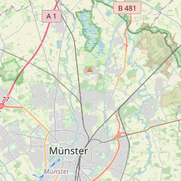
Münster on the map
Data Sources & Methodology
Our weather forecasts are powered by a professional weather data provider that aggregates data from national weather services, satellite observations, radar networks, and over 80,000 weather stations worldwide. Forecast data is updated multiple times daily. We convert raw data into clear summaries — wind speed in m/s, pressure in mmHg — so you can plan your day with confidence.