5-Tage-Wettervorhersage Toronto 14-06-2026

Wettervorhersage Toronto morgen 14.06.2026: sonnig, Temperatur von 12 °C bis 19 °C.

Niederschlagswahrscheinlichkeit 6%. Wind bis zu 4.81 m/s (Böen 9.44 m/s). Luftfeuchtigkeit 70–97%, Luftdruck 753–757 mm Hg, UV-Index bis 1.5.

Wetterwarnungen

Warnungen ausblenden
ModerateJun 13, 04:15 PMJun 14, 04:00 AMMit Google übersetzen
yellow watch - severe thunderstorm - in effect

thunderstorm — Service Notice – April 2026: The Environment and Climate Change Canada (ECCC) CAP Service undergoes changes from time to time as the business of alerting evolves. For Spring 2026, changes are expected to include... 1) ECCC's initiative to introduce free-form polygons to represent the true threat area of a weather hazard is tentatively set for June 2026 deployment. Data changes will appear in CAP following this deployment, 2) marine alerts will now be issued for smaller zone splits in certain areas of Atlantic and Pacific waters and 3) other minor improvements and corrections. For more information on these changes: https://comm.collab.science.gc.ca/mailman3/hyperkitty/list/dd_info@comm.collab.science.gc.ca/ | Notification de service – avril 2026: Le service du PAC d’Environnement et Changement climatique Canada (ECCC) subit périodiquement des changements à mesure que le système d’alerte évolue. Pour le printemps 2026, il y aura des changements incluant... 1) l’initiative d’ECCC visant à introduire des polygones libres pour représenter la véritable zone de menace d’un danger météorologique devrait être déployée provisoirement en juin 2026. Des changements de données apparaîtront dans le PAC à la suite de ce déploiement, 2) les alertes marines seront désormais émises pour des subdivisions de zones plus petites dans certaines régions des eaux de l’Atlantique et du Pacifique et 3) d’autres améliorations et corrections mineures. Pour plus d’informations sur ces changements: https://comm.collab.science.gc.ca/mailman3/hyperkitty/list/dd_info@comm.collab.science.gc.ca/

Conditions are favourable for the development of severe thunderstorms that may be capable of producing strong wind gusts and large hail. What: Wind gusts up to 90 km/h. Hail up to toonie-sized. When: This afternoon into this evening. ### Local utility outages are possible. Damage to roofs, fences, branches or soft shelters is possible. There is a risk of injury. Severe thunderstorm watches are issued when conditions are favourable for the development of thunderstorms capable of producing damaging hail, wind or rain. Please continue to monitor alerts and forecasts issued by Environment Canada. To report severe weather, send an email to ONstorm@ec.gc.ca or post reports on X using #ONStorm. For more information: https://www.ontario.ca/page/be-prepared-emergency.
When thunder roars, go indoors! Lightning kills and injures Canadians every year. Secure loose objects. Emergency Management Ontario recommends that you take cover immediately if threatening weather approaches.
SevereJun 13, 03:37 PMJun 14, 04:01 AMMit Google übersetzen
squall watch in effect

squall — Service Notice – April 2026: The Environment and Climate Change Canada (ECCC) CAP Service undergoes changes from time to time as the business of alerting evolves. For Spring 2026, changes are expected to include... 1) ECCC's initiative to introduce free-form polygons to represent the true threat area of a weather hazard is tentatively set for June 2026 deployment. Data changes will appear in CAP following this deployment, 2) marine alerts will now be issued for smaller zone splits in certain areas of Atlantic and Pacific waters and 3) other minor improvements and corrections. For more information on these changes: https://comm.collab.science.gc.ca/mailman3/hyperkitty/list/dd_info@comm.collab.science.gc.ca/ | Notification de service – avril 2026: Le service du PAC d’Environnement et Changement climatique Canada (ECCC) subit périodiquement des changements à mesure que le système d’alerte évolue. Pour le printemps 2026, il y aura des changements incluant... 1) l’initiative d’ECCC visant à introduire des polygones libres pour représenter la véritable zone de menace d’un danger météorologique devrait être déployée provisoirement en juin 2026. Des changements de données apparaîtront dans le PAC à la suite de ce déploiement, 2) les alertes marines seront désormais émises pour des subdivisions de zones plus petites dans certaines régions des eaux de l’Atlantique et du Pacifique et 3) d’autres améliorations et corrections mineures. Pour plus d’informations sur ces changements: https://comm.collab.science.gc.ca/mailman3/hyperkitty/list/dd_info@comm.collab.science.gc.ca/

Thunderstorms are expected to affect the area this afternoon and continue into the early evening. Some of these thunderstorms may be capable of producing very strong wind gusts up to 45 knots. Sizeable hail may also be a concern. ### Please continue to monitor alerts and forecasts issued by Environment Canada. For more information monitor Canadian Coast Guard radio or Weatheradio stations.
Mariners are advised to prepare for potential squalls. Vulnerable vessels are most at risk and should seek safe harbour if underway. Consider delaying or postponing travel in areas under the Squall Watch.
Sonnenaufgang 05:35
Sonnenuntergang 21:00
Neumond0% beleuchtet
Mondaufgang 04:18 · Monduntergang 20:55
Diagramm
Tabelle

Vorhersage von 12 °C bis 19 °C und Niederschlag

Temperatur & Niederschlag
Uhrzeit00:0001:0002:0003:0004:0005:0006:0007:0008:0009:0010:0011:0012:0013:0014:0015:0016:0017:0018:0019:0020:0021:0022:0023:00
Temperatur (°C)191818171718181818171514141313131314141414131312
Niederschlag (mm/Std.)00000000.320.781.455.786.52.652.491.710.520.280.030.050.110.090.0200

Bewölkung und Niederschlagswahrscheinlichkeit

Bewölkung & Regenwahrscheinlichkeit
Uhrzeit00:0001:0002:0003:0004:0005:0006:0007:0008:0009:0010:0011:0012:0013:0014:0015:0016:0017:0018:0019:0020:0021:0022:0023:00
Bewölkung (%)00000005286100100100100100100100100557710072895386
Regenwahrscheinlichkeit (%)67788984067809292868580705822263626221216

Windgeschwindigkeit und -richtung

Wind & Windböe
Uhrzeit00:0001:0002:0003:0004:0005:0006:0007:0008:0009:0010:0011:0012:0013:0014:0015:0016:0017:0018:0019:0020:0021:0022:0023:00
Wind (m/s)4.814.814.54.113.53.813.3933.192.191.894.394.393.52.313.113.693.192.811.892.894.114.614.39
Windböe (m/s)9.399.448.928.3977.586.615.55.473.53.036.316.034.833.144.2254.393.692.724.566.446.786.14
Windrichtung (°)SW 230°SW 230°SW 235°SW 230°SW 235°WSW 240°WSW 241°SW 233°WSW 243°W 264°NNW 332°NNW 339°NNW 346°N 355°N 350°NNW 342°NNW 334°NNW 338°NW 315°WNW 292°WNW 303°NW 304°NW 308°WNW 301°

Luftfeuchtigkeit

Feuchtigkeit
Uhrzeit00:0001:0002:0003:0004:0005:0006:0007:0008:0009:0010:0011:0012:0013:0014:0015:0016:0017:0018:0019:0020:0021:0022:0023:00
Feuchtigkeit (%)707475797879769193949797959695959492838181777470

Luftdruck

Druck
Uhrzeit00:0001:0002:0003:0004:0005:0006:0007:0008:0009:0010:0011:0012:0013:0014:0015:0016:0017:0018:0019:0020:0021:0022:0023:00
Druck (mm Hg)755755755755755755755755755754753754754755754755755755755755755756757757

Ultraviolett-Index

UV-Index
Uhrzeit00:0001:0002:0003:0004:0005:0006:0007:0008:0009:0010:0011:0012:0013:0014:0015:0016:0017:0018:0019:0020:0021:0022:0023:00
UV-Index00000000.20.61.10.20.40.50.50.60.50.50.51.50.40.1000

Luftqualität & Pollen

Luftqualität
Uhrzeit00:0001:0002:0003:0004:0005:0006:0007:0008:0009:0010:0011:0012:0013:0014:0015:0016:0017:0018:0019:0020:0021:0022:0023:00
PM2.5 (µg/m³)8.18.28.27.97.36.96.87.17.7911.114.315.717.415.79.94.93.32.621.71.51.31
PM10 (µg/m³)8.48.58.58.17.57.17.17.48.19.311.414.71617.816.110.25.13.42.621.71.51.31
Ozon (O₃) (µg/m³)756963585350484849505256657682776757504440414548
NO₂ (µg/m³)13.814.715.415.515.415.516.116.918.220.423.124.825.124.422.719.214.610.9987.377.17
SO₂ (µg/m³)4.54.54.44.2444.24.55.47.39.611.1119.98.66.94.93.42.72.42.32.22.22.1
CO (µg/m³)151147143136128128141160176183187186179169160155153150147145142137131126

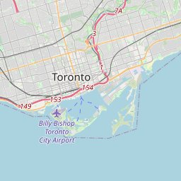
Toronto auf der Karte

Datenquellen & Methodik

Unsere Wettervorhersagen werden von einem professionellen Wetterdatenanbieter bereitgestellt, der Daten von nationalen Wetterdiensten, Satellitenbeobachtungen, Radarnetzwerken und über 80.000 Wetterstationen weltweit zusammenführt. Die Vorhersagedaten werden mehrmals täglich aktualisiert. Wir wandeln Rohdaten in übersichtliche Zusammenfassungen um – Windgeschwindigkeit in m/s, Luftdruck in mmHg – damit Sie Ihren Tag mit Zuversicht planen können.