5-Tage-Wettervorhersage Surry Hills 10. Nov. 2026

21°13–21° · Teilweise bewölkt

Wettervorhersage Surry Hills heute 10. Nov. 2026: sonnig, Temperatur von 13 °C bis 21 °C.

Niederschlagswahrscheinlichkeit 17%. Wind bis zu 9.11 m/s (Böen 14.11 m/s). Luftfeuchtigkeit 49–81%, Luftdruck 760–764 mm Hg, UV-Index bis 10.2.

Wetterwarnungen

Moderate10. Nov., 00:00 — 11. Nov., 00:00Mit Google übersetzen
Hazardous Surf Warning for Byron Coast: Point Danger to Wooli, Coffs Coast: Wooli to Smoky Cape, Macquarie Coast: Smoky Cape to Seal Rocks, Hunter Coast: Seal Rocks to Broken Bay, Sydney Coast: Broken Bay to Port Hacking, Illawarra Coast: Port Hacking to Ulladulla, Batemans Coast: Ulladulla to Montague Island and Eden Coast: Montague Island to Gabo Island for 10 November

Large Coastal Surf

NSW Police Force, Marine Area Command advise that: People should consider staying out of the water and avoid walking near surf-exposed areas. Rock fishers should avoid coastal rock platforms exposed to the ocean and seek a safe location that is sheltered from the surf. Boaters planning to cross shallow water and ocean bars should consider changing or delaying their voyage. Boaters already on the water should carry the appropriate safety equipment and wear a lifejacket. Boaters should remember to log on with their local Marine Rescue radio base, via VHF Radio or the Marine Rescue APP, and consider their safety management plan.

Moderate10. Nov., 00:00 — 11. Nov., 00:00Mit Google übersetzen
Hazardous Surf Warning for Byron Coast: Point Danger to Wooli, Coffs Coast: Wooli to Smoky Cape, Macquarie Coast: Smoky Cape to Seal Rocks, Hunter Coast: Seal Rocks to Broken Bay, Sydney Coast: Broken Bay to Port Hacking, Illawarra Coast: Port Hacking to Ulladulla, Batemans Coast: Ulladulla to Montague Island and Eden Coast: Montague Island to Gabo Island for 10 November

Large Coastal Surf

NSW Police Force, Marine Area Command advise that: People should consider staying out of the water and avoid walking near surf-exposed areas. Rock fishers should avoid coastal rock platforms exposed to the ocean and seek a safe location that is sheltered from the surf. Boaters planning to cross shallow water and ocean bars should consider changing or delaying their voyage. Boaters already on the water should carry the appropriate safety equipment and wear a lifejacket. Boaters should remember to log on with their local Marine Rescue radio base, via VHF Radio or the Marine Rescue APP, and consider their safety management plan.
Moderate10. Nov., 00:00 — 11. Nov., 00:00Mit Google übersetzen
Hazardous Surf Warning for Byron Coast: Point Danger to Wooli, Coffs Coast: Wooli to Smoky Cape, Macquarie Coast: Smoky Cape to Seal Rocks, Hunter Coast: Seal Rocks to Broken Bay, Sydney Coast: Broken Bay to Port Hacking, Illawarra Coast: Port Hacking to Ulladulla, Batemans Coast: Ulladulla to Montague Island and Eden Coast: Montague Island to Gabo Island for 10 November

Large Coastal Surf

NSW Police Force, Marine Area Command advise that: People should consider staying out of the water and avoid walking near surf-exposed areas. Rock fishers should avoid coastal rock platforms exposed to the ocean and seek a safe location that is sheltered from the surf. Boaters planning to cross shallow water and ocean bars should consider changing or delaying their voyage. Boaters already on the water should carry the appropriate safety equipment and wear a lifejacket. Boaters should remember to log on with their local Marine Rescue radio base, via VHF Radio or the Marine Rescue APP, and consider their safety management plan.
Moderate10. Nov., 00:00 — 11. Nov., 00:00Mit Google übersetzen
Hazardous Surf Warning for Byron Coast: Point Danger to Wooli, Coffs Coast: Wooli to Smoky Cape, Macquarie Coast: Smoky Cape to Seal Rocks, Hunter Coast: Seal Rocks to Broken Bay, Sydney Coast: Broken Bay to Port Hacking, Illawarra Coast: Port Hacking to Ulladulla, Batemans Coast: Ulladulla to Montague Island and Eden Coast: Montague Island to Gabo Island for 10 November

Large Coastal Surf

NSW Police Force, Marine Area Command advise that: People should consider staying out of the water and avoid walking near surf-exposed areas. Rock fishers should avoid coastal rock platforms exposed to the ocean and seek a safe location that is sheltered from the surf. Boaters planning to cross shallow water and ocean bars should consider changing or delaying their voyage. Boaters already on the water should carry the appropriate safety equipment and wear a lifejacket. Boaters should remember to log on with their local Marine Rescue radio base, via VHF Radio or the Marine Rescue APP, and consider their safety management plan.
Moderate10. Nov., 04:07 — 11. Nov., 00:00Mit Google übersetzen
Hazardous Surf Warning for Byron Coast: Point Danger to Wooli, Coffs Coast: Wooli to Smoky Cape, Macquarie Coast: Smoky Cape to Seal Rocks, Hunter Coast: Seal Rocks to Broken Bay, Sydney Coast: Broken Bay to Port Hacking, Illawarra Coast: Port Hacking to Ulladulla, Batemans Coast: Ulladulla to Montague Island and Eden Coast: Montague Island to Gabo Island for 10 November

Large Coastal Surf

NSW Police Force, Marine Area Command advise that: People should consider staying out of the water and avoid walking near surf-exposed areas. Rock fishers should avoid coastal rock platforms exposed to the ocean and seek a safe location that is sheltered from the surf. Boaters planning to cross shallow water and ocean bars should consider changing or delaying their voyage. Boaters already on the water should carry the appropriate safety equipment and wear a lifejacket. Boaters should remember to log on with their local Marine Rescue radio base, via VHF Radio or the Marine Rescue APP, and consider their safety management plan.
5 Tage im Überblick — tippen Sie auf einen Tag, um ihn zu öffnen
Sonnenaufgang 05:46
Sonnenuntergang 19:31
Neumond3% beleuchtet
Mondaufgang 05:54 · Monduntergang 20:50
Diagramm
Tabelle
Di., 10. Nov. 2026

Vorhersage von 13 °C bis 21 °C und Niederschlag

Temperatur & Niederschlag
Uhrzeit00:0001:0002:0003:0004:0005:0006:0007:0008:0009:0010:0011:0012:0013:0014:0015:0016:0017:0018:0019:0020:0021:0022:0023:00
Temperatur (°C)171614151413141415161720181821181921191919191918
Niederschlag (mm/Std.)000000000000000000000000

Bewölkung und Niederschlagswahrscheinlichkeit

Bewölkung & Regenwahrscheinlichkeit
Uhrzeit00:0001:0002:0003:0004:0005:0006:0007:0008:0009:0010:0011:0012:0013:0014:0015:0016:0017:0018:0019:0020:0021:0022:0023:00
Bewölkung (%)2886890542225525173489948554313615
Regenwahrscheinlichkeit (%)65161779675532465155766117811

Windgeschwindigkeit und -richtung

Wind & Windböe
Uhrzeit00:0001:0002:0003:0004:0005:0006:0007:0008:0009:0010:0011:0012:0013:0014:0015:0016:0017:0018:0019:0020:0021:0022:0023:00
Wind (m/s)4.194.193.543.692.693.394.112.393.312.392.114.897.115.619.117.55.897.116.814.1954.813.31
Windböe (m/s)4.614.54.8377.693.928.397.114.253.813.615.118.8911.119.1114.117.510.087.817.57.476.196.616.42
Windrichtung (°)SSW 213°SW 230°WSW 253°W 261°WSW 255°W 267°WNW 284°WNW 294°WNW 291°NW 310°N 350°NO 41°ONO 71°ONO 67°ONO 59°NO 55°ONO 58°ONO 62°ONO 61°NO 52°NO 45°NO 34°NNO 25°NNO 23°

Luftfeuchtigkeit

Feuchtigkeit
Uhrzeit00:0001:0002:0003:0004:0005:0006:0007:0008:0009:0010:0011:0012:0013:0014:0015:0016:0017:0018:0019:0020:0021:0022:0023:00
Feuchtigkeit (%)626576727279717267655849616755686762697075727581

Luftdruck

Druck
Uhrzeit00:0001:0002:0003:0004:0005:0006:0007:0008:0009:0010:0011:0012:0013:0014:0015:0016:0017:0018:0019:0020:0021:0022:0023:00
Druck (mm Hg)764764764763763763764764764764764763762761761760760761761761762763763763

Ultraviolett-Index

UV-Index
Uhrzeit00:0001:0002:0003:0004:0005:0006:0007:0008:0009:0010:0011:0012:0013:0014:0015:0016:0017:0018:0019:0020:0021:0022:0023:00
UV-Index00000000.31.22.95.37.89.610.29.47.44.92.60.90.20000

Luftqualität & Pollen

Luftqualität
Uhrzeit00:0001:0002:0003:0004:0005:0006:0007:0008:0009:0010:0011:0012:0013:0014:0015:0016:0017:0018:0019:0020:0021:0022:0023:00
PM2.5 (µg/m³)10.811.111.211.111.41212.713.711.38.18.610.111.412.11314.7161615.515.415.515.91512.9
PM10 (µg/m³)12.912.912.812.412.613.113.614.813.410.511.113.215.116.217.620.222.12221.220.92121.220.217.1
Ozon (O₃) (µg/m³)232017141111141927385164768895959186827873665749
NO₂ (µg/m³)19.421.723.625.226.426.123.419.315.412.196.75.24.54.86.59.111.513.415.116.417.217.718.1
SO₂ (µg/m³)3.74.24.85.46.178.510.110.9108.26.96.36.16.78.911.813.613.311.810.28.77.26.1
CO (µg/m³)9488891011201411671942061911601321119381777981838789898788
Di., 10. Nov. 2026

Häufige Fragen zum 5-Tage-Wetter in Surry Hills

Wie wird das Wetter in Surry Hills in den nächsten 5 Tagen?

In den nächsten 5 Tagen liegt die Temperatur in Surry Hills etwa zwischen 13 und 27 °C. Die detaillierte stündliche Vorhersage für jeden der 5 Tage finden Sie in den Diagrammen oben.

An welchen der nächsten 5 Tage regnet es in Surry Hills?

Die Regenwahrscheinlichkeit in Surry Hills erreicht in den nächsten 5 Tagen 47%. Im 5-Tage-Niederschlagsdiagramm oben sehen Sie, an welchen Tagen und Stunden es regnet.

Wie genau ist die 5-Tage-Wettervorhersage für Surry Hills?

Eine 5-Tage-Vorhersage ist recht zuverlässig: Die ersten 2–3 Tage sind meist sehr genau, die Tage 4–5 können sich noch ändern. Die Daten werden mehrmals täglich aktualisiert – schauen Sie vor wichtigen Plänen noch einmal vorbei.

Welcher der nächsten 5 Tage in Surry Hills wird am wärmsten und welcher am kühlsten?

In den nächsten 5 Tagen schwankt die Temperatur in Surry Hills etwa zwischen 13 und 27 °C. Den wärmsten und den kühlsten Tag vergleichen Sie im Temperaturdiagramm oben.

Wird es in Surry Hills in den nächsten 5 Tagen windig?

In den nächsten 5 Tagen frischt der Wind in Surry Hills auf bis zu 11 m/s auf. Die windigsten Tage erkennen Sie im Winddiagramm oben.

Welcher Wochentag in Surry Hills eignet sich am besten für einen Spaziergang oder einen Ausflug?

Für einen Spaziergang oder Ausflug wählen Sie die Tage mit der geringsten Regenwahrscheinlichkeit (bis zu 47%) und schwachem Wind – einfach in den 5-Tage-Diagrammen oben vergleichbar.

Wie nutze ich die 5-Tage-Vorhersage für Surry Hills am besten?

Die ersten 2–3 Tage sind zuverlässig genug für feste Entscheidungen, während die Tage 4–5 als Orientierung dienen und mit Annäherung präziser werden. Die Vorhersage wird mehrmals täglich aktualisiert – prüfen Sie sie vor wichtigen Plänen noch einmal.

Brauche ich diese Woche in Surry Hills einen Regenschirm oder Sonnencreme?

Die Regenwahrscheinlichkeit erreicht in den nächsten 5 Tagen 47%, nehmen Sie für die nassesten davon etwas Wasserfestes mit — welche das sind, zeigt die Tagesleiste oben. Der UV-Index erreicht heute 10.2; Sonnencreme lohnt sich etwa ab 3.

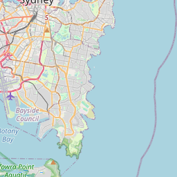
Surry Hills auf der Karte

Datenquellen & Methodik

Unsere Wettervorhersagen werden von einem professionellen Wetterdatenanbieter bereitgestellt, der Daten von nationalen Wetterdiensten, Satellitenbeobachtungen, Radarnetzwerken und über 80.000 Wetterstationen weltweit zusammenführt. Die Vorhersagedaten werden mehrmals täglich aktualisiert. Wir wandeln Rohdaten in übersichtliche Zusammenfassungen um – Windgeschwindigkeit in m/s, Luftdruck in mmHg – damit Sie Ihren Tag mit Zuversicht planen können.