5-Tage-Wettervorhersage Surry Hills 13. Nov. 2026

22°19° · Stellenweise Regen möglich

Wettervorhersage Surry Hills Freitag 13. Nov. 2026: stellenweise regen möglich, Temperatur von 19 °C bis 22 °C.

Niederschlagswahrscheinlichkeit 39%. Wind bis zu 7.19 m/s (Böen 9.39 m/s). Luftfeuchtigkeit 71–87%, Luftdruck 763–765 mm Hg, UV-Index bis 6.

Wetterwarnungen

Moderate9. Nov., 00:00 — 10. Nov., 00:00Mit Google übersetzen
Hazardous Surf Warning for Byron Coast: Point Danger to Wooli, Coffs Coast: Wooli to Smoky Cape, Macquarie Coast: Smoky Cape to Seal Rocks, Hunter Coast: Seal Rocks to Broken Bay, Sydney Coast: Broken Bay to Port Hacking, Illawarra Coast: Port Hacking to Ulladulla, Batemans Coast: Ulladulla to Montague Island and Eden Coast: Montague Island to Gabo Island for 09 November

Large Coastal Surf

NSW Police Force, Marine Area Command advise that: People should consider staying out of the water and avoid walking near surf-exposed areas. Rock fishers should avoid coastal rock platforms exposed to the ocean and seek a safe location that is sheltered from the surf. Boaters planning to cross shallow water and ocean bars should consider changing or delaying their voyage. Boaters already on the water should carry the appropriate safety equipment and wear a lifejacket. Boaters should remember to log on with their local Marine Rescue radio base, via VHF Radio or the Marine Rescue APP, and consider their safety management plan.
Moderate9. Nov., 00:00 — 10. Nov., 00:00Mit Google übersetzen
Hazardous Surf Warning for Byron Coast: Point Danger to Wooli, Coffs Coast: Wooli to Smoky Cape, Macquarie Coast: Smoky Cape to Seal Rocks, Hunter Coast: Seal Rocks to Broken Bay, Sydney Coast: Broken Bay to Port Hacking, Illawarra Coast: Port Hacking to Ulladulla, Batemans Coast: Ulladulla to Montague Island and Eden Coast: Montague Island to Gabo Island for 09 November

Large Coastal Surf

NSW Police Force, Marine Area Command advise that: People should consider staying out of the water and avoid walking near surf-exposed areas. Rock fishers should avoid coastal rock platforms exposed to the ocean and seek a safe location that is sheltered from the surf. Boaters planning to cross shallow water and ocean bars should consider changing or delaying their voyage. Boaters already on the water should carry the appropriate safety equipment and wear a lifejacket. Boaters should remember to log on with their local Marine Rescue radio base, via VHF Radio or the Marine Rescue APP, and consider their safety management plan.
Moderate9. Nov., 00:00 — 10. Nov., 00:00Mit Google übersetzen
Hazardous Surf Warning for Byron Coast: Point Danger to Wooli, Coffs Coast: Wooli to Smoky Cape, Macquarie Coast: Smoky Cape to Seal Rocks, Hunter Coast: Seal Rocks to Broken Bay, Sydney Coast: Broken Bay to Port Hacking, Illawarra Coast: Port Hacking to Ulladulla, Batemans Coast: Ulladulla to Montague Island and Eden Coast: Montague Island to Gabo Island for 09 November

Large Coastal Surf

NSW Police Force, Marine Area Command advise that: People should consider staying out of the water and avoid walking near surf-exposed areas. Rock fishers should avoid coastal rock platforms exposed to the ocean and seek a safe location that is sheltered from the surf. Boaters planning to cross shallow water and ocean bars should consider changing or delaying their voyage. Boaters already on the water should carry the appropriate safety equipment and wear a lifejacket. Boaters should remember to log on with their local Marine Rescue radio base, via VHF Radio or the Marine Rescue APP, and consider their safety management plan.
Moderate9. Nov., 00:00 — 10. Nov., 00:00Mit Google übersetzen
Strong Wind Warning for coastal waters between Point Danger and Montague Island and for Sydney Enclosed Waters for 09 November

Wind

Moderate9. Nov., 00:00 — 10. Nov., 00:00Mit Google übersetzen
Strong Wind Warning for coastal waters between Point Danger and Montague Island and for Sydney Enclosed Waters for 09 November

Wind

5 Tage im Überblick — tippen Sie auf einen Tag, um ihn zu öffnen
Sonnenaufgang 05:44
Sonnenuntergang 19:34
Zunehmende Sichel22% beleuchtet
Mondaufgang 08:27 · Monduntergang 23:36
Diagramm
Tabelle
Fr., 13. Nov. 2026

Vorhersage von 19 °C bis 22 °C und Niederschlag

Temperatur & Niederschlag
Uhrzeit00:0001:0002:0003:0004:0005:0006:0007:0008:0009:0010:0011:0012:0013:0014:0015:0016:0017:0018:0019:0020:0021:0022:0023:00
Temperatur (°C)202019202019202020202021202022202021212120202020
Niederschlag (mm/Std.)0.160.140.0700.020.020.040.080.140.130.030.010.040.020.010.020.040.01000.01000.01

Bewölkung und Niederschlagswahrscheinlichkeit

Bewölkung & Regenwahrscheinlichkeit
Uhrzeit00:0001:0002:0003:0004:0005:0006:0007:0008:0009:0010:0011:0012:0013:0014:0015:0016:0017:0018:0019:0020:0021:0022:0023:00
Bewölkung (%)741009213826287765372100721001005910010064615855606570
Regenwahrscheinlichkeit (%)343929122521272926302815272512252814141415161719

Windgeschwindigkeit und -richtung

Wind & Windböe
Uhrzeit00:0001:0002:0003:0004:0005:0006:0007:0008:0009:0010:0011:0012:0013:0014:0015:0016:0017:0018:0019:0020:0021:0022:0023:00
Wind (m/s)4.895.54.3154.53.314.614.813.815.816.695.57.197.116.316.816.616.816.816.896.896.696.616.39
Windböe (m/s)5.816.226.645.814.925.1955.316.116.227.117.57.57.57.317.317.318.148.6199.399.319.199.11
Windrichtung (°)ONO 71°ONO 61°ONO 60°ONO 60°ONO 71°ONO 63°O 94°O 93°ONO 65°O 83°O 83°ONO 65°ONO 77°ONO 76°ONO 61°ONO 72°ONO 66°NO 56°NO 56°NO 56°NO 55°NO 52°NO 48°NO 45°

Luftfeuchtigkeit

Feuchtigkeit
Uhrzeit00:0001:0002:0003:0004:0005:0006:0007:0008:0009:0010:0011:0012:0013:0014:0015:0016:0017:0018:0019:0020:0021:0022:0023:00
Feuchtigkeit (%)868682868687858583828273797971798073767880808181

Luftdruck

Druck
Uhrzeit00:0001:0002:0003:0004:0005:0006:0007:0008:0009:0010:0011:0012:0013:0014:0015:0016:0017:0018:0019:0020:0021:0022:0023:00
Druck (mm Hg)764764765763764765764764765764764765764764764764763763763764764764764764

Ultraviolett-Index

UV-Index
Uhrzeit00:0001:0002:0003:0004:0005:0006:0007:0008:0009:0010:0011:0012:0013:0014:0015:0016:0017:0018:0019:0020:0021:0022:0023:00
UV-Index000000555666666666660000

Luftqualität & Pollen

Luftqualitätsdaten sind nur für die ersten drei Tage verfügbar.

Fr., 13. Nov. 2026

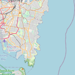
Surry Hills auf der Karte

Datenquellen & Methodik

Unsere Wettervorhersagen werden von einem professionellen Wetterdatenanbieter bereitgestellt, der Daten von nationalen Wetterdiensten, Satellitenbeobachtungen, Radarnetzwerken und über 80.000 Wetterstationen weltweit zusammenführt. Die Vorhersagedaten werden mehrmals täglich aktualisiert. Wir wandeln Rohdaten in übersichtliche Zusammenfassungen um – Windgeschwindigkeit in m/s, Luftdruck in mmHg – damit Sie Ihren Tag mit Zuversicht planen können.