5-Tage-Wettervorhersage Grožnjan 28-07-2026

Wettervorhersage Grožnjan Dienstag, 28. Juli 28.07.2026: sonnig, Temperatur von 21 °C bis 29 °C.

Niederschlagswahrscheinlichkeit 10%. Wind bis zu 2.89 m/s (Böen 6.08 m/s). Luftfeuchtigkeit 50–82%, Luftdruck 764–765 mm Hg, UV-Index bis 8.

Wetterwarnungen

Warnungen ausblenden
Severe23. Juli, 07:3127. Juli, 00:59Mit Google übersetzen
Severe Forestfire danger Warning (Degree 3/4) - Slovenia / South-West

Severe Forestfire danger Warning

There is a large risk of forest and bush fire.
Stay vigilant and be prepared there is a large risk of forest and bush fire. Immediately react to any developing fire. The public are asked to exercise extreme caution in the countryside, and immediately notify emergency services on any fire.
Moderate24. Juli, 07:5025. Juli, 10:00Mit Google übersetzen
Yellow wind warning
Locally fresh NE wind. Maximum wind gusts 35-40 knots (65-75 km/h)
IMPACT: Although rather usual in this region, locally or potentially dangerous wind speeds are expected to produce dangerous wave conditions to small crafts. Inexperienced mariners, especially those operating smaller vessels, should avoid navigating in these conditions. Mariners should pay close attention to the marine forecast and consider wind and sea conditions in planning. It is possible that some ferry lines will not operate so follow traffic information if travelling.
Moderate24. Juli, 07:5025. Juli, 09:00Mit Google übersetzen
Yellow wind warning
Locally fresh NE wind. Maximum wind gusts 35-40 knots (65-75 km/h)
IMPACT: Although rather usual in this region, locally or potentially dangerous wind speeds are expected to produce dangerous wave conditions to small crafts. Inexperienced mariners, especially those operating smaller vessels, should avoid navigating in these conditions. Mariners should pay close attention to the marine forecast and consider wind and sea conditions in planning. It is possible that some ferry lines will not operate so follow traffic information if travelling.
5 Tage im Überblick — tippen Sie auf einen Tag, um ihn zu öffnen
Sonnenaufgang 05:45
Sonnenuntergang 20:38
Vollmond100% beleuchtet
Mondaufgang 20:30 · Monduntergang 04:25
Diagramm
Tabelle
Di., 28. Juli 2026

Vorhersage von 21 °C bis 29 °C und Niederschlag

Temperatur & Niederschlag
Uhrzeit00:0001:0002:0003:0004:0005:0006:0007:0008:0009:0010:0011:0012:0013:0014:0015:0016:0017:0018:0019:0020:0021:0022:0023:00
Temperatur (°C)232222222221212224262728282829292929292826252524
Niederschlag (mm/Std.)000000000000000000000000

Bewölkung und Niederschlagswahrscheinlichkeit

Bewölkung & Regenwahrscheinlichkeit
Uhrzeit00:0001:0002:0003:0004:0005:0006:0007:0008:0009:0010:0011:0012:0013:0014:0015:0016:0017:0018:0019:0020:0021:0022:0023:00
Bewölkung (%)688644454455434333200000
Regenwahrscheinlichkeit (%)910101098754222222222234444

Windgeschwindigkeit und -richtung

Wind & Windböe
Uhrzeit00:0001:0002:0003:0004:0005:0006:0007:0008:0009:0010:0011:0012:0013:0014:0015:0016:0017:0018:0019:0020:0021:0022:0023:00
Wind (m/s)2.52.692.612.52.392.312.52.3921.50.51.111.812.312.692.612.3921.691.611.691.892.52.89
Windböe (m/s)5.145.675.475.145.034.835.2553.251.940.581.282.082.783.393.393.222.722.392.643.5845.256.08
Windrichtung (°)NO 56°NO 53°NO 47°NO 53°ONO 59°ONO 61°ONO 60°ONO 74°ONO 74°O 88°SO 142°WSW 246°W 273°W 277°W 278°W 277°W 272°W 273°WNW 282°WNW 299°NW 324°N 357°N 9°NNO 21°

Luftfeuchtigkeit

Feuchtigkeit
Uhrzeit00:0001:0002:0003:0004:0005:0006:0007:0008:0009:0010:0011:0012:0013:0014:0015:0016:0017:0018:0019:0020:0021:0022:0023:00
Feuchtigkeit (%)808282817976736962545051515151505151536064656566

Luftdruck

Druck
Uhrzeit00:0001:0002:0003:0004:0005:0006:0007:0008:0009:0010:0011:0012:0013:0014:0015:0016:0017:0018:0019:0020:0021:0022:0023:00
Druck (mm Hg)764764764764764764764764764764765765765765765764764764764764764764764764

Ultraviolett-Index

UV-Index
Uhrzeit00:0001:0002:0003:0004:0005:0006:0007:0008:0009:0010:0011:0012:0013:0014:0015:0016:0017:0018:0019:0020:0021:0022:0023:00
UV-Index00000000.312.34.15.97.487.5777777000
Di., 28. Juli 2026

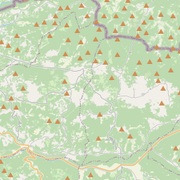
Grožnjan auf der Karte

Datenquellen & Methodik

Unsere Wettervorhersagen werden von einem professionellen Wetterdatenanbieter bereitgestellt, der Daten von nationalen Wetterdiensten, Satellitenbeobachtungen, Radarnetzwerken und über 80.000 Wetterstationen weltweit zusammenführt. Die Vorhersagedaten werden mehrmals täglich aktualisiert. Wir wandeln Rohdaten in übersichtliche Zusammenfassungen um – Windgeschwindigkeit in m/s, Luftdruck in mmHg – damit Sie Ihren Tag mit Zuversicht planen können.