5-Tage-Wettervorhersage Grožnjan 26-07-2026

Wettervorhersage Grožnjan Sonntag, 26. Juli 26.07.2026: sonnig, Temperatur von 19 °C bis 28 °C.

Niederschlagswahrscheinlichkeit 88%. Wind bis zu 9.31 m/s (Böen 16.53 m/s). Luftfeuchtigkeit 62–88%, Luftdruck 756–759 mm Hg, UV-Index bis 7.

Wetterwarnungen

Warnungen ausblenden
Severe23. Juli, 07:3127. Juli, 00:59Mit Google übersetzen
Severe Forestfire danger Warning (Degree 3/4) - Slovenia / South-West

Severe Forestfire danger Warning

There is a large risk of forest and bush fire.
Stay vigilant and be prepared there is a large risk of forest and bush fire. Immediately react to any developing fire. The public are asked to exercise extreme caution in the countryside, and immediately notify emergency services on any fire.
Moderate24. Juli, 07:5025. Juli, 10:00Mit Google übersetzen
Yellow wind warning
Locally fresh NE wind. Maximum wind gusts 35-40 knots (65-75 km/h)
IMPACT: Although rather usual in this region, locally or potentially dangerous wind speeds are expected to produce dangerous wave conditions to small crafts. Inexperienced mariners, especially those operating smaller vessels, should avoid navigating in these conditions. Mariners should pay close attention to the marine forecast and consider wind and sea conditions in planning. It is possible that some ferry lines will not operate so follow traffic information if travelling.
Moderate24. Juli, 07:5025. Juli, 09:00Mit Google übersetzen
Yellow wind warning
Locally fresh NE wind. Maximum wind gusts 35-40 knots (65-75 km/h)
IMPACT: Although rather usual in this region, locally or potentially dangerous wind speeds are expected to produce dangerous wave conditions to small crafts. Inexperienced mariners, especially those operating smaller vessels, should avoid navigating in these conditions. Mariners should pay close attention to the marine forecast and consider wind and sea conditions in planning. It is possible that some ferry lines will not operate so follow traffic information if travelling.
Moderate24. Juli, 07:4924. Juli, 23:59Mit Google übersetzen
Yellow wind warning
Locally strong NE wind. Maximum wind gusts 35-50 knots (65-95 km/h)
IMPACT: Although rather usual in this region, locally or potentially dangerous wind speeds are expected to produce dangerous wave conditions to small crafts. Inexperienced mariners, especially those operating smaller vessels, should avoid navigating in these conditions. Mariners should pay close attention to the marine forecast and consider wind and sea conditions in planning. It is possible that some ferry lines will not operate so follow traffic information if travelling.
Moderate24. Juli, 07:4924. Juli, 23:59Mit Google übersetzen
Yellow wind warning
Locally fresh and strong NE wind. Maximum wind gusts 35-50 knots (65-95 km/h)
IMPACT: Although rather usual in this region, locally or potentially dangerous wind speeds are expected to produce dangerous wave conditions to small crafts. Inexperienced mariners, especially those operating smaller vessels, should avoid navigating in these conditions. Mariners should pay close attention to the marine forecast and consider wind and sea conditions in planning. It is possible that some ferry lines will not operate so follow traffic information if travelling.
5 Tage im Überblick — tippen Sie auf einen Tag, um ihn zu öffnen
Sonnenaufgang 05:42
Sonnenuntergang 20:40
Zunehmender Mond95% beleuchtet
Mondaufgang 19:20 · Monduntergang 02:24
Diagramm
Tabelle

Vorhersage von 19 °C bis 28 °C und Niederschlag

Temperatur & Niederschlag
Uhrzeit00:0001:0002:0003:0004:0005:0006:0007:0008:0009:0010:0011:0012:0013:0014:0015:0016:0017:0018:0019:0020:0021:0022:0023:00
Temperatur (°C)202020192020202124262727272728272727272524222120
Niederschlag (mm/Std.)000.02000000000000.070.10.140.140.3102.917.053.52.03

Bewölkung und Niederschlagswahrscheinlichkeit

Bewölkung & Regenwahrscheinlichkeit
Uhrzeit00:0001:0002:0003:0004:0005:0006:0007:0008:0009:0010:0011:0012:0013:0014:0015:0016:0017:0018:0019:0020:0021:0022:0023:00
Bewölkung (%)6681667655981314689717673851668906680
Regenwahrscheinlichkeit (%)54145556765455419182122361074887873

Windgeschwindigkeit und -richtung

Wind & Windböe
Uhrzeit00:0001:0002:0003:0004:0005:0006:0007:0008:0009:0010:0011:0012:0013:0014:0015:0016:0017:0018:0019:0020:0021:0022:0023:00
Wind (m/s)3.613.313.193.53.614.695.55.615.894.8156.8987.587.117.55.814.318.118.899.314.814.61
Windböe (m/s)7.316.536.447.116.978.9410.179.177.835.865.757.949.198.649.198.178.727.425.5311.2512.6916.539.228.86
Windrichtung (°)OSO 108°O 97°O 90°O 95°OSO 104°O 96°OSO 104°OSO 122°SO 136°SSO 157°S 182°S 180°S 175°S 174°S 174°S 170°SSO 167°SSO 160°SSO 162°SSO 151°SSO 166°SSW 207°SO 144°OSO 107°

Luftfeuchtigkeit

Feuchtigkeit
Uhrzeit00:0001:0002:0003:0004:0005:0006:0007:0008:0009:0010:0011:0012:0013:0014:0015:0016:0017:0018:0019:0020:0021:0022:0023:00
Feuchtigkeit (%)666464656567707271676364636264656770677983888786

Luftdruck

Druck
Uhrzeit00:0001:0002:0003:0004:0005:0006:0007:0008:0009:0010:0011:0012:0013:0014:0015:0016:0017:0018:0019:0020:0021:0022:0023:00
Druck (mm Hg)758758758758758758758758758758758758758758758757757757756756758758758759

Ultraviolett-Index

UV-Index
Uhrzeit00:0001:0002:0003:0004:0005:0006:0007:0008:0009:0010:0011:0012:0013:0014:0015:0016:0017:0018:0019:0020:0021:0022:0023:00
UV-Index00000000.30.92.13.75.36.576.45.43.82.310.40000

Luftqualität & Pollen

Luftqualität
Uhrzeit00:0001:0002:0003:0004:0005:0006:0007:0008:0009:0010:0011:0012:0013:0014:0015:0016:0017:0018:0019:0020:0021:0022:0023:00
PM2.5 (µg/m³)4.54.34.44.24.14.13.844.34.14.24.44.74.74.44.95.14.84.43.944.24.54.3
PM10 (µg/m³)8.48.17.87.97.97.47.78.38.68.58.89.19910.41010.398.78.28.58.57.18.1
Ozon (O₃) (µg/m³)788081828281838785868990919293979898969796939087
NO₂ (µg/m³)2.21.91.81.71.61.51.51.41.31.110.90.90.70.70.70.70.70.81.11.41.61.81.9
SO₂ (µg/m³)0.20.20.20.20.20.20.20.20.20.20.20.20.20.20.20.20.10.10.10.10.10.10.10.1
CO (µg/m³)121121121121122122122123123122122122123120121122123123124123125128126128

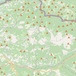
Grožnjan auf der Karte

Datenquellen & Methodik

Unsere Wettervorhersagen werden von einem professionellen Wetterdatenanbieter bereitgestellt, der Daten von nationalen Wetterdiensten, Satellitenbeobachtungen, Radarnetzwerken und über 80.000 Wetterstationen weltweit zusammenführt. Die Vorhersagedaten werden mehrmals täglich aktualisiert. Wir wandeln Rohdaten in übersichtliche Zusammenfassungen um – Windgeschwindigkeit in m/s, Luftdruck in mmHg – damit Sie Ihren Tag mit Zuversicht planen können.