5-Tage-Wettervorhersage Paris 14-08-2026

Wettervorhersage Paris heute 14.08.2026: sonnig, Temperatur von 25 °C bis 40 °C.

Niederschlagswahrscheinlichkeit 1%. Wind bis zu 5.61 m/s (Böen 7.42 m/s). Luftfeuchtigkeit 12–33%, Luftdruck 758–763 mm Hg, UV-Index bis 6.5.

Wetterwarnungen

Warnungen ausblenden
Severe15. Aug., 00:0016. Aug., 00:00Mit Google übersetzen
Severe high-temperature warning
Everyone is in danger, even those in good health. Danger is greater for elderly people, people suffering from chronicle diseases or from mental health troubles, people who regularly take medicine or people who are isolated. Watch for dehydration and heatstroke, especially in sportsmen and people working outside. Pay attention to children. Heatstroke symptoms are : a fever above 40°, hot, red and dry skin, headaches, nausea, drowsiness, intense thirst, confusion, convulsions and loss of consciousness.
Drink water several times a day. Continue to eat normally. Wet your body several times a day using a spray, a washcloth or by taking warm showers or baths. Do not go out during the hottest hours (11am-9pm). If you must go out, wear a hat and light clothing. Try to go to a cool or air-conditioned place for two to three hours a day, whilst continuing to respect physical distance and barrier gestures. Limit your physical and sports activities. During the day, close shutters, curtains and windows. Ventilate at night. If you have elderly, chronically ill or isolated people around you, check up on them or visit them. Take them to a cool place. In case of discomfort or behavioral problems, call a doctor. If you need help call the town hall. To find out more, visit the website: www.sante.gouv.fr.
Severe14. Aug., 06:0015. Aug., 00:00Mit Google übersetzen
Severe high-temperature warning
Everyone is in danger, even those in good health. Danger is greater for elderly people, people suffering from chronicle diseases or from mental health troubles, people who regularly take medicine or people who are isolated. Watch for dehydration and heatstroke, especially in sportsmen and people working outside. Pay attention to children. Heatstroke symptoms are : a fever above 40°, hot, red and dry skin, headaches, nausea, drowsiness, intense thirst, confusion, convulsions and loss of consciousness.
Drink water several times a day. Continue to eat normally. Wet your body several times a day using a spray, a washcloth or by taking warm showers or baths. Do not go out during the hottest hours (11am-9pm). If you must go out, wear a hat and light clothing. Try to go to a cool or air-conditioned place for two to three hours a day, whilst continuing to respect physical distance and barrier gestures. Limit your physical and sports activities. During the day, close shutters, curtains and windows. Ventilate at night. If you have elderly, chronically ill or isolated people around you, check up on them or visit them. Take them to a cool place. In case of discomfort or behavioral problems, call a doctor. If you need help call the town hall. To find out more, visit the website: www.sante.gouv.fr.
Severe15. Aug., 00:0016. Aug., 00:00Mit Google übersetzen
Severe high-temperature warning
Everyone is in danger, even those in good health. Danger is greater for elderly people, people suffering from chronicle diseases or from mental health troubles, people who regularly take medicine or people who are isolated. Watch for dehydration and heatstroke, especially in sportsmen and people working outside. Pay attention to children. Heatstroke symptoms are : a fever above 40°, hot, red and dry skin, headaches, nausea, drowsiness, intense thirst, confusion, convulsions and loss of consciousness.
Drink water several times a day. Continue to eat normally. Wet your body several times a day using a spray, a washcloth or by taking warm showers or baths. Do not go out during the hottest hours (11am-9pm). If you must go out, wear a hat and light clothing. Try to go to a cool or air-conditioned place for two to three hours a day, whilst continuing to respect physical distance and barrier gestures. Limit your physical and sports activities. During the day, close shutters, curtains and windows. Ventilate at night. If you have elderly, chronically ill or isolated people around you, check up on them or visit them. Take them to a cool place. In case of discomfort or behavioral problems, call a doctor. If you need help call the town hall. To find out more, visit the website: www.sante.gouv.fr.
Moderate15. Aug., 00:0016. Aug., 00:00Mit Google übersetzen
Moderate thunderstorm warning
Moderate damages may occur, especially in vulnerable or in exposed areas and to people who carry out weather-related activities.
Be careful, keep informed of the latest weather forecast.
Severe14. Aug., 16:0015. Aug., 00:00Mit Google übersetzen
Severe high-temperature warning
Everyone is in danger, even those in good health. Danger is greater for elderly people, people suffering from chronicle diseases or from mental health troubles, people who regularly take medicine or people who are isolated. Watch for dehydration and heatstroke, especially in sportsmen and people working outside. Pay attention to children. Heatstroke symptoms are : a fever above 40°, hot, red and dry skin, headaches, nausea, drowsiness, intense thirst, confusion, convulsions and loss of consciousness.
Drink water several times a day. Continue to eat normally. Wet your body several times a day using a spray, a washcloth or by taking warm showers or baths. Do not go out during the hottest hours (11am-9pm). If you must go out, wear a hat and light clothing. Try to go to a cool or air-conditioned place for two to three hours a day, whilst continuing to respect physical distance and barrier gestures. Limit your physical and sports activities. During the day, close shutters, curtains and windows. Ventilate at night. If you have elderly, chronically ill or isolated people around you, check up on them or visit them. Take them to a cool place. In case of discomfort or behavioral problems, call a doctor. If you need help call the town hall. To find out more, visit the website: www.sante.gouv.fr.
5 Tage im Überblick — tippen Sie auf einen Tag, um ihn zu öffnen
Sonnenaufgang 06:42
Sonnenuntergang 21:08
Zunehmende Sichel5% beleuchtet
Mondaufgang 08:32 · Monduntergang 21:45
Diagramm
Tabelle
Fr., 14. Aug. 2026

Vorhersage von 25 °C bis 40 °C und Niederschlag

Temperatur & Niederschlag
Uhrzeit00:0001:0002:0003:0004:0005:0006:0007:0008:0009:0010:0011:0012:0013:0014:0015:0016:0017:0018:0019:0020:0021:0022:0023:00
Temperatur (°C)303029272726252526293133353739394040403937333129
Niederschlag (mm/Std.)000000000000000000000000

Bewölkung und Niederschlagswahrscheinlichkeit

Bewölkung & Regenwahrscheinlichkeit
Uhrzeit00:0001:0002:0003:0004:0005:0006:0007:0008:0009:0010:0011:0012:0013:0014:0015:0016:0017:0018:0019:0020:0021:0022:0023:00
Bewölkung (%)467777776444566544344333
Regenwahrscheinlichkeit (%)111111111100111000000111

Windgeschwindigkeit und -richtung

Wind & Windböe
Uhrzeit00:0001:0002:0003:0004:0005:0006:0007:0008:0009:0010:0011:0012:0013:0014:0015:0016:0017:0018:0019:0020:0021:0022:0023:00
Wind (m/s)2.892.392.311.891.5221.691.69221.891.691.391.110.810.810.50.690.893.315.615.194.31
Windböe (m/s)5.814.674.4243.144.194.193.582.922.422.312.191.971.611.280.920.920.580.811.034.337.426.755.94
Windrichtung (°)NO 39°NO 36°NO 46°NO 44°N 10°NNW 330°NNW 335°NNW 346°N 354°N 349°N 2°N 5°N 7°N 3°NNW 347°NW 317°WNW 298°NW 324°NNO 13°N 2°N 350°NNW 347°N 359°N 2°

Luftfeuchtigkeit

Feuchtigkeit
Uhrzeit00:0001:0002:0003:0004:0005:0006:0007:0008:0009:0010:0011:0012:0013:0014:0015:0016:0017:0018:0019:0020:0021:0022:0023:00
Feuchtigkeit (%)212021232425262625222018161413131312121216242933

Luftdruck

Druck
Uhrzeit00:0001:0002:0003:0004:0005:0006:0007:0008:0009:0010:0011:0012:0013:0014:0015:0016:0017:0018:0019:0020:0021:0022:0023:00
Druck (mm Hg)763763763763762762762762762763763762762761761761760760759758758759760761

Ultraviolett-Index

UV-Index
Uhrzeit00:0001:0002:0003:0004:0005:0006:0007:0008:0009:0010:0011:0012:0013:0014:0015:0016:0017:0018:0019:0020:0021:0022:0023:00
UV-Index000000000.312.13.65.16.26.55.94.73.11.70.50.2000

Luftqualität & Pollen

Luftqualität
Uhrzeit00:0001:0002:0003:0004:0005:0006:0007:0008:0009:0010:0011:0012:0013:0014:0015:0016:0017:0018:0019:0020:0021:0022:0023:00
PM2.5 (µg/m³)7.99.410.611.210.710.39.9121915.813.812.412.711.111.611.710.610.710.610.410.410.310.410.7
PM10 (µg/m³)1717.118.317.817.416.316.317.325.226.423.62220.917.51817.417.216.215.615.31515.315.516.7
Ozon (O₃) (µg/m³)665861645444353027276783127147157176173168151138127117113107
NO₂ (µg/m³)23.623.421.920.120202331.354.458.84436.233.719.613.99.49.611.814.314.31613.313.411.9
SO₂ (µg/m³)1.51.31.31.41.51.51.41.72.83.63.12.72.21.91.41.210.9110.8111
CO (µg/m³)215234226223229227224268540651606501425362289243232238242234196187191187
Fr., 14. Aug. 2026

Häufige Fragen zum 5-Tage-Wetter in Paris

Wie wird das Wetter in Paris in den nächsten 5 Tagen?
In den nächsten 5 Tagen liegt die Temperatur in Paris etwa zwischen 18 und 40 °C. Die detaillierte stündliche Vorhersage für jeden der 5 Tage finden Sie in den Diagrammen oben.
An welchen der nächsten 5 Tage regnet es in Paris?
Die Regenwahrscheinlichkeit in Paris erreicht in den nächsten 5 Tagen 25%. Im 5-Tage-Niederschlagsdiagramm oben sehen Sie, an welchen Tagen und Stunden es regnet.
Wie genau ist die 5-Tage-Wettervorhersage für Paris?
Eine 5-Tage-Vorhersage ist recht zuverlässig: Die ersten 2–3 Tage sind meist sehr genau, die Tage 4–5 können sich noch ändern. Die Daten werden mehrmals täglich aktualisiert – schauen Sie vor wichtigen Plänen noch einmal vorbei.
Welcher der nächsten 5 Tage in Paris wird am wärmsten und welcher am kühlsten?
In den nächsten 5 Tagen schwankt die Temperatur in Paris etwa zwischen 18 und 40 °C. Den wärmsten und den kühlsten Tag vergleichen Sie im Temperaturdiagramm oben.
Wird es in Paris in den nächsten 5 Tagen windig?
In den nächsten 5 Tagen frischt der Wind in Paris auf bis zu 6 m/s auf. Die windigsten Tage erkennen Sie im Winddiagramm oben.
Welcher Wochentag in Paris eignet sich am besten für einen Spaziergang oder einen Ausflug?
Für einen Spaziergang oder Ausflug wählen Sie die Tage mit der geringsten Regenwahrscheinlichkeit (bis zu 25%) und schwachem Wind – einfach in den 5-Tage-Diagrammen oben vergleichbar.
Wie nutze ich die 5-Tage-Vorhersage für Paris am besten?
Die ersten 2–3 Tage sind zuverlässig genug für feste Entscheidungen, während die Tage 4–5 als Orientierung dienen und mit Annäherung präziser werden. Die Vorhersage wird mehrmals täglich aktualisiert – prüfen Sie sie vor wichtigen Plänen noch einmal.

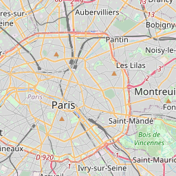
Paris auf der Karte

Datenquellen & Methodik

Unsere Wettervorhersagen werden von einem professionellen Wetterdatenanbieter bereitgestellt, der Daten von nationalen Wetterdiensten, Satellitenbeobachtungen, Radarnetzwerken und über 80.000 Wetterstationen weltweit zusammenführt. Die Vorhersagedaten werden mehrmals täglich aktualisiert. Wir wandeln Rohdaten in übersichtliche Zusammenfassungen um – Windgeschwindigkeit in m/s, Luftdruck in mmHg – damit Sie Ihren Tag mit Zuversicht planen können.