Prognoza pogody na 5 dni Stockholm 20-07-2026

Prognoza pogody Stockholm poniedziałek, 20 lipca 20.07.2026: możliwy przelotny deszcz, temperatura od 12 °C do 18 °C.

Prawdopodobieństwo opadów 58%. Wiatr do 6.31 m/s (porywy 9.06 m/s). Wilgotność powietrza 56–88%, ciśnienie atmosferyczne 761–762 mm Hg, indeks UV do 4.9.

Ostrzeżenia pogodowe

Ukryj ostrzeżenia
Moderate18 lip, 23:0019 lip, 20:00Przetłumacz przez Google
Yellow wave height warning: Northern Baltic and Sea of Åland, Sun 0.00 - 21.00

Wave height warning

Wave height warning: From the night between Saturday and Sunday to Sunday evening, probability for rough waves is 30%. The significant wave height may exceed 2.5 meters.
Moderate18 lip, 23:0019 lip, 17:00Przetłumacz przez Google
Yellow wind warning for sea area: Locally on all sea areas, Sun 0.00 - 18.00

Wind warning for sea areas

Wind warning for sea areas: From the night between Saturday and Sunday to Sunday evening, probability for north gale-force winds is 30%.
Moderate19 lip, 23:0020 lip, 23:00Przetłumacz przez Google
Yellow wind warning for sea area: Locally on all sea areas, Mon 0.00 - Tue 0.00

Wind warning for sea areas

Wind warning for sea areas: From the night between Sunday and Monday to the night between Monday and Tuesday, probability for north gale-force winds is 20%.
Moderate18 lip, 23:0019 lip, 23:00Przetłumacz przez Google
Yellow wave height warning: Northern Baltic and Sea of Åland, Sun 0.00 - Mon 0.00

Wave height warning

Wave height warning: From the night between Saturday and Sunday to the night between Sunday and Monday, probability for rough waves is 40%. The significant wave height may exceed 2.5 meters.
Moderate18 lip, 23:0019 lip, 23:00Przetłumacz przez Google
Yellow wind warning for sea area: Locally on all sea areas, Sun 0.00 - Mon 0.00

Wind warning for sea areas

Wind warning for sea areas: From the night between Saturday and Sunday to the night between Sunday and Monday, probability for north gale-force winds is 20%.
Wschód słońca 04:07
Zachód słońca 21:40
Pierwsza kwadra43% oświetlenia
Wschód księżyca 13:00 · Zachód księżyca 22:40
Wykres
Tabela
pon., 20 lip 2026

Prognoza od 12 °C do 18 °C i opady

Temperatura & Opady
Czas00:0001:0002:0003:0004:0005:0006:0007:0008:0009:0010:0011:0012:0013:0014:0015:0016:0017:0018:0019:0020:0021:0022:0023:00
Temperatura (°C)121212121212121314131416181716161817161513131313
Opady (mm/godz.)0.10.080.060.010.020.01000.030.020.010000.010000.050.240.850.1400

Zachmurzenie i prawdopodobieństwo opadów

Zachmurzenie & Szansa na deszcz
Czas00:0001:0002:0003:0004:0005:0006:0007:0008:0009:0010:0011:0012:0013:0014:0015:0016:0017:0018:0019:0020:0021:0022:0023:00
Zachmurzenie (%)100100818886681001001001001009810010010010010010010010083906275
Szansa na deszcz (%)393629262619242225282618151618161413173558351719

Prędkość i kierunek wiatru

Wiatr & Porywy wiatru
Czas00:0001:0002:0003:0004:0005:0006:0007:0008:0009:0010:0011:0012:0013:0014:0015:0016:0017:0018:0019:0020:0021:0022:0023:00
Wiatr (m/s)666.115.815.815.895.896.316.195.695.615.616.115.615.695.395.395.395.395.114.694.614.54.11
Porywy wiatru (m/s)8.898.899.068.58.588.758.448.58.197.587.476.897.037.197.4476.867.227.757.727.5387.867.03
Kierunek wiatru (°)NNE 14°NNE 14°NNE 12°N 8°N 6°N 5°N 6°N 9°N 11°NNE 12°NNE 15°NNE 23°NE 37°NE 37°NNE 29°NNE 25°NNE 27°NNE 25°NNE 23°NNE 21°NNE 14°N 3°N 6°N 9°

Wilgotność powietrza

Wilgotność
Czas00:0001:0002:0003:0004:0005:0006:0007:0008:0009:0010:0011:0012:0013:0014:0015:0016:0017:0018:0019:0020:0021:0022:0023:00
Wilgotność (%)888787868583817777838370626568645856566378838281

Ciśnienie atmosferyczne

Ciśnienie
Czas00:0001:0002:0003:0004:0005:0006:0007:0008:0009:0010:0011:0012:0013:0014:0015:0016:0017:0018:0019:0020:0021:0022:0023:00
Ciśnienie (mm Hg)761761761761761761761761761761761761761761761762761762762762762762762762

Indeks ultrafioletowy

Indeks UV
Czas00:0001:0002:0003:0004:0005:0006:0007:0008:0009:0010:0011:0012:0013:0014:0015:0016:0017:0018:0019:0020:0021:0022:0023:00
Indeks UV0000000.30.71.32.23.34.24.84.94.2444433300
pon., 20 lip 2026

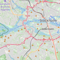
Stockholm na mapie

Źródła danych i metodologia

Nasze prognozy pogody są zasilane przez profesjonalnego dostawcę danych pogodowych, który agreguje dane z krajowych służb meteorologicznych, obserwacji satelitarnych, sieci radarowych i ponad 80 000 stacji meteorologicznych na całym świecie. Dane prognostyczne są aktualizowane wielokrotnie w ciągu dnia. Przetwarzamy surowe dane na czytelne podsumowania — prędkość wiatru w m/s, ciśnienie w mm Hg — abyście Państwo mogli planować dzień z pewnością.