
Prognoza pogody na 5 dni Santiago de Compostela 22 lis 2026

12°7° · Możliwy przelotny deszcz

Prognoza pogody — Santiago de Compostela, niedziela, 22 lis 2026: możliwy przelotny deszcz, temperatura od 7 °C do 12 °C.

Prawdopodobieństwo opadów 45%. Wiatr do 4.31 m/s (porywy 11.47 m/s). Wilgotność powietrza 75–97%, ciśnienie atmosferyczne 762–771 mm Hg, indeks UV do 1.6.

Ostrzeżenia pogodowe

Severe18 lis, 11:41 — 20 lis, 11:59Przetłumacz przez Google
Severe coastalevent warning. Costa - Suroeste de A Coruña

Severe coastalevent warning

Mar combinada del NW de 5 a 6 m.
Be prepared. Take precautions and keep up to date with the latest weather forecast. Severe damages to people and properties may occur, especially to those vulnerable or in exposed areas.
Moderate18 lis, 11:41 — 20 lis, 17:59Przetłumacz przez Google
Moderate coastalevent warning. Costa - Suroeste de A Coruña

Moderate coastalevent warning

Mar combinada del NW de 4 a 5 m.
Be aware, keep up to date with the latest weather forecast. Moderate damages to people and properties may occur, especially to those vulnerable or in exposed areas.
Severe18 lis, 18:49 — 19 lis, 23:59Przetłumacz przez Google
Severe coastalevent warning. Costa - Suroeste de A Coruña

Severe coastalevent warning

Mar combinada del Oeste o Noroeste de 6 a 8 m. Viento del Suroeste de 50 a 61 km/h (fuerza 7), temporalmente 62 a 74 km/h (fuerza 8) por la noche al norte de Cabo Vilán.
Be prepared. Take precautions and keep up to date with the latest weather forecast. Severe damages to people and properties may occur, especially to those vulnerable or in exposed areas.
Severe18 lis, 11:41 — 20 lis, 08:59Przetłumacz przez Google
Severe coastalevent warning. Costa - Rias Baixas

Severe coastalevent warning

Mar combinada del NW de 5 a 6 m.
Be prepared. Take precautions and keep up to date with the latest weather forecast. Severe damages to people and properties may occur, especially to those vulnerable or in exposed areas.
Moderate18 lis, 11:41 — 20 lis, 15:59Przetłumacz przez Google
Moderate coastalevent warning. Costa - Rias Baixas

Moderate coastalevent warning

Mar combinada del NW de 4 a 5 m.
Be aware, keep up to date with the latest weather forecast. Moderate damages to people and properties may occur, especially to those vulnerable or in exposed areas.
Wschód słońca 08:35
Zachód słońca 18:05
Pełnia98% oświetlenia
Wschód księżyca 16:20 · Zachód księżyca 06:01
Wykres
Tabela

Prognoza od 7 °C do 12 °C i opady

Temperatura & Opady
Czas00:0001:0002:0003:0004:0005:0006:0007:0008:0009:0010:0011:0012:0013:0014:0015:0016:0017:0018:0019:0020:0021:0022:0023:00
Temperatura (°C)98888877789101112121212111098887
Opady (mm/godz.)0.180.040.070.080.080.060.060.030.020.010.010.090.170.20.160.120.070.020.0100000

Zachmurzenie i prawdopodobieństwo opadów

Zachmurzenie & Szansa na deszcz
Czas00:0001:0002:0003:0004:0005:0006:0007:0008:0009:0010:0011:0012:0013:0014:0015:0016:0017:0018:0019:0020:0021:0022:0023:00
Zachmurzenie (%)877573867580717679848285798781767783802430486173
Szansa na deszcz (%)453033373434373534292733333329262322251723262932

Prędkość i kierunek wiatru

Wiatr & Porywy wiatru
Czas00:0001:0002:0003:0004:0005:0006:0007:0008:0009:0010:0011:0012:0013:0014:0015:0016:0017:0018:0019:0020:0021:0022:0023:00
Wiatr (m/s)4.313.813.613.53.392.892.52.192.192.192.192.813.193.693.613.3132.191.51.191.111.191.191.11
Porywy wiatru (m/s)11.4710.9210.399.839.088.256.725.725.615.446.227.147.758.396.616.226.115.675.54.194.116.196.191.31
Kierunek wiatru (°)WSW 254°WSW 251°WSW 247°WSW 243°WSW 240°WSW 238°SW 235°SW 232°SW 230°SW 230°SW 234°WSW 247°WSW 256°W 259°W 260°W 259°W 259°WSW 250°SW 227°SSW 193°S 181°S 170°SSE 161°SSE 154°

Wilgotność powietrza

Wilgotność
Czas00:0001:0002:0003:0004:0005:0006:0007:0008:0009:0010:0011:0012:0013:0014:0015:0016:0017:0018:0019:0020:0021:0022:0023:00
Wilgotność (%)959595949494959594939186817676757581889394959697

Ciśnienie atmosferyczne

Ciśnienie
Czas00:0001:0002:0003:0004:0005:0006:0007:0008:0009:0010:0011:0012:0013:0014:0015:0016:0017:0018:0019:0020:0021:0022:0023:00
Ciśnienie (mm Hg)762763764764765765766767767768768769769770770770770770770770771771771771

Indeks ultrafioletowy

Indeks UV
Czas00:0001:0002:0003:0004:0005:0006:0007:0008:0009:0010:0011:0012:0013:0014:0015:0016:0017:0018:0019:0020:0021:0022:0023:00
Indeks UV00000000000.30.71.31.61.61.40.80.3000000

Jakość powietrza i pyłki

Dane o jakości powietrza są dostępne tylko przez pierwsze trzy dni.

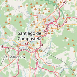
Santiago de Compostela na mapie
Źródła danych i metodologia

Nasze prognozy pogody są zasilane przez profesjonalnego dostawcę danych pogodowych, który agreguje dane z krajowych służb meteorologicznych, obserwacji satelitarnych, sieci radarowych i ponad 80 000 stacji meteorologicznych na całym świecie. Dane prognostyczne są aktualizowane wielokrotnie w ciągu dnia. Przetwarzamy surowe dane na czytelne podsumowania — prędkość wiatru w m/s, ciśnienie w mm Hg — abyście Państwo mogli planować dzień z pewnością.